Aegean Sea: Geography, history, and modern significance
The Aegean Sea lies between Greece and Anatolia, linking the Mediterranean to the Black Sea. Known for numerous islands, ancient maritime civilizations, and modern shipping, fisheries and tourism.
Overview
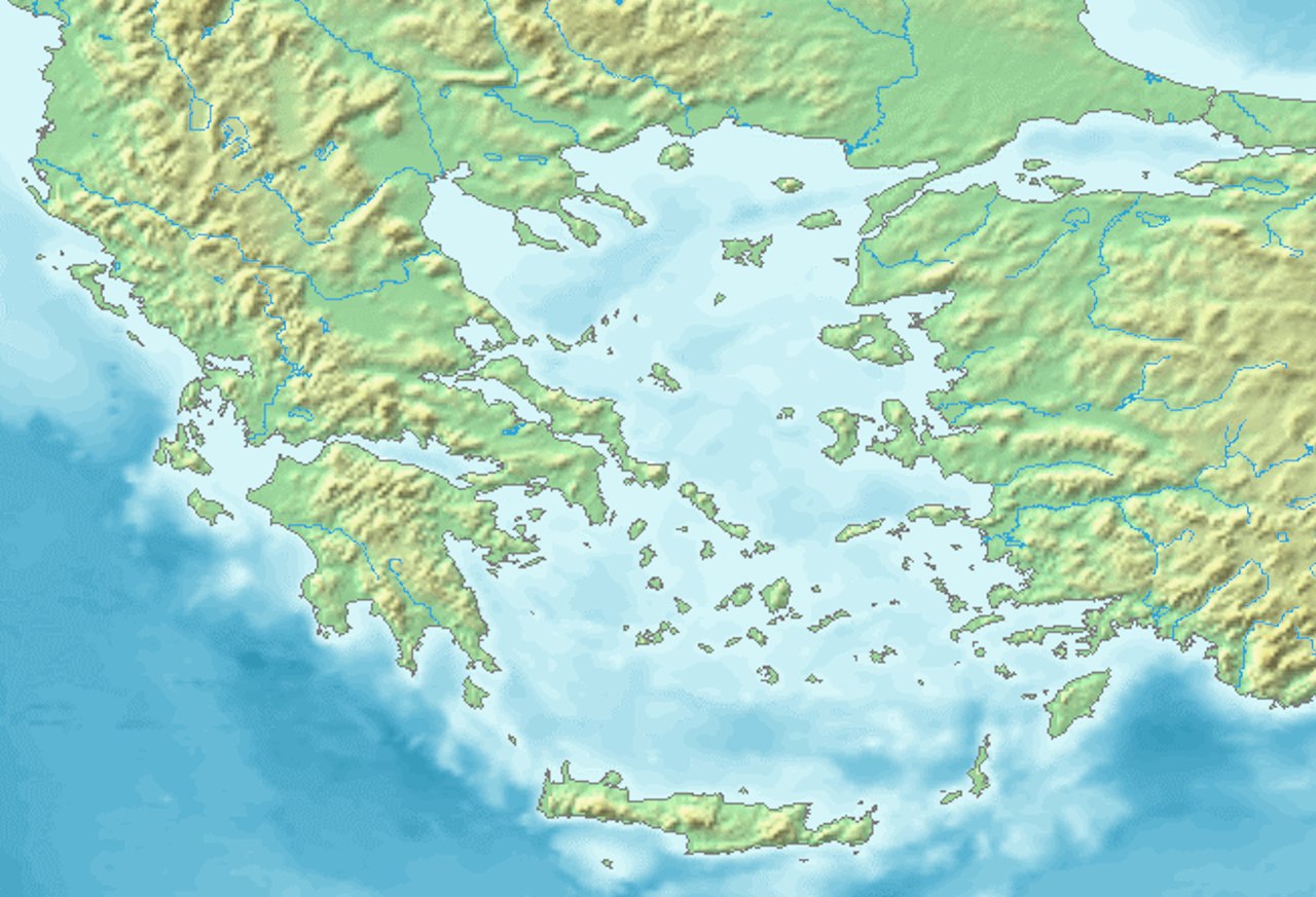
The Aegean Sea is the northernmost portion of the Mediterranean Sea, situated between the mainland of Greece and the western coast of Anatolia. Its general location is often given as 39°N 25°E. To the north the Aegean is linked to the Sea of Marmara via the Dardanelles, and the Sea of Marmara in turn connects to the Black Sea through the Bosporus. The southern limits of the Aegean are commonly marked by the large Mediterranean islands of Crete and Rhodes.
Image gallery
10 Images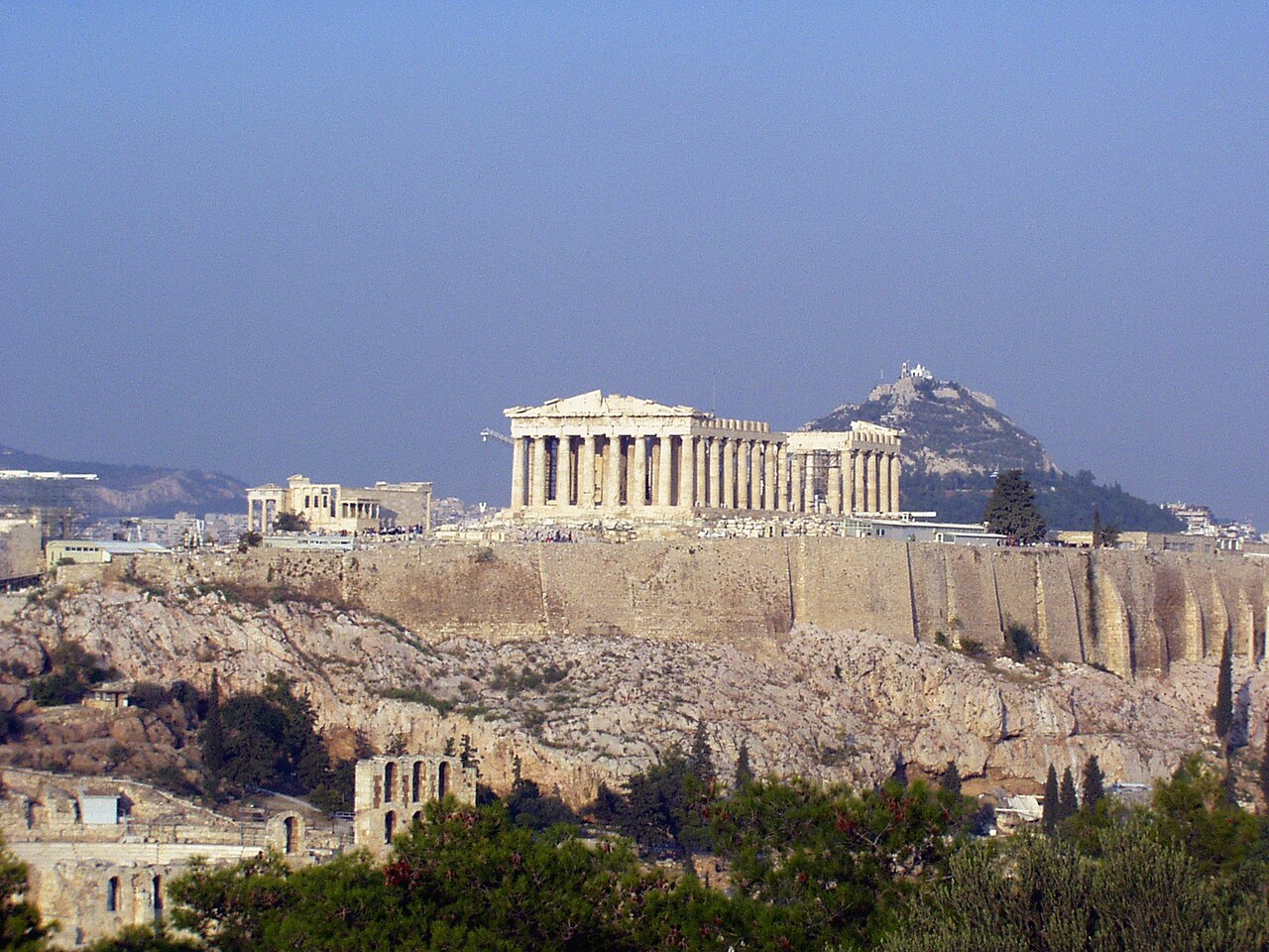


Geography and island groups
The Aegean is characterized by a heavily indented coastline and a scattering of hundreds of islands and islets. These landforms belong to several recognized groups that differ in size, geology and human settlement patterns. Major categories include:
- Cyclades — central islands known for whitewashed towns and maritime trade.
- Dodecanese — southeastern cluster including Rhodes.
- North Aegean Islands — nearer the Turkish coast.
- Sporades and Saronic Islands — closer to mainland Greece.
- Crete — the largest island, forming the sea's southern margin.
Geology, climate and marine environment
The basin of the Aegean results from complex tectonic interactions between the Eurasian and African plates; tectonic activity has produced island arcs, deep basins and frequent earthquakes. The climate is Mediterranean: hot, dry summers and mild, wetter winters. Oceanographic features include seasonal currents, significant salinity gradients and habitats that support diverse marine life, from seagrass meadows to commercially important fish species.
Historical importance
The Aegean has been central to human history in the eastern Mediterranean. It was the setting for early maritime civilizations such as the Minoans on Crete and later the Mycenaeans, and it fostered trade, cultural exchange and the rise of classical Greek city-states. Control of Aegean sea lanes shaped naval conflicts and empires for millennia, influencing commerce and politics across the region.
Modern uses and challenges
Today the Aegean supports busy commercial shipping routes, vibrant tourist industries on its islands, small-scale fisheries and local agriculture. At the same time the sea faces pressures from overfishing, pollution, coastal development and the environmental impacts of tourism. Conservation efforts and maritime management seek to balance economic use with protection of habitats and cultural sites.
Notable distinctions and practical notes
The Aegean occupies an intermediate position between the broader Mediterranean Sea and the eastern waterways leading to the Black Sea. Its islands and coasts form a natural frontier between Europe and Asia in places, creating a unique blend of languages, architecture and history along both Greek and Anatolian shores. For travel, history or marine study, the Aegean remains one of the Mediterranean's most accessible and historically resonant subregions.
References to geographic features and place names in this article use common modern conventions and can be followed up through regional atlases and reputable online resources such as national hydrographic services or geospatial databases (coordinates, Greece, Anatolia). For general background on the wider sea system see the Mediterranean and its connections via the Dardanelles and straits leading toward the Sea of Marmara and Black Sea. Major southern islands include Crete and Rhodes, which are often used to define the Aegean's southern boundary.
Location
The Aegean Sea is the north-eastern part of the Mediterranean Sea. It is bounded to the west and north by mainland Greece and to the east by the Asia Minor coast of Turkey. The Cretan island arc with the islands of Kythira, Andikythira, Crete, Kasos, Karpathos and Rhodes, which connects the mountain ranges of the Peloponnese with the Taurus Mountains in southwestern Turkey, forms the southern end. Connection to the open Mediterranean Sea in the southeast (Levantine Sea) and southwest (Libyan Sea) exists via six straits:
- Strait of Rhodes (Στενό της Ρόδου), width 17 km, depth 350 m.
- Strait of Karpathos (Στενό της Καρπάθου), width 43 km, depth 850 m.
- Strait of Kasos (Στενό της Κάσου) Latitude 67 km, depth 1000 m.
- Strait of Andikythira (Στενό των Αντικυθήρων), width 32 km, depth 700 m.
- Strait of Kythira (Στενό των Κυθήρων), width 33 km, depth 160 m.
- Strait of Elafonissos (Στενό της Ελαφόνησου), width 11 km, depth 180 m.
The Aegean does not border directly on the Ionian Sea further to the southwest, but is separated from it by the Laconian Gulf, which still belongs to the Libyan Sea.
In the northeast there is a connection to the Black Sea via the Dardanelles, the Sea of Marmara and the Bosporus.
The maximum extension is about 650 km from north to south and 390 km from west to east. With an area of about 240,000 km², the share of the shelf is 5%.


Sea Parts
Questions and answers
Q: What are the coordinates for the Aegean Sea?
A: The coordinates for the Aegean Sea are 39°N 25°E.
Q: Where is the Aegean Sea located?
A: The Aegean Sea is located between Greece and Anatolia, in the Mediterranean Sea.
Q: What is the Aegean Sea connected to in the north?
A: The Aegean Sea is connected in the north to the Sea of Marmara and the Black Sea by the Dardanelles and Bosporus.
Q: What large islands mark the south end of the Aegean Sea?
A: The large islands of Rhodes and Crete mark the south end of the Aegean Sea.
Q: Is the Aegean Sea an independent body of water?
A: No, the Aegean Sea is part of the Mediterranean Sea.
Q: What countries are located on either side of the Aegean Sea?
A: The Aegean Sea is located between Greece and Anatolia.
Q: How are the Dardanelles and Bosporus connected to the Aegean Sea?
A: The Dardanelles and Bosporus are connected to the Aegean Sea in the north.
Tags
Related articles
Author
AlegsaOnline.com Aegean Sea: Geography, history, and modern significance Leandro Alegsa
URL: https://en.alegsaonline.com/art/1139
Sources
- commons.wikimedia.org : Aegean Sea