
Sea of Marmara
Inland sea in northwestern Turkey linking the Black Sea and Aegean Sea, separating Europe and Asia; noted for strong stratification, active tectonics, historic maritime routes and unique ecology.
The Sea of Marmara is the inland sea that links the Black Sea and the Aegean Sea and forms the central segment of the Turkish Straits. It lies entirely within the borders of Turkey and separates its European and Asian sides. The Bosphorus connects the Marmara to the Black Sea while the Dardanelles connect it to the Aegean Sea. Because it occupies the middle of the straits system, the Marmara is a principal transit route for regional shipping and for vessels to and from the ports of the Black Sea basin; for broader context see a general Turkish Straits overview.
Image gallery
9 Images





Geography and physical characteristics
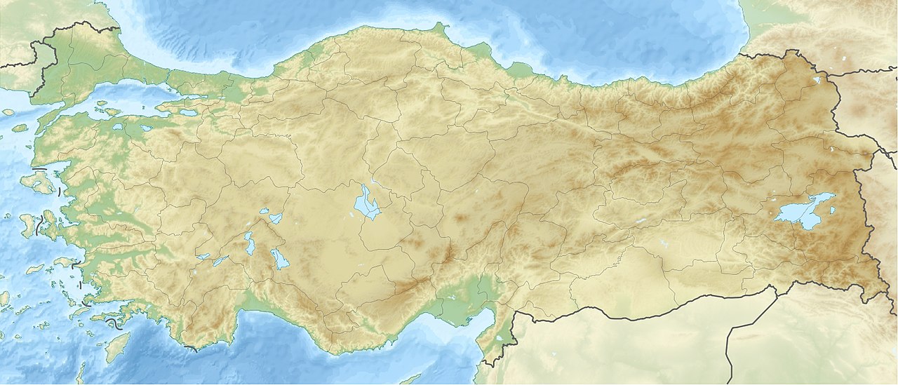
The Marmara covers roughly 11,350 km² and extends about 280 km east–west with maximum widths near 80 km. Coastal shelves and shallow gulfs alternate with deep central basins that reach more than 1,300 metres. The coastline includes several notable islands such as Marmara Island and groups of smaller isles and the seascape is indented by bays and gulfs. The basin is crossed by active tectonic structures, including the North Anatolian Fault, and the region is seismically active.
Hydrology and marine conditions
Waters of the Marmara are strongly stratified. Less saline surface waters derive from inflow of Black Sea water and river discharge, while denser, saltier Mediterranean water enters at depth. This two-layer circulation produces a sharp halocline in many places; deep layers can be oxygen-poor or anoxic, which affects benthic life and promotes preservation of organic material in sediments. Periodic algal blooms and episodes of low oxygen in bottom waters have been recorded and are matters of ecological concern.
Islands, coasts and climate
The sea contains inhabited and uninhabited islands used historically for quarrying and settlement; Marmara Island gave the sea its modern name through its marble resources. Coastal cities, large and small, line the Marmara shore and the climate is generally transitional between the wetter Black Sea and the more Mediterranean character of the Aegean, with variations along the coast influenced by elevation and exposure.
History, law and navigation
Known in antiquity as Propontis, the Marmara has been central to trade and cultural exchange between Anatolia (Anatolia) and the Balkans (Europe). Control of the Marmara and adjacent straits has been strategically important across empires and into the modern era. The international regime for passage through the Turkish Straits is a specialized area of maritime law; the straits also support dense ferry services and commercial shipping while presenting navigational challenges such as narrow channels and busy traffic near Istanbul via the Bosphorus.
Ecology, pressures and research
The Marmara supports fisheries, aquaculture and coastal ecosystems but faces environmental pressures including urban and industrial pollution, habitat change, invasive species introduced by shipping, and overfishing. Scientific monitoring, conservation measures and regional cooperation aim to address water quality and biodiversity loss. The sea's anoxic basins and preserved sediments are important for marine archaeology and for the study of past environmental change.
Regional impact
Because it links two major marine basins, the Sea of Marmara is both a physical connector and a focal point for economic activity, culture and science. Its condition affects the wider Black Sea and Aegean systems. For navigation, ecology and history, the Marmara remains a distinctive inland sea whose management involves national and international interests, including rules for passage through the straits and efforts to mitigate pollution and seismic risk around this densely populated corridor.
Further reading and authoritative resources can be found under general references to the Turkish Straits, the Black Sea, the Aegean Sea, the Bosphorus, regional studies on Anatolia, European–Asian connections (Europe) and the Dardanelles.
Questions and answers
Q: What is the Sea of Marmara?
A: The Sea of Marmara is an inland sea that connects the Black Sea to the Aegean Sea and separates Turkey's Asian and European parts.
Q: How is the Sea of Marmara connected to the Black Sea and the Aegean Sea?
A: The Sea of Marmara is connected to the Black Sea via the Bosphorus strait and to the Aegean Sea via the Dardanelles strait.
Q: What is the area of the Sea of Marmara?
A: The Sea of Marmara has an area of 11,350 km².
Q: What is the greatest depth of the Sea of Marmara?
A: The greatest depth of the Sea of Marmara is 1,370 m.
Q: What are the other names of the Sea of Marmara?
A: The Sea of Marmara is also known as the Sea of Marmora or the Marmara Sea.
Q: What does the Sea of Marmara separate?
A: The Sea of Marmara separates Turkey's Asian and European parts.
Q: What is the size of the Sea of Marmara?
A: The Sea of Marmara is 280 km x 80 km in size.
Related articles
Author
AlegsaOnline.com Sea of Marmara Leandro Alegsa
URL: https://en.alegsaonline.com/art/88271
Sources
- encyclopedia.com : Sea of Marmara