
Bosporus (Bosphorus): the strait dividing Europe and Asia
A narrow, strategic strait in northwest Turkey linking the Black Sea with the Sea of Marmara and separating the European and Asian sides of Istanbul.
Overview
The Bosporus, also spelled Bosphorus, is a natural strait in northwest Turkey that separates the European and Asian sides of the country (the Asian side is commonly called Anatolia). It connects the Black Sea in the north with the Sea of Marmara to the south, forming a key link between the seas of the wider Mediterranean basin.
Image gallery
10 Images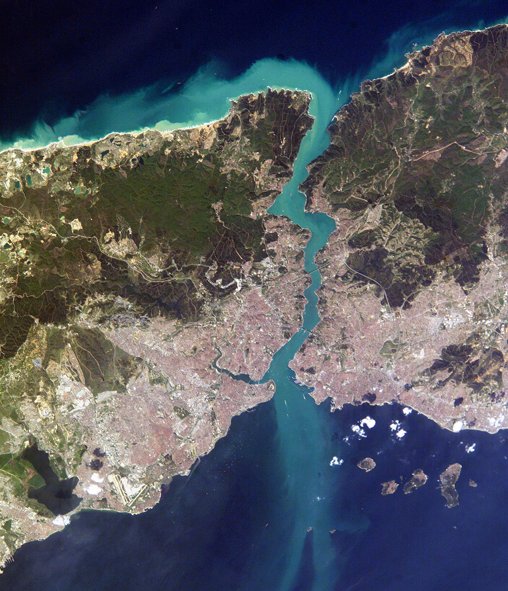


Physical characteristics
The waterway is roughly 30 km long. Width varies considerably: the northern entrance broadens to about 3,700 metres, while at narrow points it falls to around 700–750 metres. Depths in the main channel range from several dozen metres to over a hundred metres, creating a confined but deep passage for commercial and naval vessels.
Human geography and crossings
The densely populated shores are dominated by the city of Istanbul, with historic neighborhoods, fortresses and waterfront districts lining both banks. Modern infrastructure includes three road bridges, a rail-and-road suspension bridge, and the submerged Marmaray rail tunnel linking the two continents, all designed to accommodate heavy commuter and freight traffic.
History and strategic importance
For millennia the Bosporus has been a strategic gateway between Europe and Asia. Control of the strait affected ancient Greek colonies, the Byzantine and Ottoman capitals, and later regional trade and naval strategy. Its nearby fortifications and castles testify to its long military and commercial significance.
Hydrology, ecology and navigation
The Bosporus exhibits complex hydrology: surface waters tend to flow from the Black Sea toward the Sea of Marmara while denser, saltier waters return at depth. This two-layer circulation affects salinity, marine life and pollutant dispersal. The strait supports busy commercial shipping lanes, local fishing, ferries and tourism; its currents and narrow points require careful navigation.
Notable facts and modern challenges
- It links two major seas and forms part of international maritime routes.
- Urban growth along the shores places pressure on water quality and habitats.
- Traffic management, environmental protection and heritage conservation are ongoing policy concerns.
Further reading and maps are available through regional and maritime resources; for specialized studies see historical, oceanographic and urban planning references. Multiple anchors, bridges and tunnels continue to shape how people move across this historic channel.
Related links: strait (general), European side, Turkey, Asian side, Anatolia, Black Sea, Sea of Marmara, 30 km length, 3,700 m width, Istanbul.
Related articles
Author
AlegsaOnline.com Bosporus (Bosphorus): the strait dividing Europe and Asia Leandro Alegsa
URL: https://en.alegsaonline.com/art/13200