Phantom island: cartographic errors, mirages and lost lands
Phantom islands are reported landmasses that appeared on charts or in accounts but were later disproved, renamed, or submerged. Causes include mapping mistakes, optical effects, and real loss by erosion.
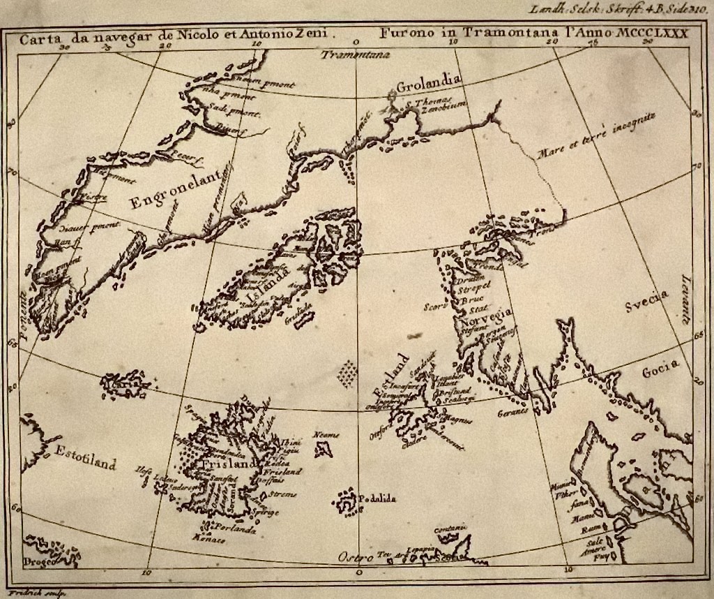
A phantom island is a reported island that at some time appeared in charts, sailors' narratives or scientific reports but whose existence was later questioned, relocated, renamed, or removed from maps. These entries persist in the historical record because early navigation and surveying relied on sparse observations, imperfect instruments and secondhand reports. Some phantom islands were never real; others correspond to misidentified or transient features.
Image gallery
6 Images


Characteristics and causes
Phantom islands arise for several reasons. Simple human error or transcription mistakes can place a feature incorrectly on a map. Natural processes such as erosion, volcanic collapse or sea-level change can reduce or destroy small islands, making formerly accurate reports obsolete. Optical phenomena — for example a superior mirage — and poor navigation under sail or in polar regions contribute further. Navigators relied on dead reckoning and rudimentary chronometers; cumulative errors sometimes produced systematic false sightings.
History and notable examples
Explorers and cartographers recorded many such places. In the early 20th century, Arctic explorer Robert Peary reported a large landmass called Crocker Land, later shown to be non‑existent. Other cases reflect partial correctness: Baja California long appeared as an island until further exploration established it as a peninsula. The classical place called Thule has been variously associated with Norway, the Orkney Islands, Shetland or broader Scandinavia, and some modern scholars link ancient descriptions to Iceland, Greenland or the Estonian island Saaremaa in the Baltic Sea.
Categories and well‑known cases
Phantom islands can be grouped by origin: mislocation, misidentification, optical illusion or genuine disappearance. Examples include reported reefs in the South Pacific such as Earnest Legouve Reef and Maria‑Theresa Reef, long unverified or removed from charts; sightings later demonstrated to be products of navigation errors; and phenomena like optical illusions leading to reports such as New South Greenland, a sighting in the Weddell Sea in 1823 not confirmed by later expeditions.
Loss, rediscovery and cultural impact
Some phantom islands turned out to be real places mislocated on early charts or renamed by later explorers: for instance, what was once called Bacalao in 16th‑century accounts influenced names such as Baccalieu Island. Other entries were once real but are now submerged: candidates include small features reported in the South Atlantic such as Thompson Island and the Mexican‑coast feature Bermeja, which have featured in debates about disappearance versus cartographic error.
Why phantom islands matter
Beyond curiosity, phantom islands illuminate the limits of historical observation, the evolution of surveying technology, and how mapmakers cope with uncertainty. They affected navigation, colonial claims and scientific hypotheses and remain a subject for historians, cartographers and geographers studying how knowledge of the world was constructed and corrected over time.
Related articles
Author
AlegsaOnline.com Phantom island: cartographic errors, mirages and lost lands Leandro Alegsa
URL: https://en.alegsaonline.com/art/76336