Shetland Islands: geography, people, economy and history
An accessible overview of the Shetland Islands: location, landscape, climate, settlement, economy, cultural highlights and historical context, with key distinctions and practical facts.
The Shetland Islands (commonly called Shetland) are a remote archipelago off the north-east coast of Scotland. They form the most northerly part of the country and lie between the islands of the North Atlantic and the North Sea. The term "Shetland" usually refers to the whole island group and to its main administrative and cultural centre, Lerwick. For a concise geographic reference see archipelago and the relationship to Scotland within the United Kingdom.
Image gallery
10 Images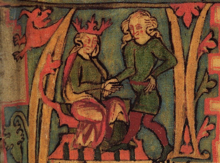


Location and geography
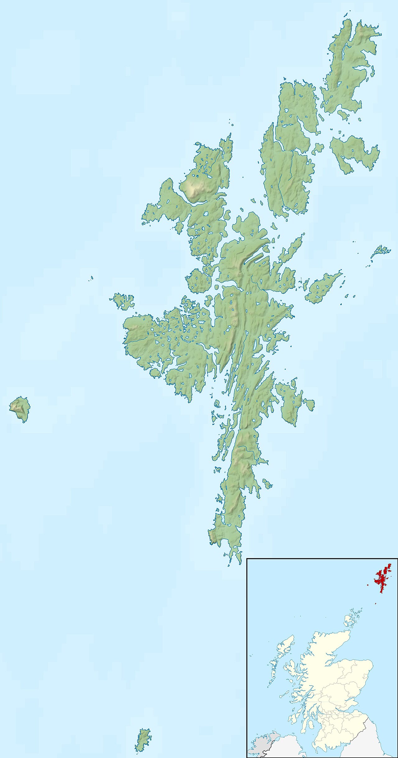
Shetland sits to the north-east of the Scottish mainland, roughly between the Faroe Islands and the Orkney Islands. The distance to Orkney is commonly given as about 50 miles. The group comprises around one hundred islands and skerries, of which about sixteen are inhabited; the largest include Mainland (the biggest island), Yell, Unst, Fetlar, Whalsay and Bressay. The islands form part of the maritime boundary where the Atlantic Ocean meets the North Sea, giving the surrounding waters strong tides and variable weather.
Landscape, climate and wildlife
The landscape is a mix of rugged coastline, cliffs, peat moorland, coastal heath and small farmland. The climate is often described as cool and maritime or temperate maritime with some features of subarctic conditions—winters are milder than inland latitudes at the same latitude but can be windy and changeable. Shetland is important for seabirds, marine life and breeding populations of waders; its sandy bays and machair support distinctive plant communities.
People, settlements and infrastructure
Lerwick serves as the principal town and administrative centre (Lerwick). Communities are typically small and distributed among the larger islands; many residents rely on ferries and inter-island transport to access services. Local culture preserves Norse place-names and traditions alongside Scottish influences. Visitors encounter traditional crofting landscapes, fishing harbours and local festivals.
Economy, agriculture and modern industries
Agriculture has long been important: Shetland sheep are noted for fine wool and hardy breeds; the islands are also known for the Shetland pony and the Shetland Sheepdog. Exports and cottage industries include knitwear and livestock products (wool). Since the late 1960s, the discovery of offshore petroleum—first reported around 1969—helped diversify the economy and brought investment and jobs connected to the energy sector. Fishing, aquaculture and growing tourism also contribute to local income.
History and identity
Shetland's history reflects layers of settlement and governance. The islands have long Norse associations and were once known by older names such as Hjaltland or Zetland. Over centuries they became integrated into Scottish administration while retaining distinct linguistic and cultural traces of their Norse past. Today Shetland combines a strong local identity with participation in modern Scottish and UK institutions.
Notable facts and distinctions
- About one hundred islands and skerries make up the group; roughly sixteen are permanently inhabited.
- Major islands include Mainland, Yell, Unst, Fetlar, Whalsay and Bressay.
- Key economic activities: crofting and sheep farming, fisheries and aquaculture, oil and gas-related services, tourism and traditional crafts.
- Climate and wildlife make Shetland a recognised area for seabird colonies and marine nature.
For further reading on the archipelago's physical geography, history and community life use the linked references above to explore specific topics such as administrative arrangements, natural environment and local industries.

History
Previous story
Shetland has been inhabited since the 3rd millennium BC. The inhabitants practiced agriculture and animal husbandry and built stone tombs (e.g. Gillaburn, Islesburgh Cairn, Ronas Hill, Punds Water or Vementry).
In the 2nd millennium BC (Bronze Age) the climate became wetter and colder, so the inhabitants settled closer to the coast. In the Iron Age, brochs, round stone towers that can still be visited today were built here: for example Clickhimin, the Broch of Culswick, the Jarlshof and Broch of Mousa, but also blockhouses, ring forts, rampart forts, earthhouses souterrains and wheelhouses or temples such as Stanydale characterise the image of the archipelago.
What language was spoken on the islands until the arrival of the Vikings is largely unclear. It may have been Pictish, a now extinct - probably Celtic - language. In the 9th century, this language was supplanted by Old Norse, spoken by the Scandinavian immigrants, which evolved into the Norse dialect of Norn in Shetland. Norn was spoken in the islands until the 18th century, with its extinction it was replaced as the vernacular by Scots. However, the influence of Norn is still noticeable in a number of grammatical peculiarities (such as the formation of tenses with "ta be" instead of "tae hae" = "I am been" instead of "I hae been" or "I wis been" instead of "I haed been") and a large number of words borrowed from Norn. This makes the Shetland island dialect a distinctive variety of Scottish English, or more precisely "North Insular Scots".
Antiquity to the present
The Skoten, whose raids are reported by the Romans, originally came from Ireland. At the time of the kingdom of Dalriada they extended from County Antrim in Northern Ireland to Argyll in Western Scotland. In the rest of Scotland and the Northern Isles lived the Picts ("the Painted Ones") first mentioned in Roman accounts in 297 AD. In the 9th century, the Vikings landed here and named the islands Hjaltland. They established new laws of their own and, above all, their own language, which developed into Norn. In the 10th century they were Christianized. Around 1195, the islands were placed directly under the crown of Norway for some time. The Shetlands also belonged to Norway later on. In the 14th century Norway (with its possessions) united with Sweden and Denmark. The hoard on St Ninian's Isle dates from the Viking Age.
The Norwegian-Danish crown estate in the Shetland Islands, i.e. the land in question and the rights accruing from the land, came under the control of Scotland as security for the dowry of the daughter of the Danish King Christian I, Margaret, in 1469, when she married King James III of Scotland. Shetland was subsequently annexed by the Kingdom of Scotland but, unlike Orkney, was not immediately incorporated into the general administration of the realm but was placed under the Royal Scottish Privy Council. From then on, Scottish influence over the islands grew. Old Norn as a commonly spoken language died out in the 19th century. Nevertheless, to this day, especially on the northernmost island of Unst, there are still a few old people who remember the old sagas and stories.
From the 15th to the end of the 17th century, lively trade relations developed between the Hanseatic League and Shetland, which required numerous imported goods.
During the Second World War, Shetland played a role in supporting the Norwegian resistance and escaping from occupied Norway. Commando operations were carried out and agents smuggled in from here. Crossing between Shetland and the entire Norwegian coast was accomplished with mainly Norwegian fishing boats, which was only possible during the winter season. The actions became known as the "Shetland Bus", of which the most famous were probably the attacks on the German battleship Tirpitz in 1942 and on the heavy water plant of Norsk Hydro at Rjukan in the Norwegian Telemark.


Earth Sciences
Geology and morphology
The archipelago was formed at the beginning of the Paleozoic era during the Caledonian mountain building. It is composed of different sedimentary rocks. Shetland's surface is rocky. The archipelago is also called "The old rock" because it is dominated by hard sediments that are among the oldest rocks on earth. Shetland-Mainland, Yell and the west of Unst are composed of crystalline shales and gneisses. North Mainland is composed mainly of granite. Gabbro and serpentine form the east of Unst and Fetlar. Sandstone is found only on the western and eastern edges of the archipelago. The glaciers of the ice age are responsible for the relief there. The landscape here resembles that of Orkney, while the rest of Shetland is rugged. The soil layer is thin, boulders, bogs and acid meadows, numerous small lakes and ponds are present. The hard rocks of Mainland offered enormous resistance to the ice masses. These followed the weak zones in the earth's crust, the fold and fracture lines from the time of mountain building or the valleys filled with limestone deposits. Thus were formed the mighty glacial valleys and the long and deep Voes: Bowland, Clousta, Culbinsbourgh, Footabrough, Leiraness, Papil, Quarf, Scalloway, Scatsta, Setter, Snarraness, Sound, Sullom and Tresta. Picturesque shapes that characterise the west-facing coastal panorama were created by the interaction of westerly winds and surf that undermined the rocks. Gloups developed as holes broke into the too-thin cover of sea caves. Crevices cutting into the land widened into what are known as geos.
The Geos and Gloups and the rock gate of Dore Holm off the west coast of Esha Ness offer the most impressive sight in the north-west of Mainland. The Catpund-burn, with steatite, serpentinite and shale layers, runs eastwards into the sea at Cunningdburgh for about a kilometre.
Climate
Shetland is generally very mild and humid (1000 mm rainfall annually), determined by the Gulf Stream. Winter on the islands is usually quite mild with only occasional frost and rather rare snowfall, although the winter half-year is also the wettest time of the year. In summer, temperatures can easily rise to 15 °C or more. However, storms, heavy rain and fog are common and can make the weather relatively uncomfortable even in summer.
Climate table Lerwick
| Month | Jan | Feb | Mar | Apr | May | Jun | Jul | Aug | Sep | Oct | Nov | Dec | Year |
| Day temperature °C | 4 | 4 | 6 | 9 | 12 | 13 | 15 | 15 | 12 | 10 | 7 | 5 | 9,3 |
| Night temperature °C | 1 | 0 | 1 | 3 | 5 | 7 | 9 | 9 | 7 | 5 | 2 | 1 | 4,1 |
| Sunshine hours per day | 1 | 2 | 3 | 4 | 5 | 6 | 6 | 5 | 4 | 2 | 1 | 0 | 3,2 |
| Rainy days | 22 | 19 | 16 | 15 | 14 | 15 | 16 | 17 | 18 | 20 | 23 | 21 | 216 |
| Water temperature °C | 5 | 5 | 5 | 6 | 7 | 9 | 11 | 12 | 11 | 10 | 8 | 6 | 8 |


Questions and answers
Q: What is Shetland?
A: Shetland is an archipelago, the furthest out part of Scotland in the United Kingdom.
Q: Where is Shetland located?
A: Shetland is located between the Faroe Islands and the Orkney Islands, about 50 miles to the northeast of the Orkney Islands.
Q: How many islands are there in the Shetland group?
A: There are about 100 islands in the Shetland group.
Q: How many islands in the Shetland group are inhabited by people?
A: People live on 16 of the islands in the Shetland group.
Q: What is the climate like in the Shetland group?
A: The climate of the Shetland group is subarctic and rather bleak.
Q: What is the administrative center of Shetland?
A: The administrative center of Shetland is Lerwick.
Q: What are some well-known exports from Shetland?
A: Some well-known exports from Shetland are the Shetland ponies, Shetland Sheepdog, and sheep known for their fine wool.
Related articles
Author
AlegsaOnline.com Shetland Islands: geography, people, economy and history Leandro Alegsa
URL: https://en.alegsaonline.com/art/89723
Sources
- fettes.com : "Tsunami hazards"
- culture.gov.uk : culture.gov.uk/news/media_releases/7220.aspx