
Physical geography: Earth's systems, landscapes, and processes
Study of Earth's natural systems—atmosphere, water, landforms and life—their processes, patterns, history, and how they shape environments and human activity.
Overview
Physical geography is the branch of geography concerned with the natural features and processes of the Earth. It examines the distribution, dynamics and interaction of air, water, land and life, and it overlaps with allied sciences such as geology and ecology while maintaining a focus on spatial patterns and scales. Physical geographers study how components of the natural environment originate, evolve and influence human systems over short and long time frames.
Image gallery
3 Images
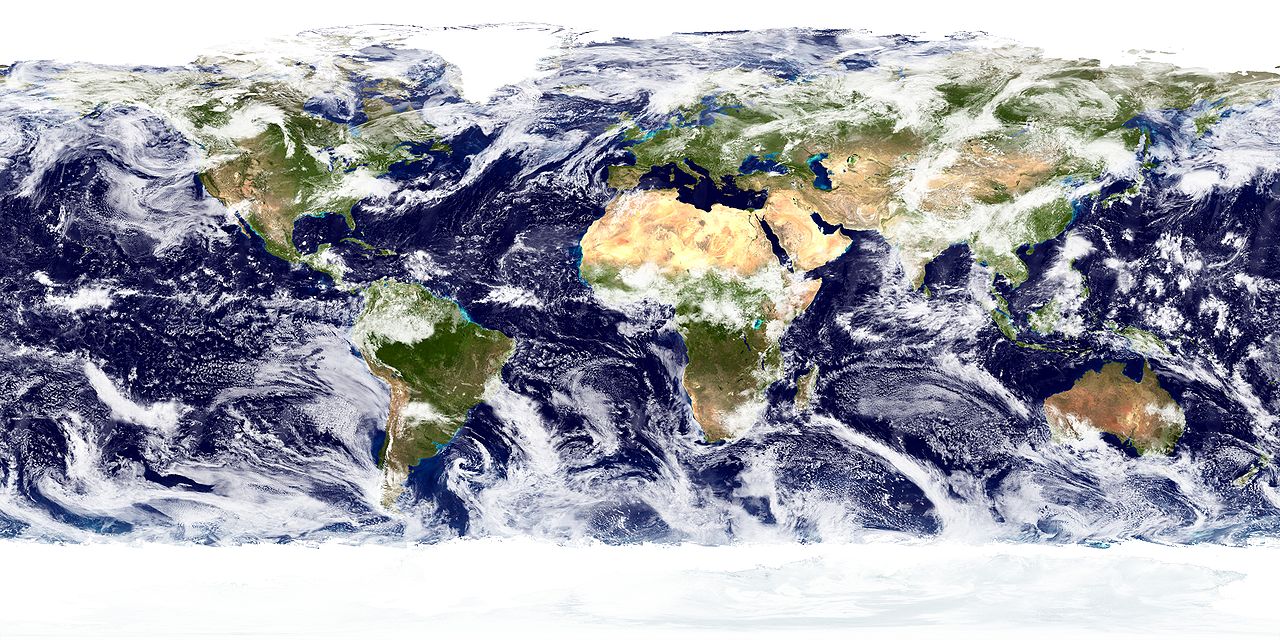

Major components and processes
The discipline describes and explains the major spheres of the Earth system and the processes that connect them. Important topics include:
- Hydrosphere: rivers, lakes, groundwater, wetlands and ocean circulation, and their role in shaping landscapes and supporting life.
- Biosphere: the distribution of plants, animals and ecosystems, and interactions between living organisms and physical environments.
- Atmosphere: weather, climate systems, and the movement of air masses that determine regional climates and extreme events.
- Land surface: landforms, soils and terrain, including mountains, plains, deltas and coastal features.
- Cryosphere: glaciers, ice sheets and seasonal snow, important for sea-level and regional hydrology.
Processes of interest include plate tectonics, volcanism, erosion and deposition, weathering, sediment transport, the water cycle and energy exchanges that drive climate. Physical geography links short-term phenomena such as storms to long-term changes in landscapes and environments.
Subdisciplines
Key subfields focus on particular systems or scales. Examples are geomorphology (landforms and surface processes), climatology (climate patterns and variability), hydrology (movement and distribution of water), glaciology (ice and glaciers), biogeography (species distributions and habitats), pedology (soils) and coastal geography (shoreline processes and sea-level change). Practitioners often work across these areas to address complex environmental questions.
Methods and tools
Physical geographers use a mix of fieldwork, laboratory techniques and quantitative modeling. Modern tools include remote sensing from satellites and aircraft, Geographic Information Systems (GIS) for mapping and spatial analysis, global positioning systems (GPS) for precise location data, and numerical models to simulate climate, hydrology and landscape evolution. Long-term observations from instruments and archives help reconstruct environmental histories and test hypotheses.
Applications and human relevance
Knowledge from physical geography informs land-use planning, water and natural-resource management, hazard assessment and conservation. It helps explain why human populations concentrate in particular places: for instance, relatively few people live in arid deserts, whereas many cities and agricultural regions are found near major waterways such as major rivers and coasts. Analyses of flood risk, soil erosion, drought and coastal erosion are essential for infrastructure, agriculture and disaster preparedness.
Challenges and contemporary issues
Contemporary concerns include climate change and its effects on sea level, hydrological cycles and extreme weather; land-use change and urban expansion; water scarcity; and biodiversity loss. Physical geographers contribute to understanding these challenges by quantifying changes, projecting future scenarios and advising on adaptation and mitigation strategies.
History, education and careers
From early explorers and mapmakers to modern earth-system scientists, the field has evolved to integrate quantitative methods and interdisciplinary perspectives. Training typically includes courses in physical science, statistics, field methods and spatial analysis. Career paths include academic research and teaching, government and environmental agencies, consulting, natural resource management and geospatial professions.
For readers seeking further orientation, introductory texts, atlases and online resources provide maps, case studies and summaries of major processes; specialized journals publish detailed studies on particular phenomena and regions.
Related articles
Author
AlegsaOnline.com Physical geography: Earth's systems, landscapes, and processes Leandro Alegsa
URL: https://en.alegsaonline.com/art/76653
Sources
- physicalgeography.net : Fundamentals of Physical Geography, 2nd Edition, by M. Pidwirny, 2006