
New South Greenland (Morrell's Land)
Account of 'New South Greenland' (Morrell's Land), a phantom Antarctic coastline reported in 1823 in the Weddell Sea, later disproved by later expeditions and ascribed to navigational error, optical illusion, or misidentification.
Overview
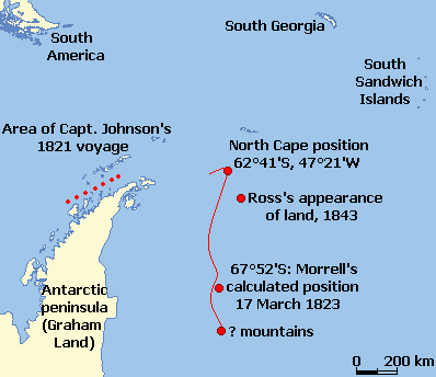
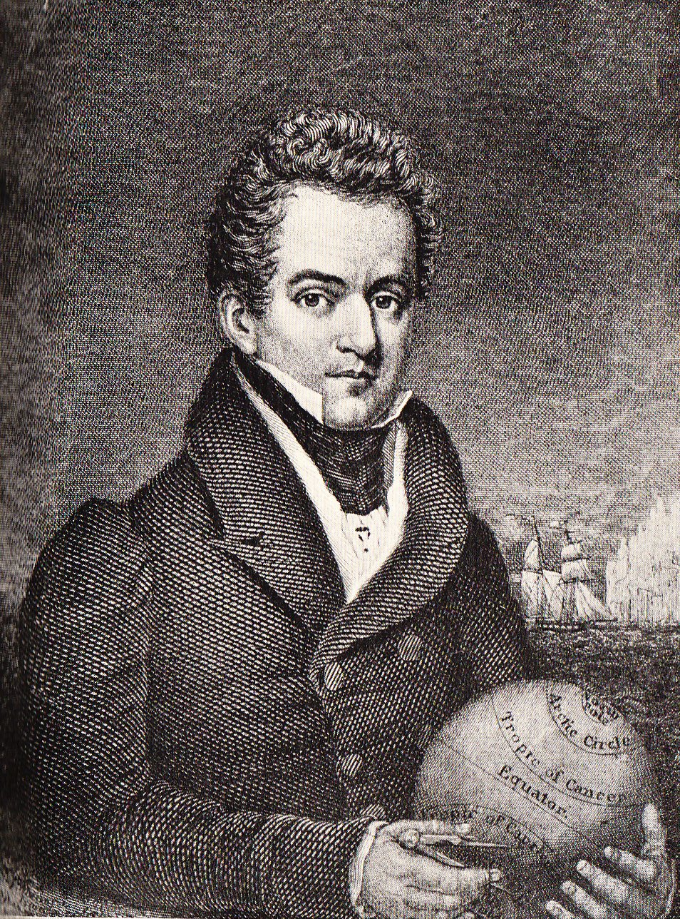
New South Greenland, commonly known as Morrell's Land, is a classic example of a "phantom" land report from the age of sail. It originated in an 1823 narrative by the American sealer and navigator Benjamin Morrell, who described a substantial stretch of coastline seen from the schooner Wasp while operating in the region now identified as the Weddell Sea sector of Antarctica. Morrell recorded coordinates and a descriptive account of coastal features and stated that he had followed the shore for many miles. For decades the report influenced maps and stimulated discussion among seafarers, naturalists and geographers.
Image gallery
8 Images




The voyage and the original report
Morrell's account was published in a period when southern high-latitude geography was very incompletely known. Vessels operating in the Weddell Sea encountered pack ice, drift ice and large tabular icebergs that made approach difficult and visibility unreliable. Contemporary readers accepted the possibility that unexplored coasts might exist in those waters, so Morrell's named land and precise coordinates were taken seriously by some mapmakers. In his narrative Morrell gives a short descriptive passage about the appearance of shorelines and headlands, and attributes the initial discovery to another sealing captain, a claim that some historians have noted as complicating a simple reading of motives or deception.
Reception, mapping and early skepticism
Not all contemporaries immediately accepted Morrell's report without reservation. Morrell already had a reputation among certain readers for exaggeration and inconsistency in his published voyage narratives, and critics pointed to internal errors and the absence of corroborating testimony from other ships in the same season. Nevertheless, the combination of scarce knowledge of the Weddell Sea and the practical difficulties of surveying in winter seas meant that the possibility of an unknown coast could not be dismissed outright, and cartographers sometimes inserted speculative features on charts in response to such reports.
Expeditions that tested the claim
Over the course of the nineteenth and early twentieth centuries several voyages entered the Weddell Sea and examined the area described by Morrell. In 1843 the British naval officer James Clark Ross reported observations of distant features in a broadly similar sector, but those reports ultimately yielded no confirmation of a continuous coastline at the positions in question. Much later, in 1912 the German expedition under Wilhelm Filchner aboard the Deutschland became beset by pack ice and drifted through waters close to Morrell's published coordinates. Filchner and his officers carried out soundings and visual searches; deep water depths and the absence of any nearshore shoals or grounding features argued strongly against a nearby landmass. A short time afterward, when Ernest Shackleton and his party were trapped in pack ice during the Endurance expedition, his team also made soundings and observations that failed to corroborate Morrell's coastline. These later investigations, using systematic sounding and more reliable navigation, led to the removal of New South Greenland from most charts.
Possible explanations for the sighting
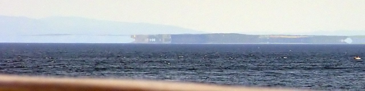
Scholars have advanced several nonexclusive explanations for Morrell's account. One possibility is honest error: navigational mistakes, especially in dead reckoning and longitude calculations before widespread reliable chronometers and celestial fixes, could place a ship many miles from its true position and thereby misplace any observed features. Another plausible cause is misidentification: groups of grounded or clustered icebergs, ice cliffs of ice shelves or distant light-and-shadow effects can mimic the appearance of solid land when viewed from a distance. Atmospheric refraction in polar regions produces superior mirages and Fata Morgana effects that distort and multiply images of distant objects; such mirages have been invoked to explain several phantom land reports in polar regions. Finally, deliberate exaggeration or invention by an author seeking to enliven a narrative has been proposed, though Morrell's attribution of the discovery to a fellow sealer complicates a simple explanation of conscious fraud.
Scientific and cartographic significance
The case of New South Greenland is instructive for understanding how exploration-era knowledge was formed and corrected. In the nineteenth century many charts incorporated reports from single voyages, and speculative coastlines sometimes persisted until independent verification was possible. The later disproof of Morrell's coastline through systematic survey, soundings showing deep ocean depths and the accumulation of negative evidence demonstrates the corrective mechanisms of follow-up exploration and more rigorous measurement. The episode is one of many in which field observation, navigation, and later scientific techniques combined to refine understanding of remote environments.
Context within polar exploration and phantom islands
New South Greenland belongs to a broader category of maritime anomalies often called phantom islands or phantom coasts. Similar cases appeared in Arctic and Pacific navigation, where visibility, weather, instrument error and human interpretation created convincing but incorrect geographic reports. Modern satellite imagery and comprehensive hydrographic surveys have eliminated almost all such uncertainties in well-traveled polar seas, but historical reports remain valuable for historians of science and exploration because they illuminate past practices of observation, the limits of instruments of the time, and the social processes by which geographic knowledge was contested and corrected.
Further study and related resources
Researchers interested in the episode can consult contemporary voyage narratives and later historical analyses discussing Morrell, the sealing trade and nineteenth-century polar navigation. Useful starting points for related topics include entries and records tied to New South Greenland, biographical material on Benjamin Morrell and narratives of voyages by the schooner Wasp. Broader context is provided by studies of the Weddell Sea, surveys of Antarctica, accounts of the Deutschland drift, the observations of James Clark Ross, and the Endurance-era work associated with Ernest Shackleton. Technical discussions often refer to the roles of large icebergs and atmospheric phenomena such as the polar mirage. Contemporary readers should be aware that primary narratives from the era must be read critically, balancing firsthand description with the limitations of period navigation and observation.
New South Greenland remains a concise case study in the history of exploration: it shows both the limits of early seafaring knowledge and the ways in which later surveys, measurement and scientific scrutiny corrected cartographic mistakes.
Questions and answers
Q: What is New South Greenland also known as?
A: New South Greenland is also known as Morrell's Land.
Q: When was the sighting of this land reported?
A: The sighting of the land was reported by American captain Benjamin Morrell on the schooner Wasp in March 1823.
Q: Where did this sighting take place?
A: The sighting took place in the Weddell Sea area of Antarctica.
Q: How long did Morrell claim to have sailed along the coastline for?
A: Morrell claimed to have sailed along the coastline for more than 300 miles (480 km).
Q: Why were many people skeptical about the sighting at first?
A: Many people were skeptical about the sighting at first because of Morrell's reputation for liking to invent new stories and his obvious errors when describing it.
Q: How did Wilhelm Filchner and Ernest Shackleton confirm that no land existed at these coordinates?
A: Wilhelm Filchner and Ernest Shackleton confirmed that no land existed at these coordinates by taking soundings of the sea bottom, which revealed more than 5,000 feet (1,500 m) of water.
Q: What are some possible explanations for Morell's error in reporting a new land mass? A: Some possible explanations for Morell's error include miscalculation of his ship's position, misremembering detail when writing his account after nine years, confusing distant icebergs with land, or being misled by Antarctic mirage.
Related articles
Author
AlegsaOnline.com New South Greenland (Morrell's Land) Leandro Alegsa
URL: https://en.alegsaonline.com/art/69608