
Bathymetry: mapping and measuring underwater terrain
Bathymetry is the measurement and mapping of underwater topography. It documents depths and seafloor shapes for navigation, science, engineering and environmental management.
Bathymetry is the science of measuring and describing the underwater terrain and relief of bodies of water such as lakes, seas and oceans. It is the submerged counterpart to land topography, producing charts and digital models that show how deep and how steep the submerged surface is. The word derives from Greek roots meaning "deep" and "measure" and the discipline overlaps with hydrography and other branches of oceanography.
Image gallery
10 Images




Core concepts and common products
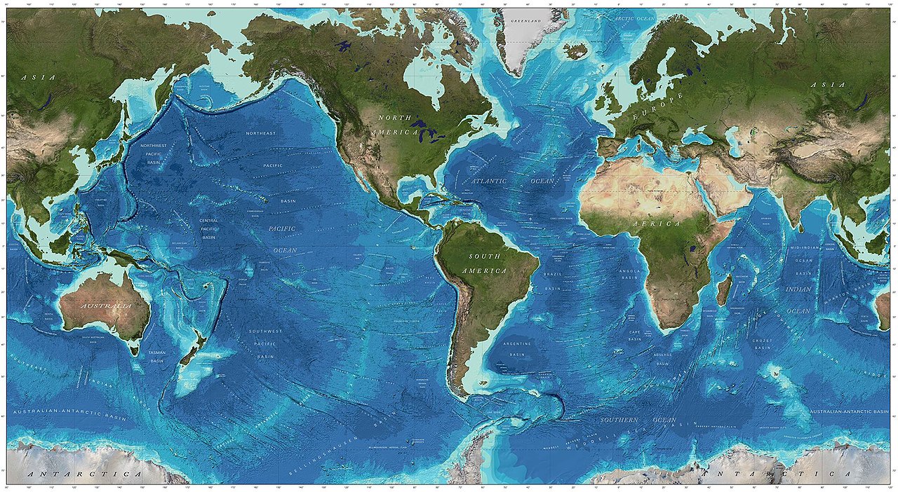
Bathymetric information is commonly presented as depth soundings, contour lines called isobaths, and gridded digital elevation models of the seafloor. Typical outputs include nautical charts that combine depth information with surface navigation guidance, habitat maps for fisheries, and three‑dimensional models used by geologists and engineers. Raw datasets can be point clouds of depth returns or continuous raster grids suitable for analysis and visualization.
Measurement methods
Historically, depths were measured by lowering weighted lines or cables from a vessel. Modern techniques are far more precise and efficient. Active acoustic systems such as single‑beam and multibeam sonar emit sound pulses and measure the travel time to the seafloor. Side‑scan sonar images seabed texture, while airborne LiDAR can survey shallow coastal zones. Satellite altimetry and gravity data help infer large‑scale bathymetry where ship data are sparse. Survey platforms range from large research vessels to autonomous surface and underwater vehicles.
History and development
Bathymetric practice evolved from simple lead‑line soundings to the adoption of echo‑sounding after early 20th‑century advances in acoustics. The mid‑20th century brought more systematic charting and, later, digital processing of sonar returns. The availability of multibeam sonar and GNSS positioning has dramatically improved coverage and vertical accuracy, enabling detailed mapping of seafloor features such as trenches, ridges, submarine canyons and volcanic edifices.
Uses and importance
Bathymetry supports maritime safety by identifying hazards to navigation and is essential for route planning, dredging and coastal engineering. Scientists use bathymetric maps to reconstruct past sea levels, model tsunami and storm surge propagation, and locate habitats for marine life. Industry relies on bathymetric surveys for cable and pipeline routing, resource exploration and environmental impact assessment. Conservation planning and fisheries management also use seafloor maps to protect sensitive areas.
Notable distinctions and considerations
- Bathymetry versus topography: bathymetry refers specifically to submerged terrain while topography more broadly covers land surface; both use similar concepts such as contours and elevation models (contours and DEM).
- Bathymetry versus hydrography: hydrography emphasizes safe navigation and maritime operations, whereas bathymetry emphasizes mapping the form and features of the seafloor (hydrographic charts).
- Data quality depends on sensor type, survey geometry and post‑processing; modern multibeam surveys provide dense, high‑resolution coverage compared with sparse historical soundings.
For further technical descriptions and standards, consult institutional resources and survey guidelines. Practical guides cover instrument calibration, tidal corrections, and data cleaning for producing reliable bathymetric maps and models (survey methods, data processing, application examples).
Related articles
Author
AlegsaOnline.com Bathymetry: mapping and measuring underwater terrain Leandro Alegsa
URL: https://en.alegsaonline.com/art/9378