North Cascades (Washington State)
Rugged, glaciated mountains in northern Washington State: steep peaks, major rivers and lakes, extensive wilderness protection and distinct ecological zones south of the Canadian border.
The North Cascades are the northernmost section of the Cascade Range and form a rugged, largely glaciated mountain region in the state of Washington. Located immediately south of Canada, the North Cascades lie entirely within the United States and are commonly distinguished from the continuation of the range north of the border, often called the Canadian Cascades. The mountains are part of the broader Cascade Range, an extensive chain of volcanic and non‑volcanic mountains that extends down the Pacific Northwest coast.
Image gallery
10 Images


Landscape and geology
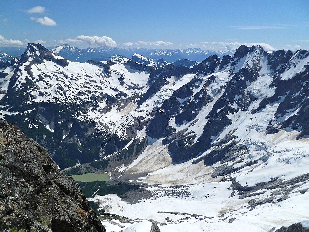
The North Cascades are characterized by steep, rocky peaks, deep U‑shaped valleys and an intricate mosaic of metamorphic and igneous rocks. Repeated glaciation carved sharp arêtes, cirques and horns, and many high basins still host small glaciers or permanent snowfields. At the northern end of the range, Mount Baker is the highest and most prominent volcanic summit in the U.S. portion of the North Cascades.
Glaciers, rivers and lakes
Glaciers in the North Cascades feed numerous rivers that flow toward the Pacific and into interior basins. Prominent rivers with headwaters in the range include the Skagit, the Nooksack, the Stillaguamish and the Stehekin. The Skagit watershed is notable for its salmon populations and for providing hydroelectric power and water resources to surrounding communities. Lake Chelan is the largest lake in the region; originally a deep glacial lake, it is now managed as a reservoir and controlled by a dam.
Ecology and conservation
A steep west‑to‑east climatic gradient creates a range of ecosystems from temperate rainforest on the western slopes to montane forests, subalpine meadows and alpine tundra above the tree line. These varied habitats support diverse plant communities and wildlife, including species adapted to old‑growth forests and cold alpine conditions. Large areas near the northern end of the range are protected within North Cascades National Park and adjacent wildernesses, which are managed to conserve ecological processes, native species and extensive glacial systems.
Human history and use
Indigenous peoples have lived in and traveled through the North Cascades for millennia, relying on river and mountain resources and maintaining travel routes across passes. In more recent centuries the range has seen mining, logging and development of water resources in valley bottoms, combined with growing efforts to protect remaining wilderness. Today the region attracts hikers, climbers, backcountry skiers and scientists who study geology, glaciers and climate change.
Access and nearby communities
The western approaches to the North Cascades are relatively close to major Puget Sound cities. Visitors commonly approach from Seattle, Tacoma and Everett, while the eastern and southern margins of the range transition toward the Columbia River basin; the Columbia River forms a geographic boundary along parts of the region. Trailheads, scenic byways and visitor centers provide access for recreation, education and resource management.
Further context and resources
- The name "North Cascades" is typically applied to the U.S. portion of the northern Cascade slopes; maps and regional guides often distinguish the area from the Canadian Cascades.
- For geological overviews and regional information see sources on the Cascade Range and mountain building in the Pacific Northwest.
- Management, visitor and safety information is available from agencies that oversee North Cascades National Park and related public lands.
- Hydrology and river stewardship programs frequently reference the Skagit River and its role in fisheries and energy.
- Practical access notes include details for reaching Lake Chelan, now a reservoir controlled by a dam, and for planning trips from cities such as Seattle, Tacoma and Everett.
Readers seeking maps, visitor guidance or scientific background can consult regional park materials and natural‑history summaries related to the Cascade Range, the North Cascades National Park complex and river basin organizations focused on the Skagit and other watersheds.
Related articles
Author
AlegsaOnline.com North Cascades (Washington State) Leandro Alegsa
URL: https://en.alegsaonline.com/art/70843