North Downs (chalk ridge of southeast England)
The North Downs are a chalk ridge in southeast England stretching from the White Cliffs of Dover to Farnham. Details on geology, history, wildlife, recreation and conservation.
The North Downs are a distinct range of hills in southeast England. They form a narrow band of high ground composed largely of chalk, running east–west from the famous White Cliffs of Dover on the Kent coast across the county of Kent and into the county of Surrey, ending near Farnham. The Downs are recognisable for their pale escarpments and gentler dip slopes; they are a prominent element of the regional landscape.
Image gallery
10 Images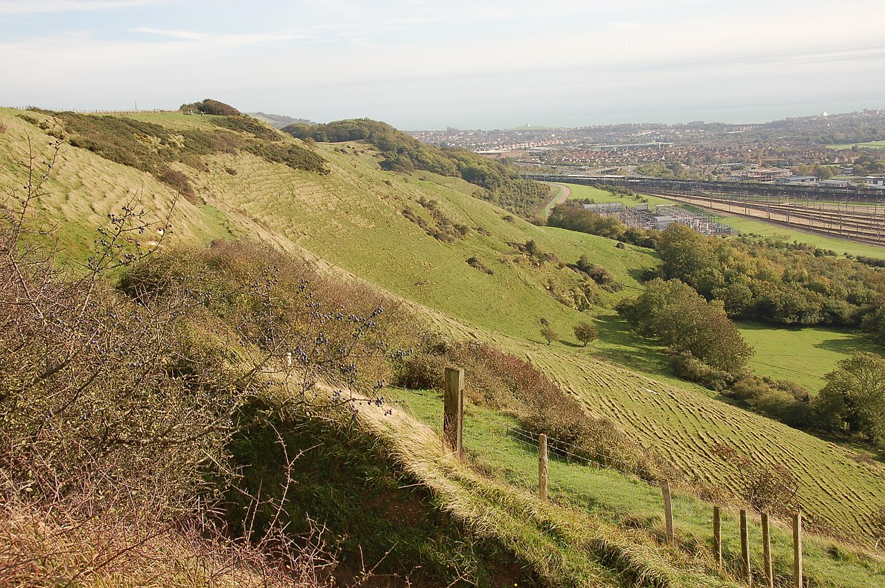


Physical characteristics and geology
The North Downs are underlain by porous Cretaceous chalk overlain in places by loess and flints. Chalk forms rounded hills, steep escarpments and a pattern of dry valleys where surface streams are absent for much of the year. Under dry, well-drained conditions the downs support specialist chalk grassland communities that harbour a rich assemblage of wildflowers and invertebrates.
History and human use
Human presence on the Downs stretches back millennia; prehistoric burial mounds, Roman roads and medieval trackways follow the higher ground. The ridge has shaped routes of communication and settlement: hilltop villages overlook fertile lowlands and the Downs provided timber, pasture and seasonal grazing. Agricultural practices such as sheep grazing helped create and maintain the open chalk grasslands valued today.
Ecology and conservation
Chalk grassland and chalk downland are internationally important habitats: a mosaic of turf, scrub and woodlands supports orchids, butterflies and scarce birds. Large tracts of the North Downs lie within protected landscapes and several tracts are designated as Areas of Outstanding Natural Beauty (AONBs) to conserve scenery and biodiversity. Conservation work often focuses on traditional grazing, scrub control and restoring species-rich turf.
Recreation and notable features
The ridge is popular for walking and cycling; long-distance routes such as the North Downs Way run along or close to the crest, offering extensive views and access to historic sites. The White Cliffs remain a symbol of the coastline, while inland chalk escarpments and dry valleys create varied scenery. Local towns and transport links make the Downs readily accessible for day visits and field study.
Distinctive facts
Compared with neighbouring uplands, the North Downs are defined by their chalk geology, a clear escarpment and a mix of exposed turf and beech or yew woodlands on steeper slopes. Their combination of natural history, archaeological sites and recreational value makes them an important and much-loved part of southern England's landscape.

Related articles
Author
AlegsaOnline.com North Downs (chalk ridge of southeast England) Leandro Alegsa
URL: https://en.alegsaonline.com/art/70863