
Khyber Pass: geography, history and strategic importance
Mountain pass linking Pakistan and Afghanistan; historic trade route and strategic frontier corridor through the Safed Koh/Hindu Kush with cultural, military and economic significance.
The Khyber Pass is a mountain passage that connects the Peshawar basin of present-day Pakistan with the highlands of eastern Afghanistan. For millennia it has been one of the principal routes between Central Asia and South Asia, carrying merchants, migrants and armies. The pass follows a gap in the Safed Koh range, an eastern spur of the Hindu Kush, and its highest point is near Landi Kotal on the Pakistani side.
Image gallery
9 Images


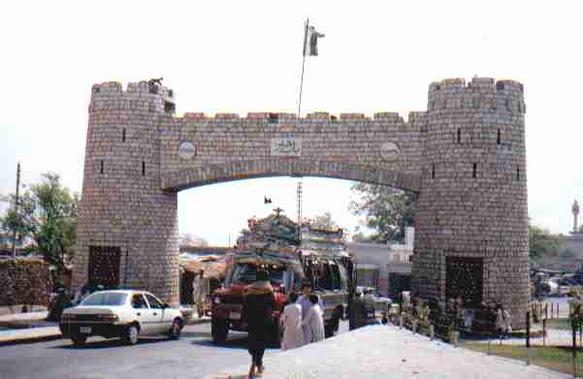
Location and physical characteristics
Geographically the corridor runs between the plains around Peshawar and the valleys of eastern Afghanistan. The summit is a short distance inside Pakistan near Landi Kotal and the gap cuts through the Safed Koh, a southeastern extension of the Hindu Kush. Elevation at the pass is roughly around 1,070 metres above sea level in the highest saddle; the route is steep and in places narrow, with rocky slopes and defensive positions that have been used historically by local tribes.
History and strategic role
Because it links the plains of South Asia with the uplands and steppes to the northwest, the Khyber Pass has played a recurring role in trade and warfare. It formed part of long-distance trade networks often called branches of the Silk Road, and it was used by invading armies and migrating peoples over centuries — from ancient and medieval campaigns to movements in the early modern period. In the 19th and early 20th centuries the pass was central to the British Indian frontier policy, which sought to control access across this corridor.
In more recent times the pass remained strategically important during 20th- and 21st-century conflicts in Afghanistan and the surrounding region, serving as a supply and transit route and a contested frontier area. The British-era Khyber Pass Railway and a main road historically linked Peshawar with Landi Kotal and beyond; maintenance and security of those transport lines have reflected wider political developments in the region.
The landscape is inhabited primarily by Pashtun communities. Local tribal groups, notably the Afridis, have long managed the routes through the pass, exercising control over caravan traffic and local defences. That local social structure has been an important factor in how the pass has been governed and contested over time.
Uses, importance and notable facts
- The Khyber Pass is an historic trade artery linking Central Asia and South Asia, used by merchants and caravans for centuries.
- It has been a focal point for military operations and frontier administration, associated with campaigns by regional powers and colonial forces.
- Modern road and (formerly) rail links have made it a key commercial and logistical corridor between Pakistan and Afghanistan.
- The pass lies within the province of Khyber Pakhtunkhwa in Pakistan and serves as an international border crossing between Pakistan and Afghanistan.
Because of its long history the Khyber Pass remains a symbol of the interface between different cultures, economies and military spheres in South-Central Asia. Its narrow gorges, strategic heights and tribal borderlands have shaped the human story of the region and continue to affect trade, security and local life.
Related links and further reading
- General overview of the pass
- Pakistan
- Afghanistan
- Khyber Pakhtunkhwa province
- Historic trade routes
- Central Asian connections
- South Asian routes
- Strategic studies
- Military history resources
- Pass summit details
- Landi Kotal
- Safed Koh range
- Hindu Kush
- Elevation and terrain
- Width and geography notes
- Afridi and other Pashtun tribes
Related articles
Author
AlegsaOnline.com Khyber Pass: geography, history and strategic importance Leandro Alegsa
URL: https://en.alegsaonline.com/art/53283