Hudson Valley: geography, geology, history, and cultural significance
The Hudson Valley of eastern New York follows the Hudson River from Westchester County to Albany. This article explains its geography, geology, glacial history, ecology, and cultural importance.
The Hudson Valley is the river valley of the Hudson River, extending roughly from Westchester County northward to Albany. The corridor lies in eastern New York State and serves as a defining natural and cultural region that links coastal areas around New York City with the interior of the state. Locally it is often simply called the Hudson Valley, and it contains a mix of urban centers, small towns, farmland, and protected natural landscapes.
Image gallery
10 Images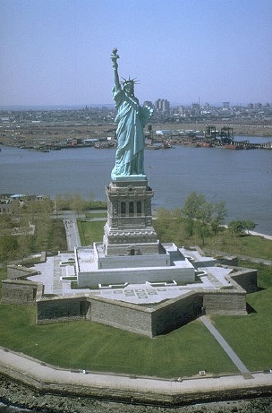


Geography and landscape
The valley runs predominantly north–south and is flanked at various stretches by uplands and cliffs. To the west rise long ridges that are part of the broader Appalachian Mountains, while to the east are smaller ranges and plateaus. In the southern reaches the river widens and is influenced by tidal flows; farther north it narrows and becomes more riverine. Notable landmarks include steep cliffs near the Tappan Zee Bridge corridor and the rocky outcrops of the Palisades.
Geology and rock types
The valley contains a complex geologic record. In the southern sections one finds sedimentary formations including Triassic sandstones and redbeds, while the famous Palisades Sill represents an igneous intrusion that forms dramatic cliffs. Farther north, older Precambrian metamorphic bedrock such as gneiss becomes more common. These rock units record hundreds of millions to over a billion years of Earth history and influence soil types, vegetation, and land use.
Glacial history and landforms
During the last ice age the valley was overridden by a continental glacier that sculpted bedrock and left deposits of till, outwash, and lakes. Glacial carving produced steep-sided segments, and in the area known as the Hudson Highlands the river flows through a deep, narrow channel that is often described as a fjord formed by ice action. At the close of the Pleistocene, meltwater from ice and from proglacial lakes such as ancient Lake Iroquois helped shape drainage; some of that flow drained toward what is now the Great Lakes system and to the Atlantic via the Hudson. Ice reached as far south as Long Island, and modern lakes such as Lake Ontario are remnants of these evolving postglacial waters. Accounts of repeated ice ages explain many of the region’s current landforms.
Ecology, land use, and culture
Vegetation ranges from mixed hardwood forests in uplands to riparian wetlands along the river. The valley has long been important for agriculture, transportation, and settlement: the Hudson itself served as a major colonial and early American corridor for commerce and migration. Today it supports a mix of urbanized suburbs, historic estates, working farms, vineyards, and protected parks. Recreation, conservation, and tourism—focused on hiking, river boating, and cultural sites—are major contemporary uses.
Notable features and distinctions
Distinctive features include the Palisades and other cliffs, the Hudson Highlands’ narrow gorge, and a sequence of historic towns and estates along the river. The valley’s geology—from Triassic basins to Precambrian gneiss and the Palisades Sill—is often studied for its clear record of tectonic and igneous events. For travelers and scholars alike, the Hudson Valley remains a place where natural history, glacial legacy, and human development are visible side by side. For further regional information consult local resources and geological surveys via links such as regional overview, river studies, county pages, and historical references to Albany.
- Geographic corridor: New York State east side.
- Glacial influence: glaciation and Pleistocene events.
- Rock types: gneiss, Triassic sandstones, Palisades Sill.
- Hydrologic links: Great Lakes history and Lake Ontario.
- Coastal extent: reaches toward Long Island at ancient ice limits.
Related articles
Author
AlegsaOnline.com Hudson Valley: geography, geology, history, and cultural significance Leandro Alegsa
URL: https://en.alegsaonline.com/art/45552
Sources
- water.usgs.gov : "Physiographic divisions of the conterminous U. S."