
Appalachian Mountains
A broad overview of the Appalachian Mountains: geography, geology, ecology, human history, uses, and the Appalachian Trail across eastern North America.
Overview
The Appalachian Mountains form a long, forested chain that stretches along the eastern part of North America. Extending from the island of Newfoundland in Canada to central Alabama in the United States, the range typically spans 100 to 300 miles in width and runs roughly 1,500 miles north–south. Elevations are modest compared with many world ranges: many summits are around 3,000 feet (about 900 metres), and the highest peak is Mount Mitchell in North Carolina at 6,684 feet (2,037 metres). The chain plays an important physical and cultural role in the eastern continent, shaping climate, river drainages and settlement patterns.
Image gallery
10 Images



Geology and landscape
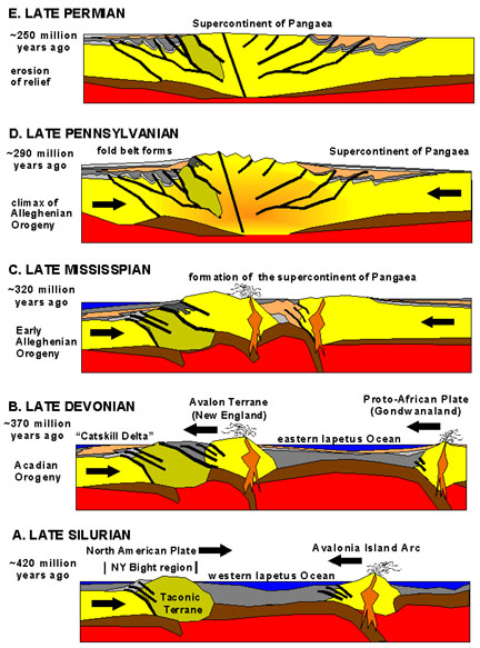
The Appalachians are an ancient mountain system formed by several Paleozoic orogenies—long episodes of crustal collision and uplift hundreds of millions of years ago—followed by prolonged erosion. That deep geological history produces folded ridges, long parallel valleys, plateaus and isolated knobs rather than the sharp alpine peaks of younger chains. The region contains multiple physiographic provinces, including the Appalachian Plateau, the Ridge and Valley province, and the Blue Ridge, each with distinctive rock types, soils and slopes.
Ecology and natural resources
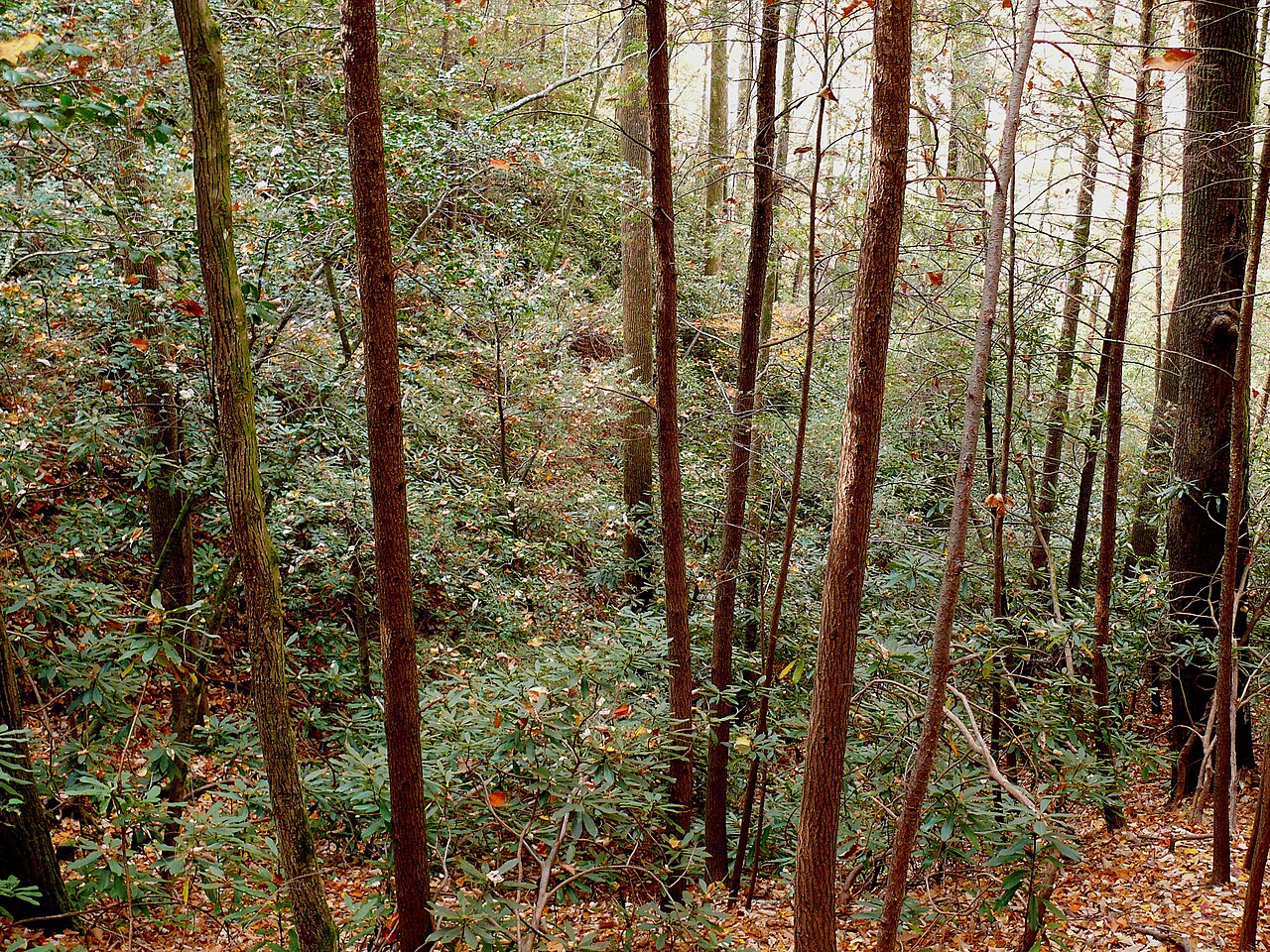
Large tracts of the Appalachians are covered by temperate deciduous forest, with diverse communities of trees, shrubs and understory plants. The mountains host a rich fauna, including many salamander species and migratory birds, and they serve as an important corridor of biodiversity in eastern North America. Economically, the range has long supplied timber, coal, natural gas and other minerals; those industries have driven local economies but have also caused environmental impacts that prompted conservation and reclamation efforts in the 20th and 21st centuries.
Human history and cultural region
Indigenous peoples occupied and used Appalachian landscapes for millennia before European colonization. During and after European settlement, the mountains influenced migration, transport and regional identity. The term "Appalachia" describes not only the physical range but also a broader cultural and economic region that has fostered distinctive music, crafts, dialects and community traditions. Mining, small-scale agriculture and later tourism have all shaped local societies.
Transport, recreation and the Appalachian Trail
The north–south orientation of ridges and valleys historically created a barrier to east–west movement, concentrating roads and canals at a few passes. In modern times the range is valued for outdoor recreation: hiking, hunting, fishing and winter sports. The Appalachian Trail is a celebrated long-distance footpath that traverses the spine of the mountains from Georgia to Maine, offering hikers a continuous route through diverse landscapes and communities.
Notable facts and uses
- Watershed role: The Appalachians separate many Atlantic coastal basins from interior systems that drain toward the continent's interior.
- Economic legacy: Coal mining and forestry shaped regional development and remain subjects of environmental and social concern.
- Conservation: National and state parks, wilderness areas and private conservation lands protect key habitats and scenic values.
Further links and references
- French name and language references
- North America overview
- Canadian portions of the range
- United States sections and states
- Newfoundland and nearby islands
- Island geography
- Central Alabama and southern terminus
- Metric conversions and standards
- North Carolina and Mount Mitchell
- Mississippi River and eastern high points
- Mountain passes and historic routes
- Canals and early transport (e.g., Erie Canal)
- Drainage basins and watershed maps
- Atlantic Ocean coastal systems
- Plateaus, hills and surrounding uplands
- West Virginia and central Appalachian states
- State boundaries and regional definitions
- Kentucky's Appalachian foothills
- Tennessee's mountain landscapes
- Virginia's Appalachian counties
- Southern extensions toward Georgia and the Carolinas
- Pennsylvania and northern Appalachia
- Western reaches toward Ohio
- Appalachian Regional Commission and policy
- Broader inclusion of western and southern counties
- Appalachian Trail and long-distance hiking
This article summarizes the physical character, ecological importance and cultural role of the Appalachian Mountains. For detailed geological timelines, species lists and policy history consult specialized sources and regional conservation agencies.
Questions and answers
Q: Where are the Appalachian Mountains located?
A: The Appalachian Mountains are located in North America, partly in Canada and mostly in the United States. They run from Newfoundland in Canada to central Alabama in the United States.
Q: What is the average height of individual mountains within the Appalachian range?
A: The individual mountains within the Appalachian range average around 3,000 ft (900 m) in height.
Q: What is the highest peak of the Appalachians?
A: The highest peak of the Appalachians is Mt. Mitchell in North Carolina, which stands at 6,684 ft or 2,037m tall. It is also considered to be the highest point east of Mississippi River and eastern North America.
Q: How does east-west travel through this mountain range typically occur?
A: East-west travel through this mountain range typically occurs by climbing ridgelines and valleys that run north-south as there are only a few mountain passes that run east-west. One example is Erie Canal which was built through one such pass.
Q: What areas does "Appalachia" refer to?
A: Appalachia usually refers to areas in central and southern parts of Appalachian Mountains but not northern parts; these areas include all of West Virginia and parts of Kentucky, Tennessee, Virginia, and North Carolina as well as extending as far south as northern Georgia and western South Carolina, as far north as Pennsylvania, and as far west as southeastern Ohio. In 1965 Congress created an Appalachian Regional Commission to include these areas plus more extending up to Mississippi.
Q: How long is the Appalachian Trail?
A: The Appalachian Trail is about 3,500 km (2190 miles) long and goes through 14 states from Georgia to Maine.
Related articles
Author
AlegsaOnline.com Appalachian Mountains Leandro Alegsa
URL: https://en.alegsaonline.com/art/4947
Sources
- news.sciencemag.org : "The mountains that froze the world"
- geology.er.usgs.gov : "Geology of the Great Smoky Mountains"
- bbc.co.uk : bbc.co.uk/news/world-latin-america-45663960