Mount Shasta: geology, glaciers, history, and human significance
Mount Shasta is a prominent Cascade stratovolcano in northern California, noted for its height, glaciers, eruptive history, cultural importance, and recreational opportunities.
Overview
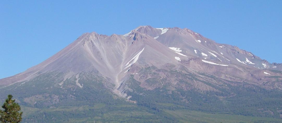
Mount Shasta is a prominent, largely freestanding volcano in northern California, United States. The mountain rises to about 14,179 feet above sea level and dominates a broad plain, making it a visible landmark for many miles. It is part of the Cascade volcanic arc and is typically described as a stratovolcano. A secondary summit, Shastina, adjoins the main peak and contributes to the massif's complex profile.
Image gallery
10 Images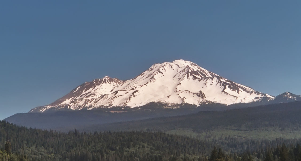


Geology
Mount Shasta formed by subduction-related volcanism typical of the Cascades. Its cone is composed of many overlapping lava flows, pyroclastic deposits, and volcanic domes from repeated eruptions over tens of thousands of years. Like other Cascade volcanoes, its activity is driven by melting associated with oceanic lithosphere subducting beneath the North American Plate. Geologists study its lava chemistry, layering, and eruptive deposits to reconstruct past behavior and assess future hazards. For general background on volcanoes see available volcanology guides and regional volcano resources.
Glaciers, hydrology, and infrastructure
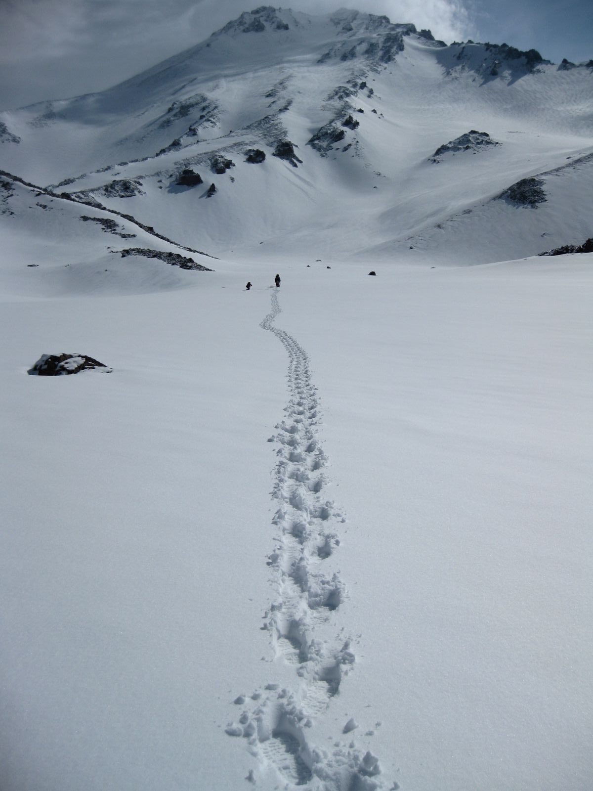
The mountain supports seven named glaciers, including the Hotlum and Whitney glaciers; these are among the southernmost glaciers in the Cascade Range. Glacial melt contributes to local streams and influences the timing of water flows downstream. The Sacramento River runs near the western slopes, and nearby human-made features such as Shasta Lake Reservoir and Shasta Dam provide regional water storage, hydroelectric power, and flood control. The mountain's snowpack and glaciers play a role in seasonal water supply and local ecosystems.
Eruptive history and hazards
Mount Shasta has erupted repeatedly through the late Pleistocene and Holocene. While sometimes called "dormant" in public usage, scientists consider it an active volcano because it has erupted in geologically recent times and could erupt again. Potential hazards include lava flows near the vent, explosive ashfall that could affect downwind communities, and volcanic mudflows (lahars) that could follow river valleys. Emergency planners and scientists maintain hazard maps and response plans for local communities.
Cultural significance
The mountain has deep cultural and spiritual importance for Indigenous peoples of the region and later attracted settlers, naturalists, and spiritual seekers. It appears in local traditions and place names, and the town of Mount Shasta takes its name from the mountain. The mountain's presence shaped regional history, transportation routes, and early scientific exploration.
Recreation and access
Mount Shasta is a popular destination for hiking, mountaineering, backcountry skiing, and sightseeing. Routes range from nontechnical summer trails to snow and ice ascents that require experience with crampons and ropes. Trailheads and services are centered around the town of Mount Shasta and nearby recreation areas. Visitors are advised to prepare for rapid weather changes, high-elevation conditions, and seasonally variable avalanche risk.
Monitoring, preparedness, and further information
Federal and state agencies monitor seismic activity, gas emissions, ground deformation, and other indicators of volcanic unrest. Local authorities maintain emergency procedures and public information resources to help communities prepare. Quick facts:
- Volcano type: stratovolcano.
- Part of the Cascade Range volcanic arc.
- Contains seven named glaciers.
- Nearby water features include the Sacramento River and Shasta Lake system.
Readers seeking authoritative, current information about Mount Shasta's geology, volcanic status, and travel guidance should consult regional geological surveys, national agencies, and local land management organizations. For introductory material on the Cascades and volcano monitoring see regional overviews and state resources or specialized volcano information. Local visitor centers and guide services provide practical advice for safe recreation.
Additional specialized resources include academic studies, glaciological reports, and monitoring updates available through scientific networks and public agencies that track Cascade volcanoes and mountain glaciers.
Related articles
Author
AlegsaOnline.com Mount Shasta: geology, glaciers, history, and human significance Leandro Alegsa
URL: https://en.alegsaonline.com/art/67089
Sources
- volcaniclegacybyway.org : "Geology Tour"