Shasta Dam
Large concrete dam on the Sacramento River in northern California, completed in 1945. Forms Shasta Lake and supplies water storage, flood control, hydroelectricity, and recreation.
Shasta Dam is a major concrete dam on the Sacramento River in northern California. Constructed between 1938 and 1945, it impounds the river to form Shasta Lake, one of the larger reservoirs in the state. The structure is notable for its size, multi-purpose role in regional water management, and its influence on the surrounding landscape and communities.
Image gallery
10 Images


Design and physical characteristics
The dam is an arch-gravity concrete structure that stands about 602 ft high and stretches roughly 3,460 ft across the canyon. Its height is commonly also expressed as 183 m. At its base is a hydroelectric power plant that converts stored water into electricity for the regional grid. The reservoir behind the dam, Shasta Lake, provides large water-storage capacity used across agricultural and urban areas.
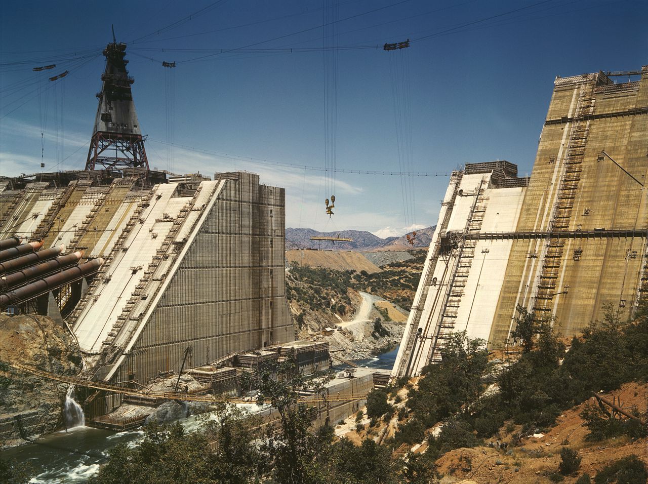
History and construction
Shasta Dam was built as part of broader efforts to manage California's rivers for flood control, irrigation and municipal water supply during the early 20th century. Construction began in the late 1930s and continued through the World War II years, finishing in the mid-1940s. Its completion reshaped local settlement patterns and submerged earlier communities in the canyon.
Functions and uses
- Water storage and delivery for irrigation and cities
- Flood control during high runoff seasons
- Hydroelectric power generation
- Recreation: boating, fishing, and camping on Shasta Lake
These roles make the dam a critical component of northern California's water infrastructure. It is operated to balance competing needs: agricultural deliveries, environmental flow requirements, and power production.
Impacts and notable facts
While the dam brought economic benefits and reliable water supplies, it also produced environmental and cultural impacts, including changes to river ecosystems and the inundation of prehistoric sites and former settlements. Today, management of the dam involves ongoing maintenance, safety inspections, and discussions about environmental mitigation and water allocation as regional conditions and priorities evolve.
For technical details, historical documents, and recreational information consult official resources and regional water authorities via local agency pages or conservation organizations linked to the Sacramento watershed: river reports, state resources, and facility summaries at engineering records and hydrology summaries.
Related articles
Author
AlegsaOnline.com Shasta Dam Leandro Alegsa
URL: https://en.alegsaonline.com/art/89531