
Bloods Range (central Australia)
A compact mountain range on the NT–WA border of central Australia noted for rugged hills, deep gorges, several named peaks and its 19th-century exploration by Ernest Giles and W. H. Tietkins.
Overview
Bloods Range is a modest but rugged mountain chain in central Australia that runs roughly east–west along the boundary between the Northern Territory and Western Australia. Often written as Blood's Range in historical accounts, the formation is composed of multiple hill groups separated by valleys and dissected by numerous gorges and ravines. The area is remote and dry, typical of the central Australian interior, and it forms part of a wider complex of ranges and ridges in this part of the continent (map reference).
Image gallery
2 Images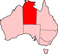
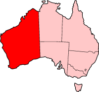
Geography and physical characteristics
The topography of the range includes two principal valleys carved by the Hull and Docker Rivers, which are usually ephemeral watercourses that flow only after significant rainfall. Erosion has left a landscape of steep-sided gullies and rocky outcrops, and the range links with the Petermann Ranges at its western extremity. In its central sector the range reaches its highest points: Mount Harris and Mount Carruthers. Further east the main ridge splits into subsidiary chains such as the Rowley Range, McNichol's Range and the Pinyinna Range. The hills are cut by many small ravines and chasms that add to the rugged character of the terrain (ravine detail, valley systems).
Notable peaks and branches
- Mount Carruthers — one of the highest points in the central section.
- Mount Harris — a prominent peak from which broad views of the surrounding ranges were historically recorded.
- Rowley Range, McNichol's Range and Pinyinna Range — eastern branches that radiate from the main spine.
- Connection to the Petermann Ranges to the west, forming part of a network of uplands across the arid interior.
History and European exploration
The name Bloods Range dates to the 19th century. On 14 March 1874 the explorer Ernest Giles reported observing the range from the summit of Mount Curdie and applied the name in honour of a South Australian pastoralist associated with an early pastoral station account. Giles's later subordinate, W. H. Tietkins, made an independent visit on 12 June 1889 and surveyed the area, naming its principal peaks. From high points such as Mount Harris Tietkins recorded distant views toward features including Kata Tjuṯa and the Tomkinson Ranges, illustrating how these uplands form visual landmarks across the desert.
Environment, significance and access
Although in a harsh, arid climate, ranges like Bloods provide microhabitats that differ from the surrounding plains: cooler, sheltered gullies can retain more moisture after rain and support distinctive assemblages of plants and animals compared with flat terrain. The landscape has cultural and natural values typical of remote central Australian ranges, while access is limited and usually requires four‑wheel‑drive vehicles and careful planning. Visitors and researchers should respect any on‑site cultural restrictions and the practical challenges posed by distance, heat and scarce water.
Further reading and references
For maps, historical accounts and detailed geographic descriptions consult specialist regional guides and historical expedition narratives. Online and archival sources may provide the original expedition journals and modern topographic maps (map, South Australian records). For focused information about exploration and surveys, see material related to Ernest Giles and the field reports of W. H. Tietkins.
Note: this summary draws on widely known geographic and historical information about the range and its exploration. Specifics such as precise elevations and hydrological behaviour may vary between sources and with seasonal conditions.
Related articles
Author
AlegsaOnline.com Bloods Range (central Australia) Leandro Alegsa
URL: https://en.alegsaonline.com/art/12273
Sources
- ntlis.nt.gov.au : "Basedow Range"
- books.google.com.au : Australia Twice Traversed
- trove.nla.gov.au : "Man Who Climbed Mt. Unapproachable"
- trove.nla.gov.au : "Mr. Tietkens's Explorations"
- books.google.com.au : Journal of the Central Australian Exploring Expedition