Ernest Giles (William Ernest Powell Giles)
William Ernest Powell Giles (1835–1897), known as Ernest Giles, was an Australian explorer who led three major expeditions into central Australia and published accounts that expanded European knowledge of the interior.
William Ernest Powell Giles (7 July 1835 – 13 November 1897), commonly known as Ernest Giles, was an Australian overland explorer active in the latter half of the 19th century. He is best known for leading three long expeditions into the arid interior of the continent, journeys that helped to map previously little‑charted regions and to draw public attention to central Australia's geographic character.
Image gallery
4 Images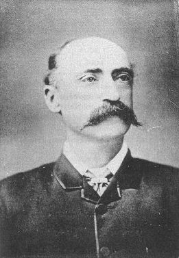


Context and purpose
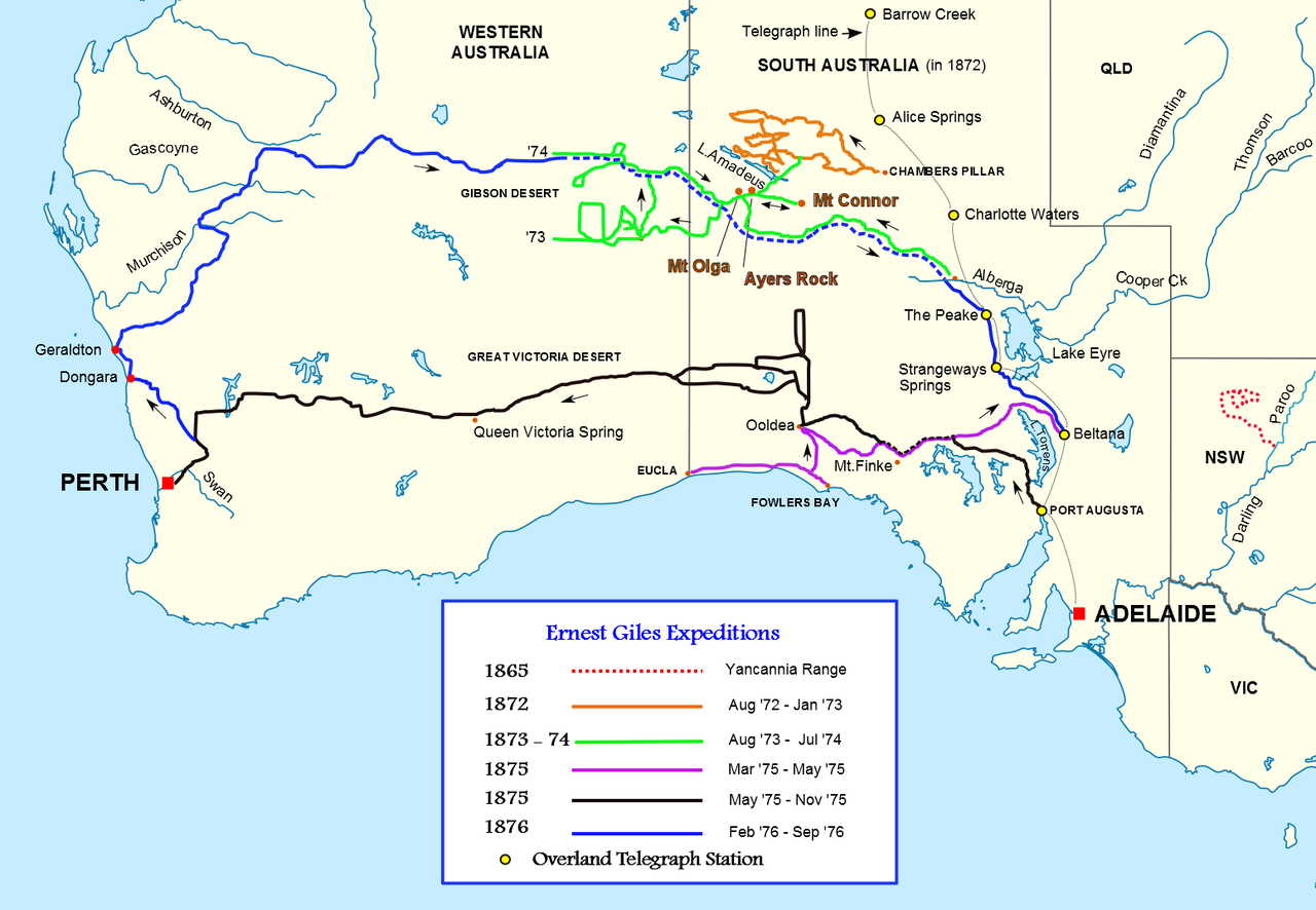
Giles' work took place during a period when colonial governments and private sponsors supported inland exploration for scientific knowledge, pastoral opportunity and route finding. Expeditions of this era sought water sources, practicable tracks and information that could be used for pastoral settlement, telegraph lines or further surveying.
Expeditions and methods
Across his main journeys Giles traversed vast stretches of desert and scrub, operating out of South Australia and pushing into the continent's centre. His parties faced prolonged shortages of water and feed for animals, extreme heat, and the navigational challenge of largely featureless terrain. Like other explorers of his time, Giles recorded bearings, sketched maps and kept journals intended for scientific and public audiences.
Contributions and publications
Giles contributed to the European mapping of central Australia by documenting previously uncharted areas and by applying new place‑names that entered colonial maps. He published accounts of his travels that described landscape, resources and the hardships of overland travel; those narratives helped contemporaries understand the scale and nature of the interior.
Legacy and assessment
Today Giles is remembered as one of several 19th‑century explorers who filled in large gaps on Australia's inland maps. His routes and reports were used by later surveyors and pastoralists. He has been commemorated in place‑names and in historical studies of exploration. For more on his journeys and contemporary sources, see accounts of his expeditions, including contemporary publications and later summaries of his work: expedition accounts and analyses.
- Overview: three major inland expeditions in the 1870s.
- Challenges: arid conditions, navigation, supply limits.
- Outcomes: increased mapping, published narratives, named landmarks.
Related articles
Author
AlegsaOnline.com Ernest Giles (William Ernest Powell Giles) Leandro Alegsa
URL: https://en.alegsaonline.com/art/31993
Sources
- gutenberg.net.au : "Giles, Ernest"
- adb.online.anu.edu.au : Giles, Ernest (1835 - 1897)