
Surveying: principles, history, tools, and applications
Surveying is the practice and science of determining positions, distances and angles for mapping, construction, land boundaries and infrastructure projects.
Overview
Surveying combines practical field techniques and theoretical methods to determine the location of points and the measurements between them. It is both a technique and a science for establishing the position of features and the distances and angles that relate them, most commonly with respect to the surface of the Earth. The professionals who perform these tasks—surveyors—combine a mix of practical observation, instruments and calculations to produce reliable spatial information.
Image gallery
10 Images





Principles, tools and methods
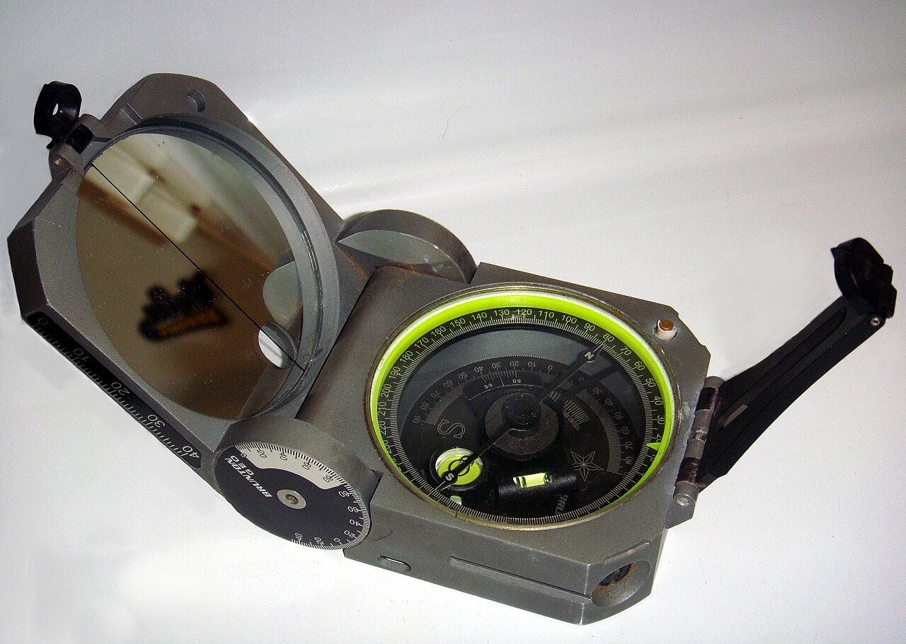
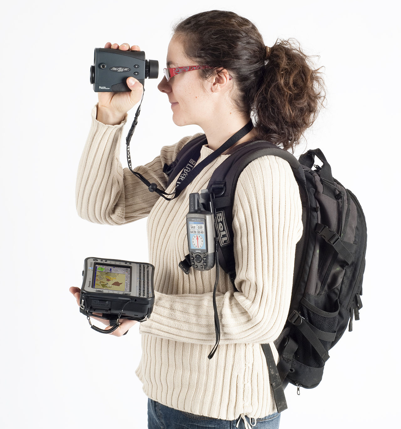
At its core, surveying relies on mathematical and physical principles. Practitioners apply geometry, trigonometry and broader mathematics, together with ideas from physics and geology, to interpret measurements. Modern instruments include total stations, optical and digital theodolites, levels, laser scanners and satellite navigation receivers (GNSS/GPS). Fieldwork is commonly paired with data processing software and geographic information systems to create maps, 3D models and datasets for design and analysis.
Historical development
Surveying has ancient roots and has been vital to human settlement and infrastructure since antiquity. Early civilizations used basic geometry and sighting techniques to divide land, lay out roads and build monuments. Over centuries the discipline evolved with improvements in instruments, mathematical theory and later the adoption of aerial imagery and satellite positioning that transformed accuracy and scope.
Common applications
- Land parceling and property boundaries, establishing legal limits of ownership.
- Engineering surveys for design and construction projects in construction, building and civil works.
- Transport corridor layout and route alignment for roads, rail and airports (transport).
- Planning for utilities and networks including communications infrastructure.
- Topographic mapping, hydrographic surveys and environmental monitoring.
Legal, professional and practical aspects
Surveying often intersects with legal requirements: many jurisdictions require licensed surveyors and formal procedures when establishing boundaries or recording plans, and the work is governed by law. Practical survey projects entail reconnaissance, control network establishment, detailed measurement, quality control and documentation that support engineering design or land registration.
Types of surveying and notable distinctions
Common categories include cadastral (land and ownership), geodetic (large-area, high-precision control), engineering (site layout and construction stakeout), hydrographic (water bodies) and topographic (terrain mapping). Each uses different scales, tolerances and instruments. Modern surveying increasingly blends traditional field methods with remote sensing, photogrammetry and GNSS technologies to improve speed, coverage and accuracy while maintaining rigorous standards for measurement and record-keeping.
Further reading and technical standards are available from professional bodies and national mapping agencies; for general introductions see sources on the practice as both a field of engineering and a key input to mapping and planning.
For related topics see entries on measurement, cartography and geodesy; practical training combines classroom theory with supervised field experience to develop the skills needed by modern surveyors.
Related keywords: measurement, trigonometry, geometry, technique, science.
Questions and answers
Q: What is surveying?
A: Surveying is the scientific technique of accurately finding the position of points and the distances and angles between them, often associated with positions on the surface of the Earth.
Q: What is the job of a surveyor?
A: A surveyor is responsible for conducting surveying operations and using various scientific techniques and tools to accurately determine the position of points and the distances and angles between them.
Q: What are the subjects or fields used in surveying?
A: Surveying uses a variety of subjects such as geometry, engineering, trigonometry, mathematics, physics, geology, and law to obtain the information that surveyors need.
Q: What are the common uses of surveying?
A: Surveying has many uses, including land maps and boundaries, transportation planning, building and construction, communication, mapping, and the making of legal boundaries for land ownership.
Q: How significant is surveying in the development of the human environment?
A: Surveying has been very important in the development of the human environment since recorded history and has become a requirement in the planning and construction of nearly every form of construction.
Q: What is the importance of surveying in land ownership?
A: Surveying is important in land ownership because it is used to determine legal boundaries of properties.
Q: When did the importance of surveying begin?
A: The importance of surveying began since the beginning of recorded history, around 5000 years ago.
Related articles
Author
AlegsaOnline.com Surveying: principles, history, tools, and applications Leandro Alegsa
URL: https://en.alegsaonline.com/art/95217