Weather front: boundary between contrasting air masses
A weather front is the transition zone where two air masses with different temperature and humidity meet, producing clouds, precipitation, wind shifts and often significant day-to-day weather changes.
A weather front is a boundary separating two air masses of differing density, typically because of contrasts in temperature and moisture. These boundaries are central to mid-latitude weather and are shown on surface analyses with colored lines and conventional symbols. A front marks not only a horizontal change in conditions but often the line along which vertical motion, cloud formation and precipitation are most active. For a concise definition and background see air mass boundary.
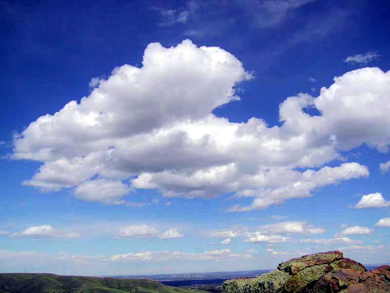
Fronts form when large volumes of air with different properties move toward one another. The denser, colder air tends to act like a wedge that lifts the warmer, lighter air, producing condensation and clouds. Differences in warmth and moisture across the front are key: temperature contrasts are fundamental (temperature contrast), while humidity contrasts influence cloud type and precipitation (moisture difference).
Image gallery
7 Images


Types of fronts
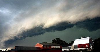
- Cold front: cold air advances, forcing warm air upward. Often associated with narrow bands of showers and thunderstorms and abrupt weather changes. Related topics: cold fronts, thunderstorm bands.
- Warm front: warm air rises gradually over retreating cold air, usually producing layered clouds, prolonged precipitation and reduced visibility; fog is common ahead of the front (warm fronts, fog and stratus).
- Stationary front: little or no east–west movement, weather can linger for days with mixed clouds and precipitation.
- Occluded front: forms when a fast cold front overtakes a warm front, lifting warm air off the surface and producing complex cloud and precipitation patterns.
- Dry line: not always classified as a traditional front but important in some regions; it separates very dry air from moist air and can trigger severe storms or squall lines when conditions are favorable (severe weather).
Each frontal type has characteristic cloud sequences and precipitation. Cold fronts tend to produce cumulus and cumulonimbus clouds with sharp temperature drops and gusty winds after passage. Warm fronts favor nimbostratus and stratiform clouds with steady precipitation that tapers off slowly. Occlusions often show mixed stratiform and convective features.
Observation, symbols and forecasting
Meteorologists depict fronts on weather maps using colored lines and symbols: triangles for cold fronts, semicircles for warm fronts, alternating symbols for stationary fronts, and a combined symbol for occluded fronts. Forecasters track frontal position and speed because fronts concentrate lift and wind shifts, making them focal points for weather warnings. Modern forecasting combines surface observations, radar, satellite imagery and numerical models to predict frontal evolution and impacts.
Fronts are important not only for short-term forecasts but for understanding seasonal regimes and storm tracks. They influence temperature distributions, precipitation patterns and severe-weather potential in many populated regions. While some fronts pass with little fanfare, others are associated with dramatic thunderstorms, heavy rain or snow, and rapid changes in wind and temperature that affect aviation, shipping and daily life.
For further reading on frontal processes and maps see basic concepts, synoptic examples at temperature contrasts, satellite analysis at moisture imagery, and specialized discussions of cold fronts, convective lines, severe weather, warm front behavior and fog and low cloud.
Related articles
Author
AlegsaOnline.com Weather front: boundary between contrasting air masses Leandro Alegsa
URL: https://en.alegsaonline.com/art/107037