
Niagara Falls: Geography, Geology, Tourism and Hydropower
Niagara Falls is a group of three waterfalls on the Canada–United States border, formed by glacial drainage over the Niagara Escarpment and known for scenic value, tourism, and major hydroelectric development.
Overview
Niagara Falls refers to three adjacent waterfalls on the Niagara River, located in eastern North America at the international boundary between the United States and Canada. The three falls—the Horseshoe Falls, the American Falls and the smaller Bridal Veil Falls—form a continuous spectacle that has been a focal point for visitors, industry and local communities for more than a century. The twin cities named Niagara Falls on each side of the border provide urban services and tourist amenities that concentrate around parks, viewpoints and riverfront infrastructure.
Image gallery
10 Images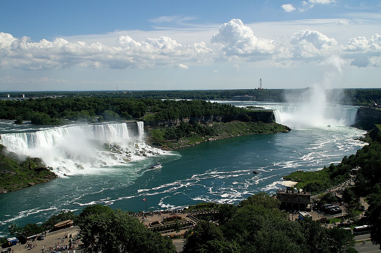




Geology and formation
The canyon and waterfalls developed after the last major glaciation, when retreating ice sheets and meltwater reconfigured drainage of the newly formed Great Lakes system. Water flowing from Lake Erie dropped over the Niagara Escarpment as it moved toward the Atlantic Ocean. The escarpment has a layer of harder caprock, principally limestone, overlying softer shale and other sedimentary rocks; differential erosion of these layers produced the vertical faces of the falls and caused gradual upstream migration (headward erosion) over thousands of years. The broader glacial history, including events associated with the Wisconsin glaciation, set the region's topography and the pathway that the Niagara River follows today.
The three falls and local geography
The group of waterfalls is divided by small islands: Goat Island separates the American Falls from the Horseshoe Falls, while Luna Island lies between the American Falls and Bridal Veil Falls. The Horseshoe Falls is the most voluminous and gives the site its iconic curved skyline; it is commonly called the Canadian Falls because a large share of its crest lies within Canadian territory. The American and Bridal Veil Falls are separated visually and physically by the river channels and the islands, and each offers distinct perspectives from observation points, walkways and boat routes.
Hydrology and flow
The Niagara River channels a very large volume of water as it transfers the outflow of the upper Great Lakes toward the St. Lawrence. Seasonal variations and weather affect the river's discharge, which can be extremely high during spring melt and storm-driven inflows. For operational and safety reasons, river managers and operators control and monitor flow at the crest, and some water is regularly diverted upstream for power generation; this diversion is subject to international agreements and real-time management that balance navigation, energy, and scenic considerations.
Hydroelectric development and engineering
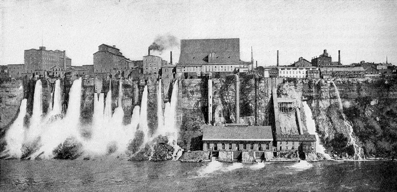
Because of its reliable flow and drop in elevation, the falls and the Niagara River have been developed for hydroelectric power since the late 19th and early 20th centuries. Generating facilities, intake structures and diversion tunnels on both the Canadian and American sides capture part of the river's energy to produce electricity for regional grids. Over time, engineering works—including dams, control gates and transmission systems—have been implemented to stabilize head, manage seasonal extremes and limit rapid erosion while maintaining the site’s scenic and recreational functions.
Tourism, culture and recreation
Niagara Falls is one of the world’s best-known waterfall attractions. Tourism infrastructures include panoramic towers, observation decks, riverside parks, boat excursions that approach the base or the crest, interpretive centres and museums. The falls attract domestic and international visitors for sightseeing, photography, festivals and events; lights and seasonal illuminations are a common feature of nighttime displays. The surrounding communities provide accommodations, dining and cultural services, and tourism has shaped local economies for generations.
Management, conservation and safety
Because the falls cross a national boundary and provide critical water resources and power, their use and protection are governed by binational agreements, agencies and local authorities. Efforts focus on conserving scenic and ecological values, maintaining safe public access, preventing hazardous activities, and slowing erosion through engineered and non-invasive measures. Rescue services, signage and physical barriers are standard at viewing areas; unauthorized stunts or risky behaviour are subject to law enforcement and public-safety campaigns.
Visiting and practical information
Visitors planning a trip should consider seasonal conditions: summer is the busiest period, while winter presents different views and fewer crowds. Access points, tours and parking vary between the Canadian and American sides, and international travellers should be aware of border-crossing rules. Local visitor bureaus and park authorities publish details about permitted activities, ticketed attractions and conservation rules. Popular experiences include close-range boat trips, riverside walks, aerial viewpoints and interpretive exhibits that explain geology, history and power generation.
Further reading and related links
Related articles
Author
AlegsaOnline.com Niagara Falls: Geography, Geology, Tourism and Hydropower Leandro Alegsa
URL: https://en.alegsaonline.com/art/69911