
Arctic Circle: definition, geography, phenomena, and changing boundary
The Arctic Circle is the northernmost major circle of latitude marking where at least one day of polar day and polar night occurs. This article covers its position, movement, geography, climate, and human relevance.
Overview
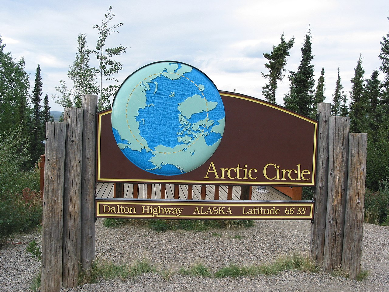
The Arctic Circle is one of the principal circles of latitude used to describe Earth's geographic zones. It is drawn on maps and globes as an imaginary parallel encircling the northern hemisphere; consult a typical world map for a visual reference. The line corresponds to the parallel of latitude that, around the year 2000, was located at approximately 66° 33′ 39″ north of the Equator. Areas north of the Arctic Circle experience at least one day each year when the Sun does not set (around the summer solstice) and at least one day when the Sun does not rise (around the winter solstice).
Image gallery
10 Images


Geographic extent and nations
The region commonly referred to as the Arctic is centered on the North Pole and includes ocean, islands and parts of continental landmasses. Sovereign states and territories with land or sea areas that extend above the Arctic Circle include several countries; see the list of countries below for national examples and overseas territories.
- Russia
- Canada
- Denmark (via Greenland)
- United States (via Alaska)
- Norway
- Sweden
- Finland
- Iceland (a very small area, under 1 km²)
Astronomical phenomena
Two distinctive astronomical phenomena are associated with locations inside the Arctic Circle. The midnight sun occurs when the Sun remains continuously above the horizon for a period around local summer solstice. Conversely, the polar night occurs when the Sun remains continuously below the horizon for a period around local winter solstice. Local experience of these events can be affected by atmospheric refraction and the observer's elevation, so coastal and mountainous locations can observe extended or shortened periods of continuous day or night compared with the simple geometric definition.
Climate, ecosystems and environment
The Arctic contains a range of environments from year-round sea ice and seasonal pack ice to tundra, wetlands and the southern margins of the boreal forest. Permafrost, short growing seasons and low temperatures shape the vegetation and animal communities. Marine ecosystems beneath the ice and along seasonal ice edges are productive and support seals, walruses, whales and seabirds, while terrestrial areas host species adapted to cold such as Arctic foxes, reindeer (caribou) and migratory birds. Human settlements vary from small Indigenous communities to regional towns and ports that support modern industry and services.
Human presence, culture and economy
Indigenous peoples have lived across Arctic lands for millennia and maintain distinct cultures, languages and livelihoods closely tied to local ecosystems. Economic activities in Arctic regions include fishing, hunting, tourism, scientific research, and extraction of natural resources where accessible. Shipping routes that cross Arctic waters have gained attention as sea ice patterns change seasonally, and governance of these activities involves national laws, regional cooperation and international agreements.
Position, causes of movement and timescale
The precise latitude of the Arctic Circle is not fixed. It depends directly on Earth's axial tilt, or obliquity. The tilt varies over long timescales—primarily through gravitational and tidal interactions with other bodies such as the Moon—in cycles measured in tens of thousands of years. Because the axial tilt changes, the Arctic Circle drifts slowly; in recent decades the boundary has been moving northward by on the order of metres per year, so the set of places that lie just inside or just outside changes over human timescales.
Measurement, mapping and practical considerations
On maps the Arctic Circle is a useful reference for climatology and navigation, but it is not a strict ecological border: tree lines, permafrost limits and sea-ice extents do not coincide exactly with the circle and are influenced by local climate, ocean currents and topography. Atmospheric refraction, elevation and local horizons mean that solar phenomena associated with the circle may be observed beyond or within the idealized line. For practical purposes, planners, scientists and communities use a combination of astronomical definitions, climate records and ecological indicators when describing Arctic conditions.
Research and contemporary issues
Scientific work in the Arctic covers glaciology, sea-ice dynamics, oceanography, permafrost monitoring, and the study of flora, fauna and human adaptation. The region is central to discussions about climate change because warming tends to be amplified at high latitudes, leading to changes in ice cover, permafrost thaw and ecosystem shifts. Policies about resource use, indigenous rights, conservation and shipping are areas of active international and local attention.
Further reading and resources
For general background and maps, consult introductory resources on the circle of latitude, a selection of world maps, and reference material about the Arctic. Historical and scientific treatments offer more detail on the circle's changing position, the physics of Earth's axial tilt, and the human and ecological dimensions of the Arctic.
Related articles
Author
AlegsaOnline.com Arctic Circle: definition, geography, phenomena, and changing boundary Leandro Alegsa
URL: https://en.alegsaonline.com/art/5343