
Indus Valley Plain
A broad alluvial plain in Pakistan shaped by the Indus River and its tributaries, the Indus Valley Plain supports dense agriculture, historic settlements and varied landscapes from plateaus to deserts.
Overview
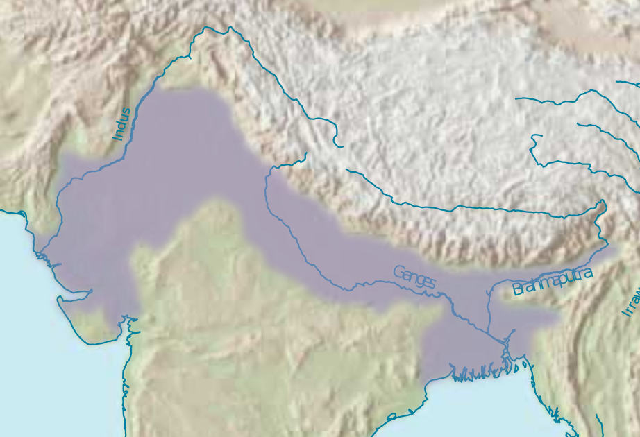
The Indus Valley Plain is a broad flat landform primarily within Pakistan. It is the western portion of the subcontinental Northern Plain and owes its character to centuries of sediment deposited by the Indus River and its network of tributaries. The plain is a major agricultural and population zone and includes a mix of fertile lowlands, seasonally inundated floodplains and pockets of higher ground.
Image gallery
8 Images


Formation and geography
The plain is an alluvial landscape formed by repeated flooding and the gradual accumulation of river-borne material. Deposition from the Indus and its tributaries built up thick soils that support intensive farming. Toward the north and east the plain rises into the Pothohar Plateau, a higher terrace near the foothills of the Himalayas. Rivers, canals and irrigation channels structure the plain and determine local drainage patterns.
Land use and economy
Agriculture dominates land use. Primary crops include:
Extensive irrigation networks allow multiple growing seasons in many areas. The plain also supports major urban centers, transport corridors and industries that process agricultural products and extract local resources.
Deserts and higher ground
Not all of the plain is uniformly fertile. Several arid zones interrupt the alluvial belt, including the Thal desert, the regional Indus Valley desert, the Thar Desert along the southeastern margin, and the Cholistan desert. These areas have sparser vegetation and different land-use traditions, often adapted to low rainfall and mobile sand.
History and importance
The Indus Valley Plain has been a cradle of settled agriculture and early urban life for millennia. Its fertile soils and river access supported dense rural populations and historic cities. The plain remains central to Pakistan's food security and cultural landscape, with long-standing links between water management, farming systems and settlement patterns.
Environmental challenges
Contemporary issues include flood risk during high river flows, waterlogging and soil salinity from intensive irrigation, and pressures from urban expansion. Sustainable management of river flows, canal maintenance and soil conservation are critical to preserve the plain's productivity into the future. Further reading on regional geography and land use can be found through general geographic resources and local studies (Punjab province references and hydrology reports).
Related articles
Author
AlegsaOnline.com Indus Valley Plain Leandro Alegsa
URL: https://en.alegsaonline.com/art/47234