
Indus River
Major South Asian river rising in the Tibetan Plateau, flowing through India and Pakistan to the Arabian Sea; cradle of the Indus Valley Civilization and central to regional irrigation and history.
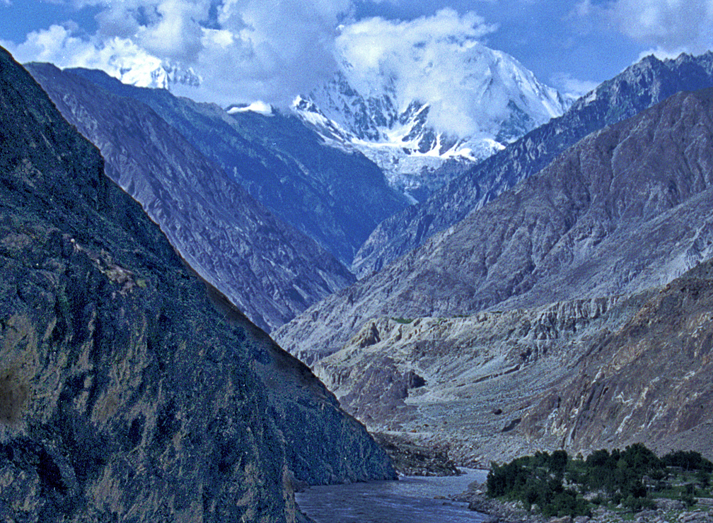
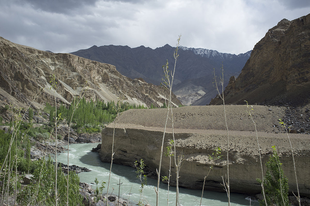
The Indus River is a major river of South Asia that rises on the Tibetan Plateau and flows generally southwest through Ladakh and the mountain regions of northern Pakistan before crossing the plains of Punjab and Sindh to reach the Arabian Sea. It is the longest river of Pakistan and one of the principal waterways of the western subcontinent. The river basin supports intensive agriculture, hydroelectric power and dense human settlement, and has been a focal point of human civilization for millennia.
Image gallery
10 Images




Physical characteristics and statistics
The Indus is commonly measured at about 3,180 km in length, with a drainage basin exceeding 1,165,000 km2. Its annual runoff has been estimated in the range of 200–210 km3, and long-term average discharge figures commonly cited place it among the world’s larger rivers by volume. The river carries meltwater from Himalayan and Karakoram glaciers as well as seasonal monsoon rainfall, producing a strong seasonal variation in flow.
Course and main tributaries
The river begins in the Tibetan region of western China, flows through the Indian union territory of Ladakh and then enters Pakistan, traversing mountainous northern regions and the broad alluvial plains of Punjab and Sindh. Major tributaries feed the Indus along its course; among the best known are the Zanskar and Shyok in the upper reaches, and the five rivers of the Punjab system—Jhelum, Chenab, Ravi, Beas and Sutlej—which join indirectly through the Panjnad. The Kabul River, draining parts of Afghanistan and northern Pakistan, is another important inflow. The Indus forms a wide delta in Sindh before emptying into the Arabian Sea.
History, culture and etymology
The lower Indus valley was the heartland of the Bronze Age Indus Valley Civilization, known for its urban planning and trade networks; archaeological sites lie along the river and its ancient channels. In later Indian tradition the region is associated with Sapta Sindhu (literally "seven rivers") and is mentioned in early religious literature; the river system is counted among sacred waters in some Brahmanic texts (Brahmanic sources). The name Indus derives from the Sanskrit Sindhu and passed into Old Persian and Greek as forms that eventually gave rise to the modern names "Indus" and "India" (Sindhu, Classical Greek usage). The river's valley thus played an outsized role in regional identity and the naming of the subcontinent (name origins).
Uses, management and environmental issues
The Indus basin supports one of the world's largest contiguous irrigation systems and is vital to the economies of Pakistan and parts of India. Large dams and reservoirs — including internationally known projects on the main stem and tributaries — provide irrigation storage and hydroelectric power while also regulating floods. Water-sharing between India and Pakistan is governed by the Indus Waters Treaty and related arrangements. Environmental concerns include glacier retreat in the headwaters, reduced seasonal flows in some reaches, salinization and waterlogging of irrigated soils, industrial and municipal pollution, and pressures on native species such as the Indus dolphin.
Notable facts and legacy
- The river is historically and archaeologically significant as the cradle of one of the world's earliest urban civilizations (Indus Valley Civilization).
- It is Pakistan's principal river by length and one of the key arteries of South Asian hydrology.
- Its basin has shaped regional politics, agriculture and settlement patterns for thousands of years; references to the river appear throughout classical and medieval sources (ancient accounts).
For further reading on the river's archaeology, hydrology and modern management see specialized studies and basin reports available through academic and governmental sources (religious and historical context, linguistic background, geopolitical overview).
Questions and answers
Q: What is the Indus River?
A: The Indus River is the greatest river on the western side of the south Asian subcontinent. It is one of the seven sacred rivers for The Brahmans of Vedic period and was the birthplace of the early Indus Valley civilization.
Q: Where does it flow?
A: The Indus River flows through China (Western Tibet), India, and Pakistan. It is also one of the main rivers of the Indo-Gangetic Plain.
Q: How long is it?
A: The Indus River is 3180 km long, making it Pakistan's longest river.
Q: What is its total drainage area?
A: The total drainage area for the Indus River exceeds 1,165,000 km2 (450,000 sq mi).
Q: How much water does it discharge annually?
A: The estimated annual flow for the Indus River stands at around 207 km3 (50 cu mi), making it one of world's largest rivers in terms of annual flow. It discharges about 6,600 cubic meters per second.
Q: Where did its name come from?
A:The word "Indus" and cognate word "Hindu" are derived from Sapta Sindhu (Sanskrit for "seven rivers") as this region was ancient when these words were first used by Ancient Greeks who called it "Indós". Hinduš was Old Persian; Sindhu in Sanskrit while modern languages on sub-continent use either Sindh or Sindhu which are very similar words to those mentioned before. This region's name eventually became synonymous with country India itself.
Related articles
Author
AlegsaOnline.com Indus River Leandro Alegsa
URL: https://en.alegsaonline.com/art/47231