
Meridian (geography) — lines of longitude, measurement and uses
A meridian is an imaginary line of longitude running between the poles. This article explains what meridians are, how they are measured, their history, practical uses and related terms.
A meridian is an imagined line of longitude that runs from the North Pole to the South Pole. On the globe each meridian appears as a half of a great circle that connects the two poles. Unlike parallels of latitude, meridians converge at the poles and are widest at the equator. Meridians are a fundamental component of the geographic coordinate system used for locating any point on the Earth's surface.
Image gallery
3 Images

How meridians are measured
Meridians are quantified in angular degrees east or west of a reference line called the Prime Meridian. Modern geographers and navigators measure longitude from that zero-degree line. Longitudes are commonly expressed in degrees (°), minutes (′) and seconds (″) or in decimal degrees. In many digital contexts values east of the Prime Meridian are given as positive numbers and values west as negative numbers; the use of a negative sign for westward longitudes is widespread in mapping software and data formats.
History and the Prime Meridian
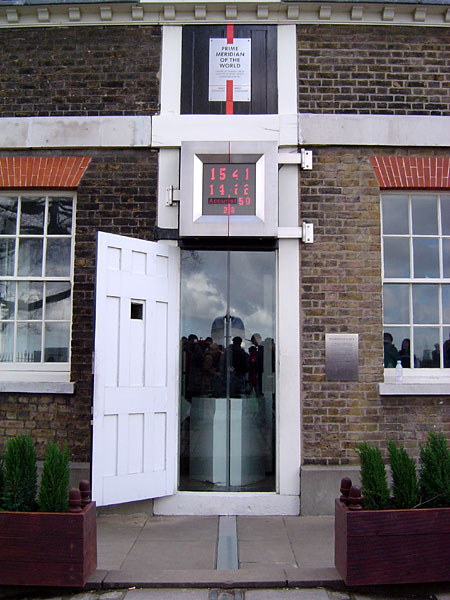
The internationally accepted Prime Meridian passes through the Royal Observatory at Greenwich; the decision to adopt that line was formalized at the 1884 International Meridian Conference. The Royal Observatory in Greenwich is often referenced as the historic site of the zero-longitude marker and is commonly called the Royal Greenwich Observatory location in England. The Prime Meridian underpins timekeeping systems such as Greenwich Mean Time (GMT) and influenced the later development of coordinated global time standards.
Practical uses and examples
- Navigation and mapping: meridians, combined with parallels of latitude, provide coordinates for ships, aircraft and GPS receivers.
- Timekeeping: time zones are generally based on offsets from the Prime Meridian; local time shifts roughly by one hour per 15° of longitude.
- Cartography: on cylindrical projections such as Mercator, meridians plot as vertical straight lines; on globes they are curved toward the poles.
- Examples: many published coordinates use familiar approximations—Los Angeles is near Los Angeles, California at about 118° west, while the city of Mecca lies roughly 40° east of the Prime Meridian.
Related concepts and notable facts
Each meridian has an opposite counterpart 180° away; together they form a full great circle. The meridian around 180° longitude is important because the International Date Line follows a path near that meridian, though it deviates to accommodate political boundaries. The term "meridian" may also be used in specialized contexts—astronomers speak of a local meridian (the north–south line that passes overhead), and surveyors use named principal meridians for land division. Magnetic variation is a different concept: the magnetic meridian refers to the direction of the Earth's magnetic field at a point and does not coincide with geographic meridians except by chance.
Understanding meridians helps to interpret maps, set navigation systems, and appreciate the relationship between longitude and time. For further basic definitions and maps consult general geography references or online map services via authoritative pages such as those indicated here: longitude overview, polar regions, southern pole, geographers' resources, Prime Meridian details, Royal Observatory, England guide, westward longitudes, Los Angeles, California, negative coordinate notation, eastward longitudes, Mecca location.
Related articles
Author
AlegsaOnline.com Meridian (geography) — lines of longitude, measurement and uses Leandro Alegsa
URL: https://en.alegsaonline.com/art/63979