Hurricane Irene (2011)
Hurricane Irene was a large 2011 Atlantic hurricane that reached Category 3. It affected the Caribbean, the Bahamas, the U.S. East Coast and parts of Canada, causing extensive flooding, power outages and infrastructure damage.
Overview
Hurricane Irene was a major tropical cyclone of the 2011 Atlantic hurricane season. It formed in late August and reached Category 3 intensity at its strongest phase. Irene moved across parts of the eastern Caribbean, the Bahamas and then tracked northward along the western Atlantic before making landfall or producing impacts across portions of the eastern United States and into southeastern Canada. For a general basin context see Atlantic hurricane climatology.
Image gallery
10 Images


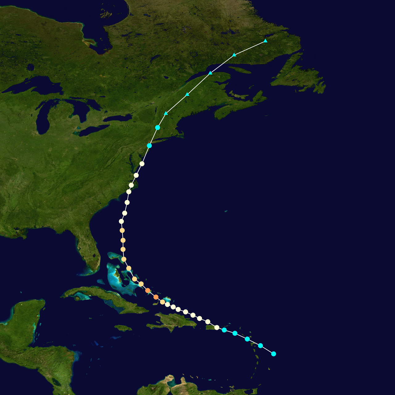


Formation and track
The system developed from a tropical wave and was classified as a tropical cyclone in late August; official records list its formation date as August 20. After strengthening over warm waters it attained major hurricane strength, then gradually weakened as it moved northward and encountered changing atmospheric conditions. The storm lost tropical characteristics and dissipated near the end of August; see dissipation and aftermath for timeline details.
Areas affected
Irene struck or affected a chain of territories and countries. Early impacts were felt in the U.S. Virgin Islands and Puerto Rico, and the system produced heavy rain over parts of Hispaniola. The storm later passed near or over portions of the U.S. East Coast, where coastal storm surge combined with prolonged rainfall to produce flooding inland in several states of the United States. Remnant moisture and wind impacts extended into parts of Canada, particularly in Atlantic provinces and nearby areas.
Impacts
- Hydrologic: Widespread heavy rain led to flash flooding and river flooding in many affected areas, highlighting the inland flood risk of tropical cyclones.
- Wind and surge: Coastal storm surge and strong gusts caused beach erosion, damage to coastal infrastructure, and localized wind damage.
- Societal: The storm prompted evacuations, emergency declarations, transportation disruptions, power outages, and extended recovery needs for utilities and communities.
Aftermath and retirement
In the months after the event, governments and agencies conducted assessments, recovery operations and repairs to public infrastructure. Because of the storm's impacts and to avoid future confusion, the World Meteorological Organization retired the name Irene from the rotating Atlantic list after the 2011 season; it was replaced by the name Irma for subsequent lists. For official reports and post-storm assessments consult regional summaries and federal or provincial documents such as United States federal reports and Canadian effects.
Meteorological and emergency lessons
Irene is often cited in discussions of how large tropical cyclones can produce significant inland flooding well away from the immediate coast, and how preparedness must address not only wind and surge but also heavy rainfall and river response. Emergency managers and researchers studied Irene's structure, rainfall distribution and societal impacts to improve forecasting, evacuation planning and resilience measures. Additional technical analyses and regional impact summaries are available in official archives and storm summaries such as basin overviews and formation reports at formation details.
Related resources and regional summaries: Virgin Islands impact summary, Puerto Rico reports, Hispaniola assessments, U.S. East Coast impacts, dissipation and aftermath.
Related articles
Author
AlegsaOnline.com Hurricane Irene (2011) Leandro Alegsa
URL: https://en.alegsaonline.com/art/45917
Sources
- ecocentric.blogs.time.com : "How to Survive Hurricane Irene - Ecocentric - TIME.com"