Hurricane Katrina tornado outbreak (August 29–31, 2005)
A series of tornadoes spawned by Hurricane Katrina's outer bands and remnants across the eastern United States from August 29–31, 2005; Georgia suffered the heaviest effects and one fatality was reported.
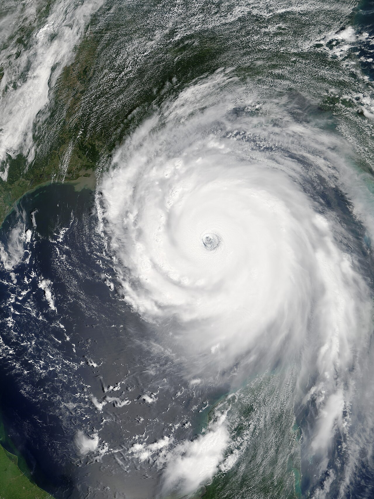
The Hurricane Katrina tornado outbreak occurred from August 29 to 31, 2005, when numerous tornadoes were generated by the outer rainbands and inland remnants of Hurricane Katrina. While attention on Katrina has focused on the catastrophic coastal storm surge and flood damage, the system also produced a distinct inland tornado threat that affected a broad swath of the eastern United States. Tornadoes were reported from areas as far south as central Mississippi and reached northward into Pennsylvania, with Georgia among the hardest hit states.
Image gallery
7 Images


How hurricanes produce tornado outbreaks
Tornadoes associated with tropical cyclones form for meteorological reasons tied to wind shear and embedded convective cells. As a hurricane or its remnants move inland, the combination of strong low-level winds, changing wind direction with height, and numerous small-scale thunderstorms can create brief but intense rotating storms. These tornadoes are often relatively short-lived and localized compared with those in classic mid-latitude outbreaks but can still cause significant damage and pose risks to communities outside the immediate coastal impact zone.
Typical characteristics
- Usually spawned in outer rainbands, especially in the right-front quadrant of the storm relative to its motion.
- Tend to be brief and smaller in scale, though damage can reach moderate to severe levels in individual cases.
- May accompany heavy rains and flooding, complicating response and recovery efforts.
During the August 29–31 episode, a range of communities from central Mississippi northward reported varying degrees of wind and tornado damage. Georgia experienced the most widespread tornado activity for August on record in the state, and at least one death was attributed to tornado-related impacts during the outbreak. Damage patterns reflected the short-lived, pulse-like nature of tropical cyclone tornadoes: concentrated but sometimes severe swaths of destruction superimposed on broader storm-related impacts.
Timeline, warnings and aftermath
The outbreak coincided with Katrina's landfall and inland progression, producing tornadic storms as the circulation weakened but continued to interact with local thunderstorms. National and local weather services issued tornado watches and warnings where conditions supported spin-up within rainbands. Because hurricane-related tornadoes can appear with little lead time inside rainbands, public messaging emphasized sheltering even as communities coped with flooding and wind damage. In the longer term, this outbreak is remembered as part of Katrina's multi-hazard legacy—an event that combined coastal catastrophe with inland wind and tornadic threats across several states.
For further meteorological background and historical context on tropical cyclone tornadoes, see resources provided by national weather services and storm research organizations: Hurricane Katrina summaries, regional storm reports in the eastern United States, and state impact briefings from central Mississippi, Pennsylvania and Georgia.
Questions and answers
Q: What was the Hurricane Katrina tornado outbreak?
A: The Hurricane Katrina tornado outbreak was a tornado outbreak across the eastern United States from August 29 to 31, 2005, spawned mostly by the outer bands of Hurricane Katrina (or the remnants thereof).
Q: How many people were killed in this event?
A: One person was killed.
Q: What areas were affected by this event?
A: Numerous communities suffered damage of varying degrees from central Mississippi to Pennsylvania.
Q: Which state experienced the worst damage?
A: Georgia was the hardest hit.
Q: Was this the worst tornado outbreak ever in that state?
A: Yes, it was the worst tornado outbreak ever in that state for August.
Q: When did this event take place?
A: This event took place from August 29 to 31, 2005.
Q: What caused this event? A: This event was caused by the outer bands of Hurricane Katrina (or its remnants).
Related articles
Author
AlegsaOnline.com Hurricane Katrina tornado outbreak (August 29–31, 2005) Leandro Alegsa
URL: https://en.alegsaonline.com/art/45937
Sources
- spc.noaa.gov : Storm Report 08/25
- spc.noaa.gov : Storm Report 08/29
- srh.weather.gov : Jackson office
- srh.noaa.gov : Birmingham office
- srh.weather.gov : Tallahassee office
- srh.weather.gov : Atlanta office
- erh.noaa.gov : State College office
- talkweather.com : TalkWeather archive of Baltimore/Washington office