
Eastern Ghats: geography, ecology and human significance
An encyclopedic overview of the Eastern Ghats of India: their geography, geology, rivers, biodiversity, cultural connections and contemporary conservation challenges.
Overview
The Eastern Ghats are a discontinuous chain of low- to medium-elevation hills and plateaus running along the eastern seaboard of peninsular India. They extend roughly from the coastal fringes of Odisha in the north, through Andhra Pradesh, and into Tamil Nadu in the south, with outlying hill blocks reaching parts of Karnataka and the Wayanad area of Kerala. Rather than a single unbroken ridge, the Eastern Ghats comprise several separated ranges, isolated hills and valleys carved by rivers and erosion. For a regional reference see a general map regional map.
Image gallery
10 Images





Geography and principal ranges
The ranges run approximately parallel to the Bay of Bengal and lie to the east of the Deccan Plateau. Prominent hill groups include the Nallamala, Seshachalam, Shevaroy, Javadi and Araku ranges, along with numerous smaller blocks. The coastal plain between the hills and the sea is commonly called the Coromandel Coast and borders the Bay of Bengal coastal context. The transition to the higher and more continuous Western Ghats is separated by the central Deccan Plateau plateau boundary.
Geology and rivers
Geologically the Eastern Ghats are ancient, composed largely of Precambrian metamorphic and igneous rocks that have been reworked by long-term weathering. Major peninsular rivers cut transverse gaps through the ranges and have strongly influenced their present fragmentation. Rivers that intersect or drain the Eastern Ghats include the Mahanadi, Godavari, Krishna and Kaveri; these systems shape valleys, plains and estuaries and are central to regional hydrology. See specific river contexts: Mahanadi overview, Godavari basin, Krishna river, Kaveri (Cauvery).
Climate
Climate across the Eastern Ghats varies with latitude, elevation and local topography. Much of the belt receives moderate to seasonal rainfall driven by the southwest and northeast monsoons, producing dry deciduous forests over large areas and moist pockets where orographic effects and local microclimates permit evergreen or semi-evergreen growth. Rainfall patterns are generally less intense and more variable than on the Western Ghats, contributing to different vegetation and land-use regimes.
Biodiversity and protected areas
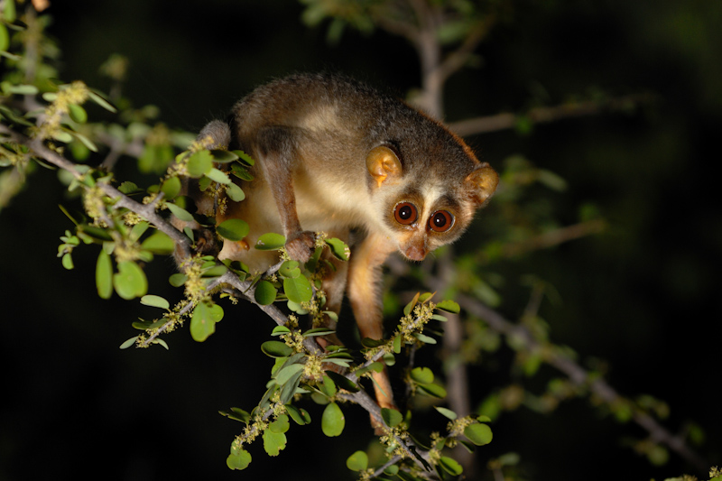
The Eastern Ghats host a mosaic of habitats: dry deciduous and scrub forest, moist pockets, riparian corridors and isolated rocky hills. These varied environments support diverse plant and animal communities, including several endemic and range-restricted species found in hill blocks such as the Seshachalam and Nallamala. Faunal communities include herbivores, small and medium-sized carnivores, birds and a variety of reptiles and amphibians; elephants occur in some connected forest tracts, while larger predators persist in larger protected areas. Conservation designations include wildlife sanctuaries and reserved forests aimed at protecting watershed functions, biodiversity and cultural landscapes.
Human presence and cultural importance
Human populations—both tribal and agrarian—have long inhabited the Eastern Ghats. Communities rely on agriculture, forest resources and pastoral activities; many hills contain pilgrimage sites and temples that are culturally significant, for example in the Tirupati-Seshachalam area. Multiple Indian states share management responsibilities for land, forests and water; administrative context includes the states of Odisha Odisha, Andhra Pradesh Andhra Pradesh, Tamil Nadu Tamil Nadu, Karnataka Karnataka and Kerala (Wayanad) Kerala (Wayanad).
Threats and conservation challenges
The Eastern Ghats face multiple pressures: fragmentation from agriculture and infrastructure, surface and open-cast mining in mineral-rich areas, conversion of forest to plantations, invasive species and water-resource developments. These pressures reduce habitat connectivity and resilience, making conservation of remaining contiguous forest patches and riparian corridors a priority. Efforts to conserve the Ghats involve protected-area expansion, community-based forest management, watershed protection and inter-state coordination.
Research, management and sustainable use
Ongoing scientific study aims to better document endemic species, watershed services and landscape connectivity across the Ghats. Sustainable management approaches emphasize balancing local livelihoods with biodiversity conservation, restoring degraded lands, and maintaining river health. Regional resources and further reading are available for those seeking more detail: overview, state notes, district information, northern sector, southern sector, central sector, river systems, coastal context, plateau boundary.
This article summarises the geography, ecology and human dimensions of the Eastern Ghats in broad terms; detailed local conditions vary by range, state and watershed.
Related articles
Author
AlegsaOnline.com Eastern Ghats: geography, ecology and human significance Leandro Alegsa
URL: https://en.alegsaonline.com/art/29757