
Delmarva Peninsula: Geography, History and Coastal Life
The Delmarva Peninsula is a large Mid-Atlantic coastal peninsula shared by Delaware, Maryland and Virginia. This article covers its geography, history, economy, recreation and distinctive features.
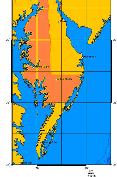
The Delmarva Peninsula is a prominent landform on the East Coast of the United States. Its name is a portmanteau formed from the three states that occupy it: Delaware, Maryland and Virginia. The peninsula stretches roughly 300 by 100 km and about 180 by 60 miles, lying between two major water bodies. To the west the region is bounded by the Chesapeake Bay and to the east by the Delaware River, Delaware Bay and the Atlantic Ocean.
Image gallery
7 Images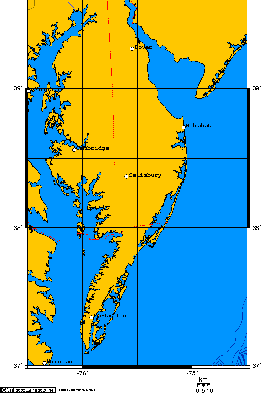


Geography and natural environment
Delmarva is predominantly low-lying and consists of coastal plain, barrier islands, marshes and estuaries. Its soils and tidal waters have supported extensive agriculture, shellfishing and wildlife habitat. The peninsula’s western shore faces the broad Chesapeake while the eastern shore is marked by sandy beaches and inlets. Popular resort towns and beaches include several well-known destinations, such as Bethany Beach and Ocean City, which draw seasonal tourism.
History and development
Before European colonization the area was inhabited by Indigenous peoples whose economies relied on coastal resources. Colonial settlement and later state boundaries produced the three-way division that gives Delmarva its name. Over centuries the peninsula developed a mixed economy of farming, oystering, fishing, shipbuilding and, more recently, tourism and service industries.
Economy, culture and recreation
The local economy balances agriculture—especially poultry and vegetable production—with maritime industries and beach tourism. Small towns and seaside communities preserve regional traditions, cuisine and festivals. Outdoor recreation is a major draw: sportfishing, birdwatching, boating and beach activities are common. Infrastructure such as ferries, causeways and bridges connects Delmarva to the mainland and supports commerce and commuting.
Distinctive facts and conservation
- Administratively the peninsula belongs to three states, which affects planning and public policy (Delaware, Maryland, Virginia).
- Barrier islands and marshes provide natural protection but are vulnerable to erosion and sea-level rise; conservation groups and state agencies work to manage habitats (Chesapeake Bay programs).
- Transportation links include major bridges and seasonal ferry service that maintain ties across the bay and along the coast (Delaware River crossings, Atlantic coast routes).
For visiting, studying, or managing coastal environments, Delmarva offers a compact example of Mid-Atlantic ecosystems and culture, where agriculture, maritime life and beach tourism coexist and shape regional identity. Further reading and resources can be found through regional guides and state conservation pages (distances and maps, area statistics, bay information, beach listings, national context).
Related articles
Author
AlegsaOnline.com Delmarva Peninsula: Geography, History and Coastal Life Leandro Alegsa
URL: https://en.alegsaonline.com/art/26415