Wrangell Island: geography, history, ecology, and communities
Wrangell Island in the Alaska Panhandle is a forested island at the mouth of the Stikine River. This article covers its geography, history, population, economy, wildlife and recreational significance.
Overview
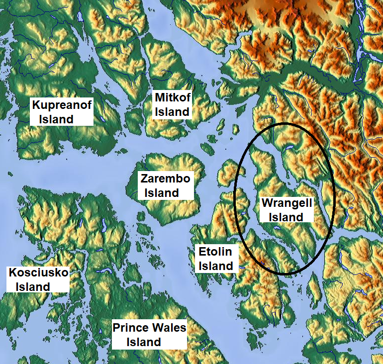
Wrangell Island lies in the Alaska Panhandle in southeastern Alaska. Roughly 48 km (30 mi) long and 8–23 km (3–14 mi) wide, the island covers about 544.03 km2 (210.05 sq mi), making it one of the larger islands in the United States. It is separated from the mainland by the narrow Blake Channel and sits at the mouth of the Stikine River. The primary settlement is the city of Wrangell; the smaller community of Thoms Place also occupies the island.
Image gallery
3 Images
Geography and ecology
The island is heavily forested and forms part of the temperate rainforest region characteristic of southeastern Alaska. Dense stands of Sitka spruce and western hemlock dominate the lowlands, while wetlands and estuarine habitats occur near the Stikine River delta. This variety of habitats supports salmon runs, waterfowl, black bears, wolves and other coastal wildlife. Marine waters around the island are important for commercial and subsistence fisheries.
History and cultural background
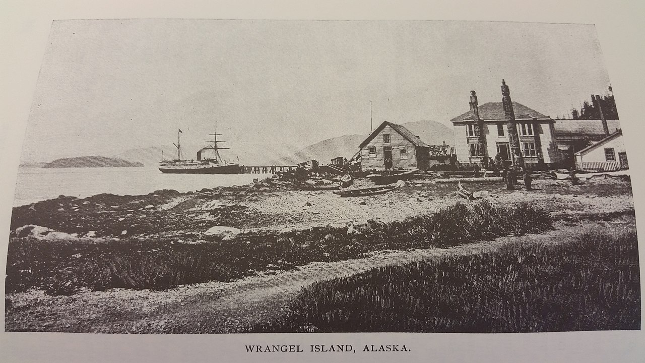
Indigenous Tlingit people, especially the Stikine Tlingit, have long used the island and adjacent mainland for fishing, hunting and seasonal camps. European and American exploration and commerce began in the late 18th century: recorded visits include an American trading vessel from Boston in 1799. The island later came under Russian influence and was occupied by Russians in the 1830s. It was named for Ferdinand Wrangel, a German-born explorer in Russian service. Control of the region passed through several authorities—Russia, British interests in the area, and ultimately the United States—reflecting the broader colonial and diplomatic history of southeastern Alaska.
Population, economy and infrastructure
The community of Wrangell has long been a regional hub for fishing, small-scale mining, logging and transportation. Fishing—commercial and subsistence—remains a key economic activity, and mining historically attracted miners using the Stikine River route to the Yukon. A local sawmill operated for decades but closed in the 1990s, altering employment patterns. The island's year-2000 population was recorded as 2,401; residents are served by local roads, a small airport and waterborne connections to other coastal communities.
Recreation, conservation and access
Wrangell Island and its surroundings offer recreation opportunities such as sport fishing, wildlife viewing, kayaking and hiking. The proximity of the Stikine River and its estuary makes the area attractive for birdwatching and riverine exploration. Parts of the landscape are managed for multiple uses, balancing subsistence harvests, commercial activities and conservation. Access is typically by air or ferry and by private boat; seasonal weather and tides influence travel.
Notable facts and references
- Naming: Named for Ferdinand Wrangel, an explorer in Russian service; later administered under Russian, British and U.S. authorities. More on the island.
- Early visits: Visited by a Boston trading vessel in 1799 and engaged in trade with Stikine Tlingit communities. Early contacts.
- Russian presence: Occupied in the 1830s during Russian expansion into southeastern Alaska. Russian era and Russian operations.
- Colonial transition: The island's sovereignty history includes British and American periods. British involvement and U.S. administration.
- Local communities: The city of Wrangell is the island's main settlement; Thoms Place is a smaller community. Wrangell city and industrial history.
- Routes and use: Served historically as a stopping point for travelers and miners using the Stikine route to the Yukon. Stikine route, early vessels, and Maritime links.
- Environment: Rich coastal and forest ecosystems with important fisheries. Ecology notes and recreation areas.
For more detailed sources and further reading, consult regional histories and current management plans maintained by local and federal agencies. Specific navigational, ecological and demographic data are updated periodically by state and federal institutions; the placeholders above point to further resources and archival material.
Related articles
Author
AlegsaOnline.com Wrangell Island: geography, history, ecology, and communities Leandro Alegsa
URL: https://en.alegsaonline.com/art/109170
Sources
- commons.wikimedia.org : Wrangell Island