
Wulingyuan: quartzite pillars and protected scenic area in Hunan, China
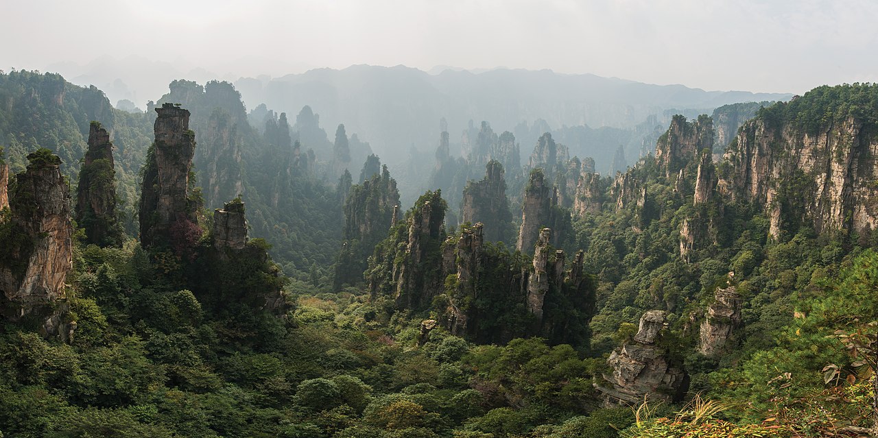
Wulingyuan is a UNESCO World Heritage scenic area in Hunan, China, famous for over 3,000 quartzite-sandstone pillars, deep ravines, caves, streams and two natural bridges. It is a major conservation and tourism site.
Overview
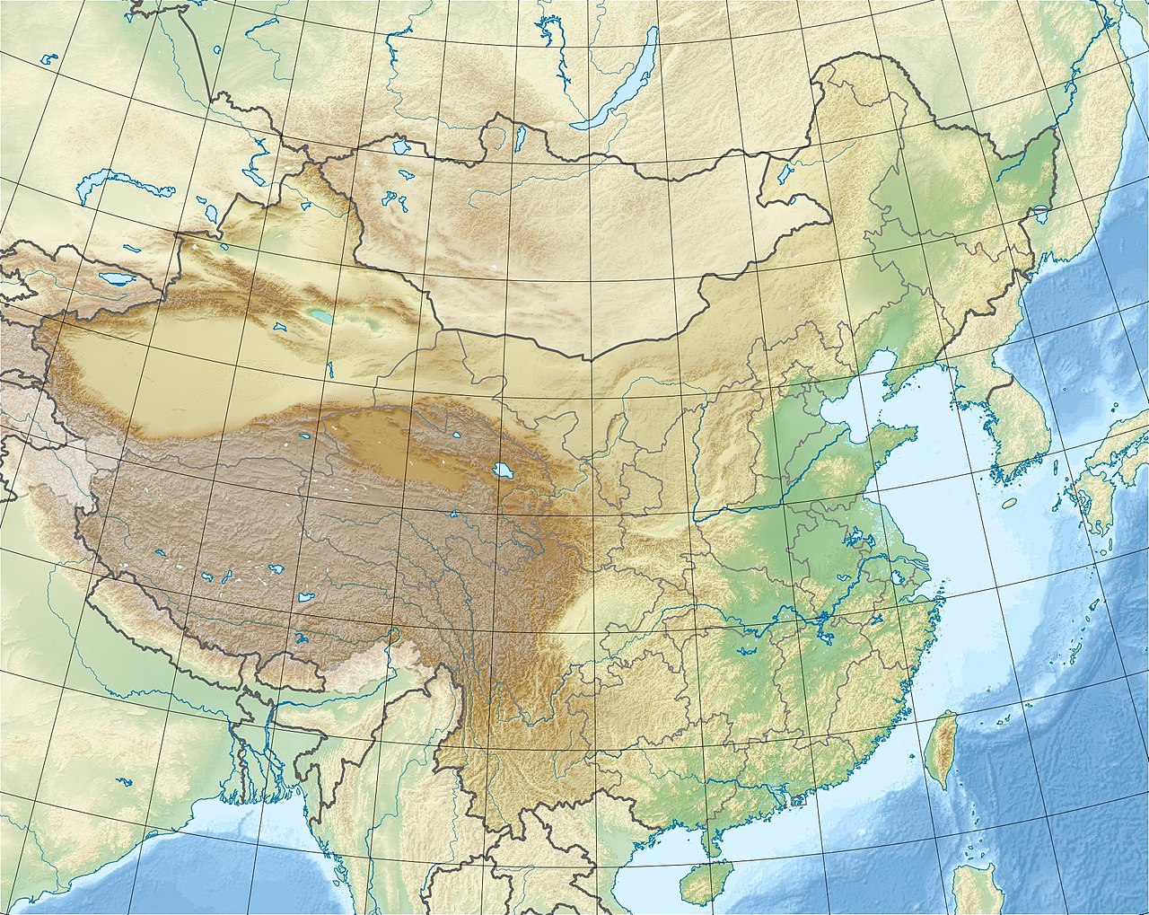
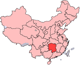
Wulingyuan (武陵源) is a large protected scenic area in south-central China, inscribed as a UNESCO World Heritage Site for its exceptional natural landscape and geological features. Located in Hunan Province, the site lies roughly 270 kilometres northwest of Changsha and covers about 690 square kilometres (approximately 266 square miles). The protected area is widely celebrated for its dramatic vertical rock pillars, scenic gorges and biologically rich forests.
Image gallery
7 Images



Location and extent
Wulingyuan occupies a portion of the Wuling Mountain Range and includes multiple reserves and scenic zones. Administratively it stretches across a chain of valleys and peaks in the Zhangjiajie region of Hunan. The area contains hundreds of named viewpoints, trails and attractions organized for conservation and visitor management.
Geology and formation
The signature landforms of Wulingyuan are more than 3,000 tall pillars and peaks composed largely of quartzite-rich sandstone. These columns, many rising over 200 metres, are the outcome of long-term erosion along joints and fractures, combined with physical weathering in a subtropical climate. Over geological time, the selective removal of weaker rock and ongoing downcutting of valleys left isolated, steep-sided pillars that give the landscape its distinctive, vertical character.
Karst-like features, caves and natural bridges
Although Wulingyuan's pillars are sandstone rather than classic limestone karst, the area includes extensive caves—roughly forty documented caverns—with notable mineral deposits such as calcite in places. Two famous natural arches or bridges, Xianrenqiao ("Bridge of the Immortals") and Tianqiashengkong ("Bridge Across the Sky"), are among the most photographed structural features. Deep ravines and gorges, with numerous streams, pools and waterfalls, channel runoff and create scenic water features that complement the stone towers.
Vegetation and wildlife
The region supports subtropical forests and a diversity of plant communities that vary with altitude and aspect. Dense tree cover and shrubs on cliff ledges and in sheltered gullies provide habitat for a range of wildlife and help stabilise soils. The mix of microhabitats—rocky outcrops, forested slopes and wet valleys—contributes to local biodiversity and is one reason the area has been conserved.
Human history and cultural context
Local communities have long used passes, river valleys and hill slopes in and around Wulingyuan for travel, agriculture and gathering. Traditional uses and cultural ties to the mountains continue to shape how the landscape is perceived and managed. The area's inscription as a World Heritage Site reflects both its natural values and its importance for regional identity and sustainable tourism.
Tourism, access and visitor management
Wulingyuan is a major tourist destination that attracts visitors for hiking, photography and sightseeing. Park authorities operate a network of trails, boardwalks, cable cars and designated viewpoints to concentrate visitor flows, reduce erosion, and protect fragile cliff faces and watercourses. Interpretive signage and guided routes help visitors understand geological processes and ecological considerations while reducing impacts on sensitive sites.
Conservation challenges
Managing a popular scenic area with complex geology and diverse ecosystems presents ongoing challenges. Key conservation priorities include preventing soil erosion, limiting infrastructure sprawl, protecting water quality and cave systems, and balancing visitor access with habitat protection. Efforts typically combine legal protection, local management plans and measures to promote responsible tourism.
Practical information for visitors
Visitors should plan for variable weather and steep terrain, wear appropriate footwear, and follow all park guidance and seasonal restrictions. Popular activities include viewpoint walks, short hikes into forested valleys, and visits to the most accessible pillar clusters. Because conditions can change rapidly in mountain terrain, following local safety advice and staying on official paths is important.
Further information and resources
For official descriptions, conservation documentation and practical visitor guidance, consult the following resources and overviews. These links provide background on geology, management and travel planning:
- General overview of Wulingyuan
- UNESCO site page
- World Heritage documentation and criteria
- Hunan Province information
- Geological context: quartzite and sandstone
- Sandstone formation and erosion processes
- Ravines, gullies and geomorphology
- Streams, waterfalls and hydrology
- Pools, lakes and aquatic features
- Cave mineralogy and calcite deposits
- Natural arches and bridge formations
- Regional transport and access via Changsha
- Area, scale and mapping references
Note: This article summarizes widely reported features of Wulingyuan and provides general guidance for understanding the area's geology, ecology and visitor considerations. For detailed scientific studies, current access rules, or site-specific conservation plans, consult specialist publications or official park authorities linked above.
Questions and answers
Q: Where is Wulingyuan located?
A: Wulingyuan is located in south-central China's Hunan Province.
Q: How many quartzite sandstone pillars and peaks are there at the site?
A: There are over 3,000 quartzite sandstone pillars and peaks at the site.
Q: What is the approximate distance from Changsha to Wulingyuan?
A: The approximate distance from Changsha to Wulingyuan is 270 kilometres (170 miles).
Q: What type of mountain range does Wulingyuan belong to?
A: Wulingyuan belongs to the Wuling Mountain Range.
Q: How many attraction sights are there in total at the scenic area?
A: There are over 560 attraction sights in total at the scenic area.
Q: What two natural bridges can be found at this site?
A: The two natural bridges that can be found at this site are Xianrenqiao ("Bridge of the Immortals") and Tianqiashengkong ("Bridge Across the Sky").
Q: How large is the park in terms of square kilometers/miles?
A: The park covers an area of 690 square kilometers (266 square miles).
Related articles
Author
AlegsaOnline.com Wulingyuan: quartzite pillars and protected scenic area in Hunan, China Leandro Alegsa
URL: https://en.alegsaonline.com/art/109273
Sources
- whc.unesco.org : "Wulingyuan Scenic and Historic Interest Area"
- travelchinaguide.com : "Wulingyuan Scenic and Historic Area"