Panama Canal Zone
Former U.S.-administered territory surrounding the Panama Canal (1903–1979/1999), its administration, history, strategic role in shipping, and transfer to Panama under the Torrijos–Carter agreements.
Overview
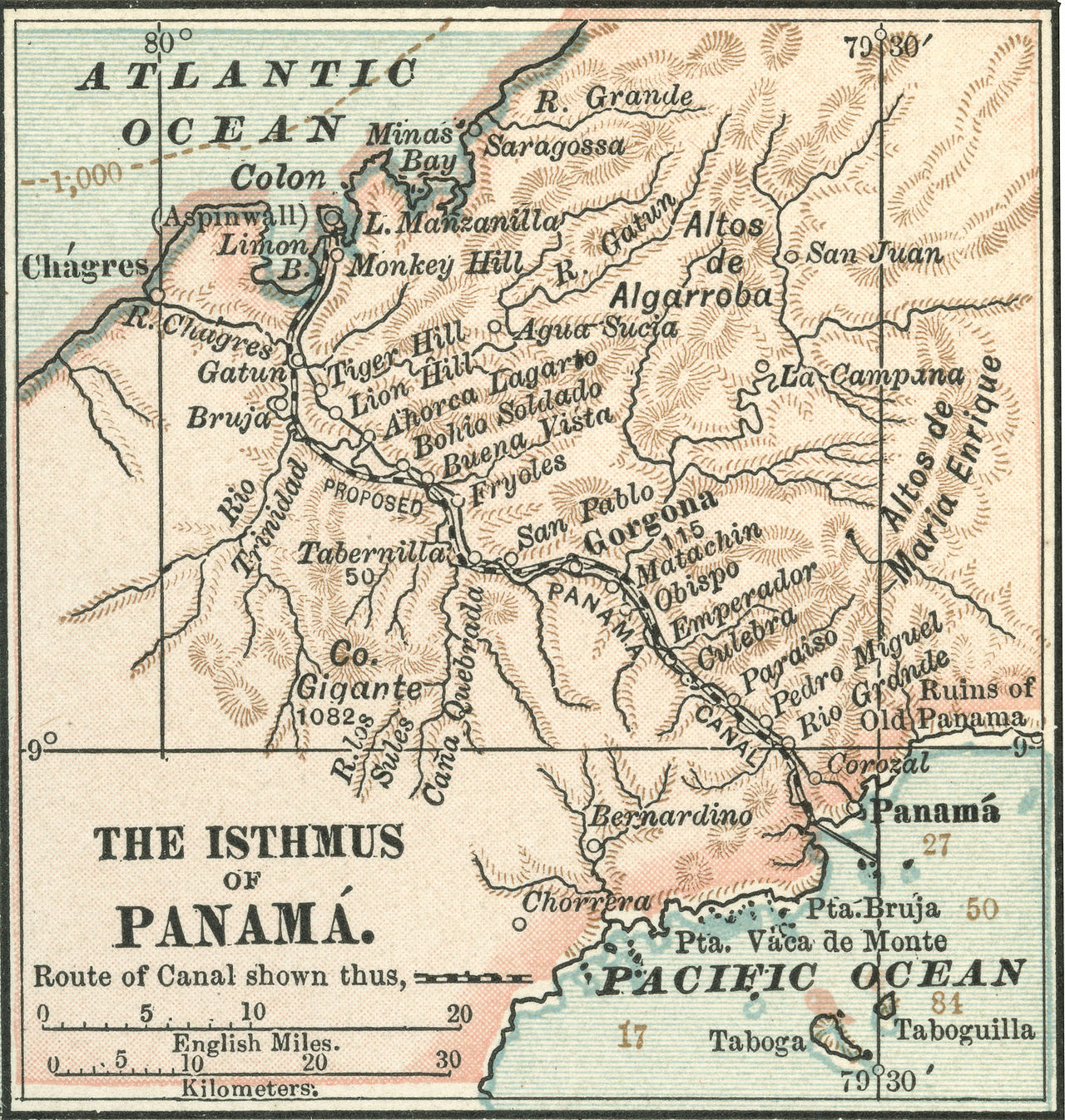
The Panama Canal Zone was a distinct territory established to administer and protect the Panama Canal and adjacent lands on the Isthmus of Panama. The Zone covered roughly 553 square miles (about 1,430 km2) of land that included canal infrastructure, towns, military installations and support facilities. Its location is recorded at geographic coordinates that place it across the narrow Atlantic–Pacific isthmus of Central America. For much of the 20th century the Zone was administered by the United States and functioned as a semi-autonomous area with its own civil and military governance structure; it was not a U.S. state but a territorial possession often described in contemporary documents as the Panama Canal Zone.
Image gallery
10 Images


Territory, infrastructure and daily life
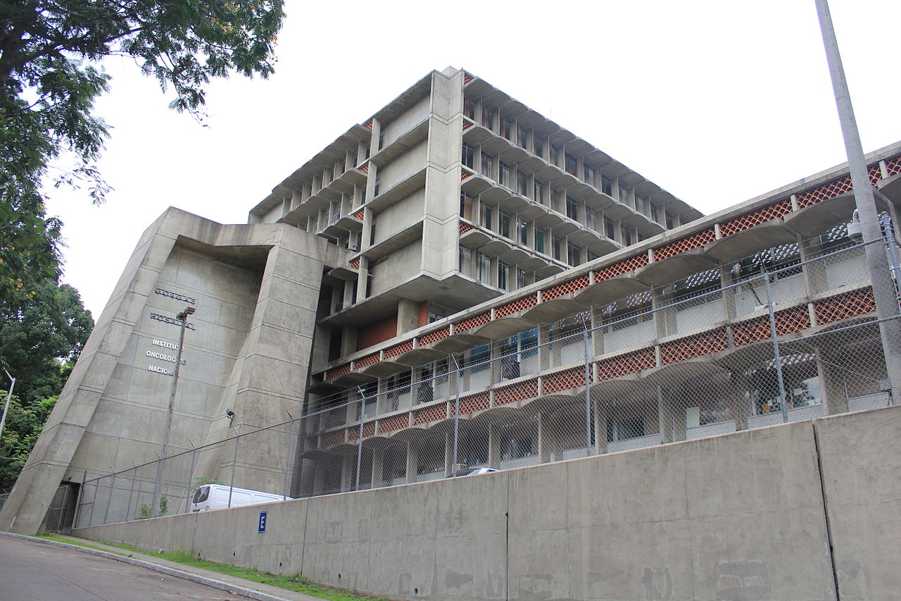
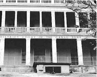
The Zone encompassed the waterway itself and surrounding lands on both the Atlantic and Pacific sides. It contained piers, locks, repair yards, administrative offices and housing for canal employees. Several towns and residential areas grew to serve the Canal’s workforce and U.S. military personnel. American-style public services—schools, hospitals, postal operations and law enforcement—were established to serve Zone residents. The governing authority combined civilian canal management with military oversight when needed to protect the waterway and American interests.
History and legal basis
The political arrangements that created U.S. control of the Canal Zone grew out of early 20th-century negotiations and agreements involving Panama and the United States. The United States supported Panama’s separation from Colombia and negotiated rights to build and operate an interoceanic canal. Over the decades the Zone’s existence was a focal point of Panamanian political debate, sovereignty claims and international diplomacy. In the 1970s new treaties negotiated between Panamanian leaders and the U.S. presidency redefined the relationship and set a timetable for transferring control.
Torrijos–Carter negotiations and transfer
In 1977 the two governments reached agreements that amended the old arrangements and set a path toward Panamanian sovereignty over the canal and the surrounding lands. These accords, commonly associated with Panamanian leader Omar Torrijos and U.S. President Jimmy Carter, replaced earlier treaties and provided for gradual transfer of functions. The formal framework is often referred to as the 1977 treaties, and implementation began with changes to the Zone’s status and administration in 1979. The United States continued to operate and defend the canal until the final handover of canal operations to Panamanian authorities at the end of 1999, after which the territory formerly known as the Canal Zone became fully integrated into the Republic of Panama.
Economic and strategic importance
The Panama Canal and the surrounding Zone were of major strategic and commercial importance. By creating a shorter maritime route between the Atlantic and Pacific Oceans, the canal dramatically altered global shipping patterns and military logistics. The Zone’s economy centered on canal operations, related maritime services, and the presence of U.S. forces and civilian contractors. Control of the Canal was therefore significant for international trade, naval mobility and regional influence throughout the 20th century.
Legacy and notable facts
The Canal Zone left a lasting imprint on Panama’s urban development, infrastructure and bilateral relations with the United States. Its institutions—schools, hospitals, housing layouts and transport corridors—shaped local communities. The transition completed in 1999 led to the creation of Panamanian entities charged with canal management and a new era of sovereign control. Scholarly and public interest in the Zone continues because it illustrates themes of imperial influence, engineering ambition and the politics of sovereignty. For further contextual reading about the Zone’s geography, administration and historical disputes see contemporary references and archival material linked through government and historical resources (further reading).
- Area: approximately 553 square miles (1,430 km2).
- Primary function: administration and protection of the Panama Canal.
- Major milestones: creation after early 20th-century agreements; treaty revisions in 1977 (Torrijos–Carter); final transfer of canal operations on December 31, 1999.
Related articles
Author
AlegsaOnline.com Panama Canal Zone Leandro Alegsa
URL: https://en.alegsaonline.com/art/74303