
Magellan (spacecraft) — Venus Radar Mapper
Magellan was a NASA mission that orbited Venus (1990–1994) using radar to produce near-global surface maps and gravity data, revealing volcanic and tectonic features beneath the clouds.
Overview
The Magellan mission, commonly called the Venus Radar Mapper, was a planetary spaceprobe led by NASA to study the surface and gravity field of Venus, the second planet from the Sun. Launched in 1989, Magellan arrived at Venus in 1990 and operated in a near-polar orbit for about four years. Because Venus is hidden beneath a dense cloud layer, the spacecraft relied on active microwave sensing rather than visible-light imaging to characterize surface form and texture.
Image gallery
10 Images





Design and instruments
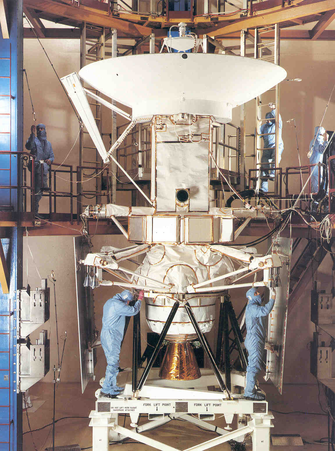
Magellan’s payload was optimized to penetrate the opaque atmosphere and return detailed surface information. Its main instruments and capabilities included:
- Synthetic aperture radar (SAR) for high-resolution mapping of surface morphology and for radar altimetry to measure elevations.
- Radar scatterometry to infer surface roughness and reflectivity.
- Radio science experiments using spacecraft tracking to determine variations in Venus’s gravity field.
The spacecraft architecture borrowed engineering heritage and spare components from earlier projects, which reduced cost and development time. In particular, some subsystems used parts related to the Voyager program design lineage.
Launch and mission timeline
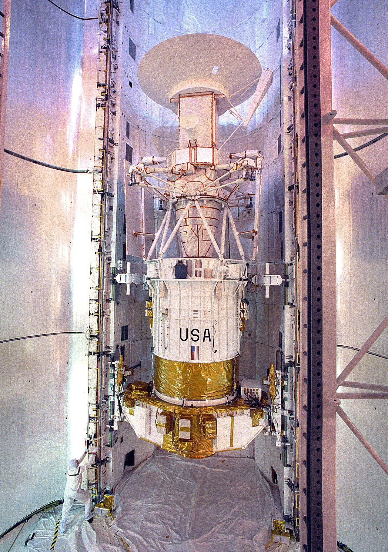
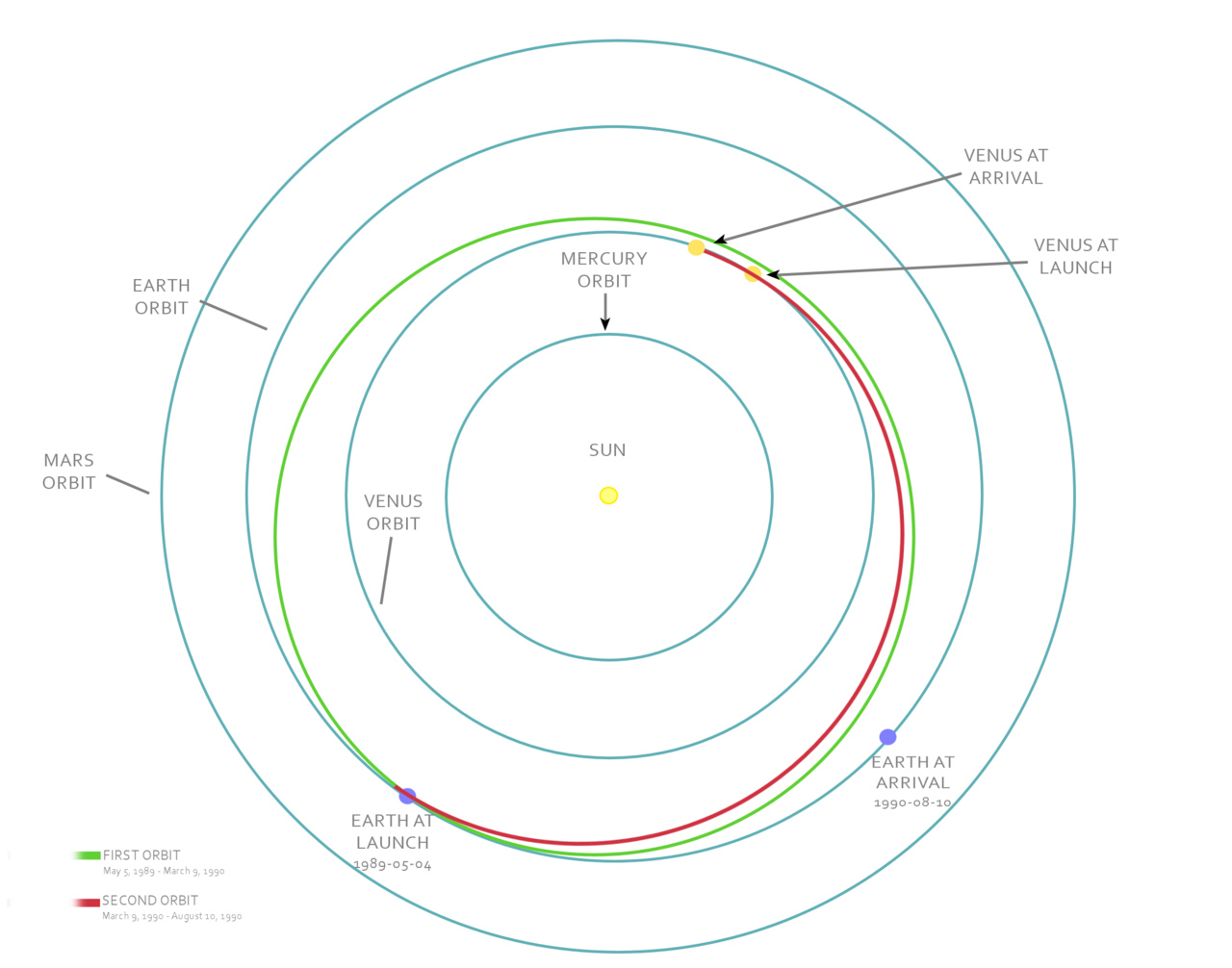
Magellan was launched from the Space Shuttle Space Shuttle Atlantis on May 4, 1989, using an upper stage to inject it toward Venus. It reached Venus on August 10, 1990, and was inserted into a near-polar orbit. Over successive mapping cycles the spacecraft built a nearly complete radar portrait of the planet. The operational mapping phase continued through 1994 and ended when mission controllers performed a planned deorbit burn that sent Magellan into the Venusian atmosphere on October 12, 1994.
Scientific results and importance
Magellan delivered the first detailed global view of Venus’s surface. Its radar maps covered most of the planet, revealing vast volcanic plains, large shield volcanoes, complex tessellated terrains, rift zones, and impact craters. Analysis of topography and crater populations led to the conclusion that Venus’s surface is relatively young geologically and is dominated by volcanic and tectonic processes rather than Earth-like plate tectonics. Gravity data helped define mass concentrations and subsurface structure, improving models of crustal thickness and mantle dynamics.
Distinctions, legacy and name
Magellan is notable for having been deployed from a Shuttle and for finishing with a deliberate atmospheric impact into Venus as a planned mission termination. The spacecraft was managed by the Jet Propulsion Laboratory and is often cited as an efficient use of available hardware to achieve a high-return planetary mission. The name honors the Portuguese explorer Ferdinand Magellan, reflecting the probe’s role in mapping an unfamiliar world. For more detailed technical and archival material, consult mission documentation and planetary science archives about the planet and historical mission pages on radar and gravity studies.
Magellan remains a benchmark in planetary radar remote sensing and continues to inform comparative studies between Earth and Venus. Its data sets are still used to examine surface evolution, volcanic resurfacing, and regional tectonic styles, and they laid groundwork for subsequent missions and interest in Venus exploration worldwide spacecraft studies and proposals by NASA.
Related articles
Author
AlegsaOnline.com Magellan (spacecraft) — Venus Radar Mapper Leandro Alegsa
URL: https://en.alegsaonline.com/art/60573
Sources
- solarviews.com : "Magellan Mission to Venus"
- aerospaceguide.net : "Magellan Spacecraft - Venus Radar Mapper"