
Line of Actual Control (India–China)
De facto border separating Indian and Chinese controlled territory in the Himalaya; its sectors, origins, management agreements, and strategic importance.
Overview
The Line of Actual Control (LAC) refers to the de facto military boundary that separates areas administered by India and China. It is not a formally agreed international border but a practical frontier along which troops of the two countries patrol and exercise control. Because each side has its own perception of where the line runs, the LAC is often described as a zone of differing claims rather than a single precisely demarcated line.
Image gallery
6 Images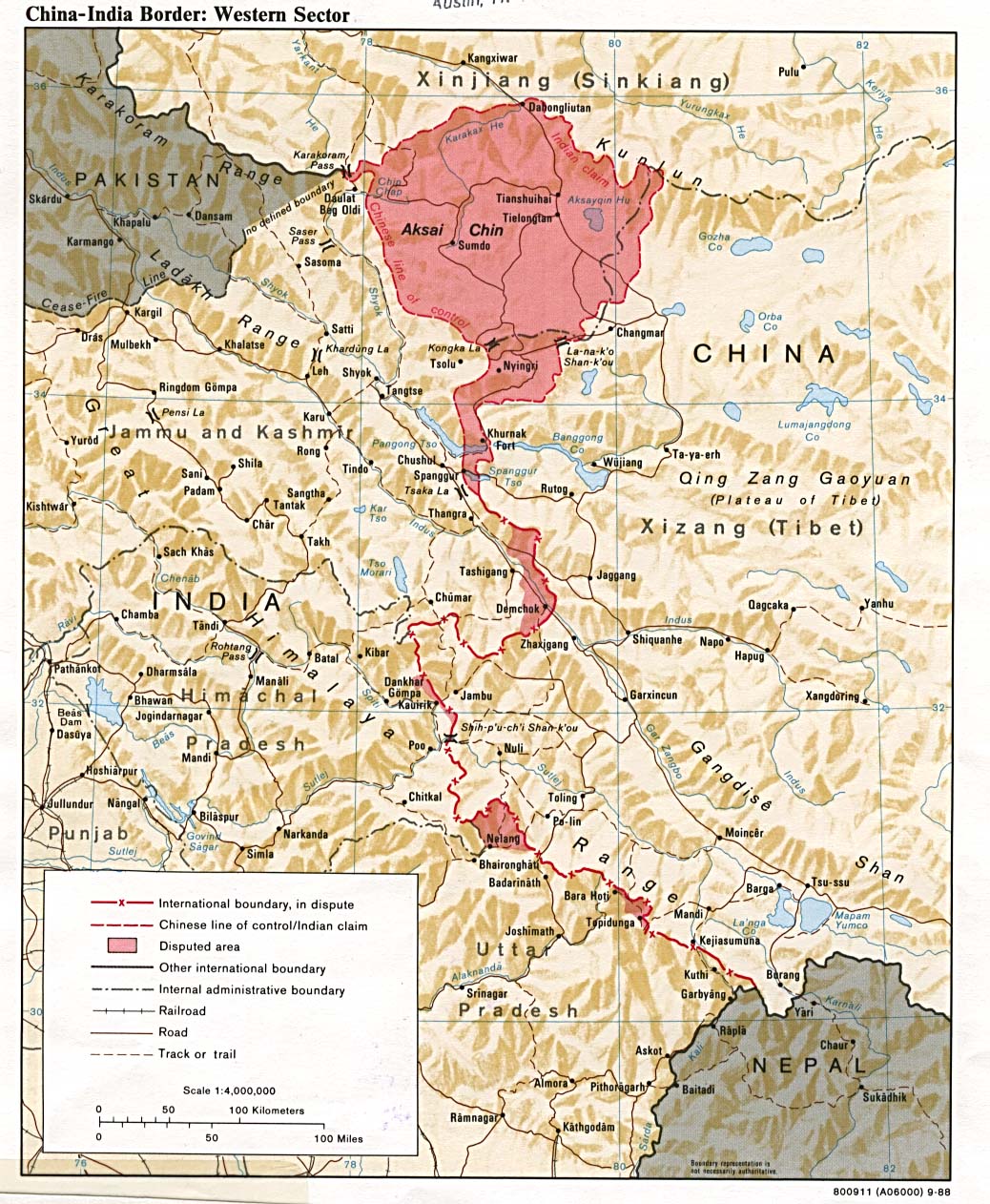


Geography and sectors
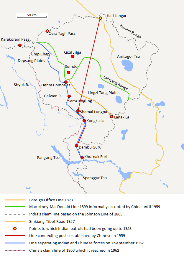
The LAC extends across a large stretch of the Himalaya and nearby ranges and is conventionally discussed in three broad sectors. The western sector includes areas around Ladakh and the larger Kashmir region; the middle sector runs past parts of Uttarakhand and Himachal Pradesh; and the eastern sector lies across the border areas near Sikkim and Arunachal Pradesh. In the eastern sector, the historic McMahon Line forms one reference point for India, while China maintains a different interpretation of the boundary.
Origins and historical development
The term "Line of Actual Control" entered diplomatic usage in 1959 when Chinese Premier Zhou Enlai used it in correspondence with Indian Prime Minister Jawaharlal Nehru, first in a letter dated October 24 and later on November 7. Zhou described the LAC as including "the so-called McMahon Line in the east and the line up to which each side exercises actual control in the west." Ambiguity over the LAC and competing territorial assertions contributed to tensions that culminated in the 1962 Sino-Indian War, after which the two countries maintained differing perceptions of the frontier.
Management, agreements, and incidents
Because the LAC is not mutually agreed, India and China over time negotiated a series of protocols, confidence-building measures and military arrangements intended to reduce the risk of accidental escalation. These measures aim to regulate patrols, communications and behaviour of troops, and to provide mechanisms for local commanders to resolve standoffs. Despite these arrangements, there have been periodic stand-offs and clashes, including high-profile confrontations in recent decades that underscored the line's fragile and contested nature.
Distinctions and strategic importance
The LAC should not be confused with the McMahon Line, which was drawn as part of early 20th-century boundary arrangements in the eastern Himalaya and is accepted by India but rejected by China, nor with the separate Line of Control that divides Indian- and Pakistani-administered Kashmir. The LAC's strategic significance is high: it affects military deployments, infrastructure development, local populations, and bilateral relations between India and China. The broader Tibet region figures in the historic context of the frontier disputes and policy considerations involving both capitals; references to Tibet frequently appear in diplomatic discussions about the boundary.
Notable facts
- The LAC is a working, operational concept rather than a legally finalized international boundary.
- Its segments traverse different terrain types—from high-altitude plateaus in Ladakh to more forested hills in Arunachal Pradesh.
- Key historical exchanges that shaped the phrase appear in correspondences between Zhou Enlai and Indian leaders on October 24 and November 7, 1959.
Understanding the LAC requires attention to geography, history, and diplomacy: it remains a central element of India–China relations and a focus of ongoing negotiations, patrol protocols and periodic crisis management efforts between the two neighbours.
Related articles
Author
AlegsaOnline.com Line of Actual Control (India–China) Leandro Alegsa
URL: https://en.alegsaonline.com/art/58241
Sources
- news.oneindia.in : news.oneindia.in