Linth (Swiss river)
Alpine river in eastern Switzerland rising near Linthal in the canton of Glarus, flowing about 50 km into Lake Zurich. Noted for 19th‑century river corrections, historic textile power and modern hydroelectric use.
Overview
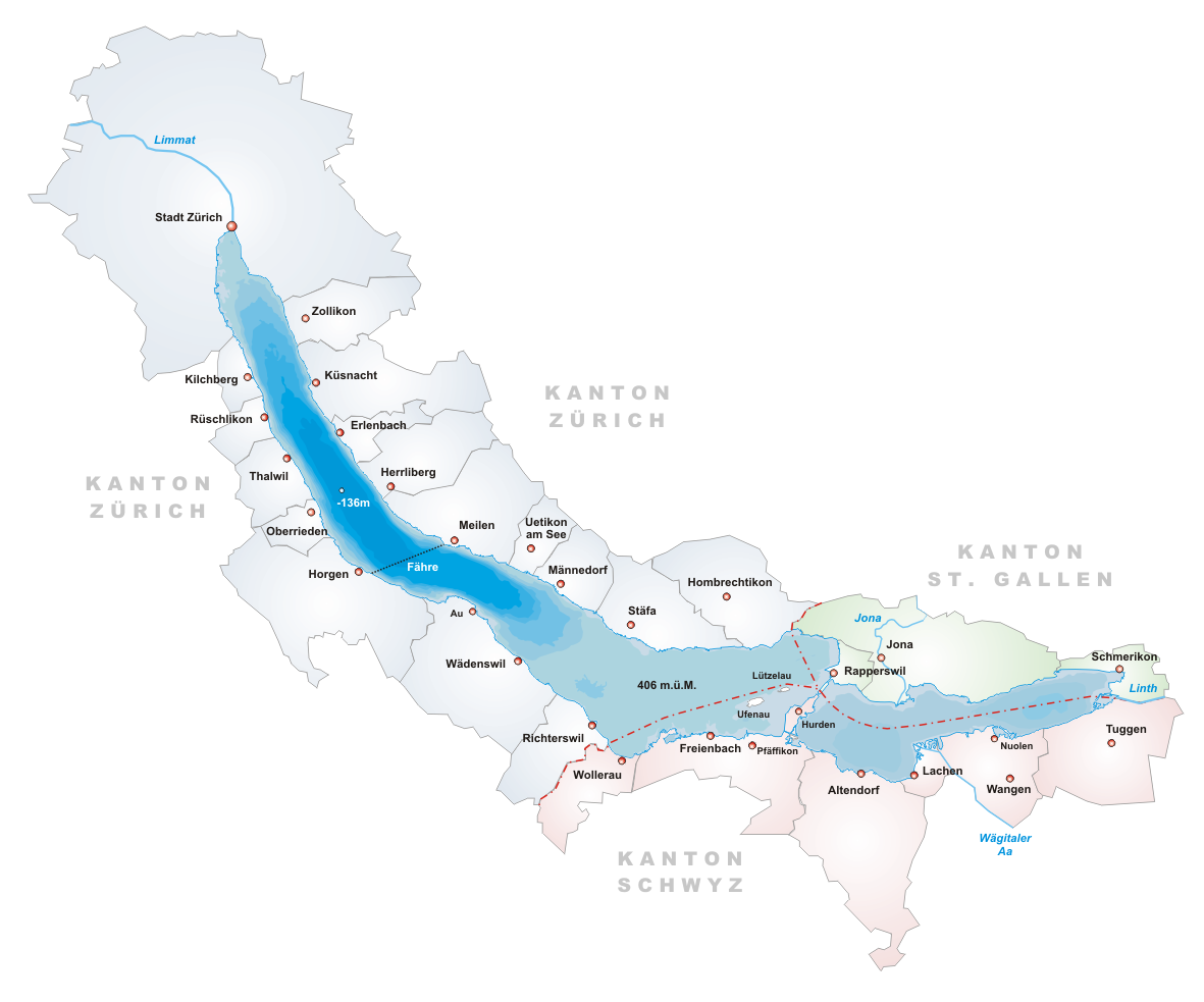
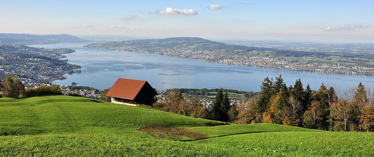
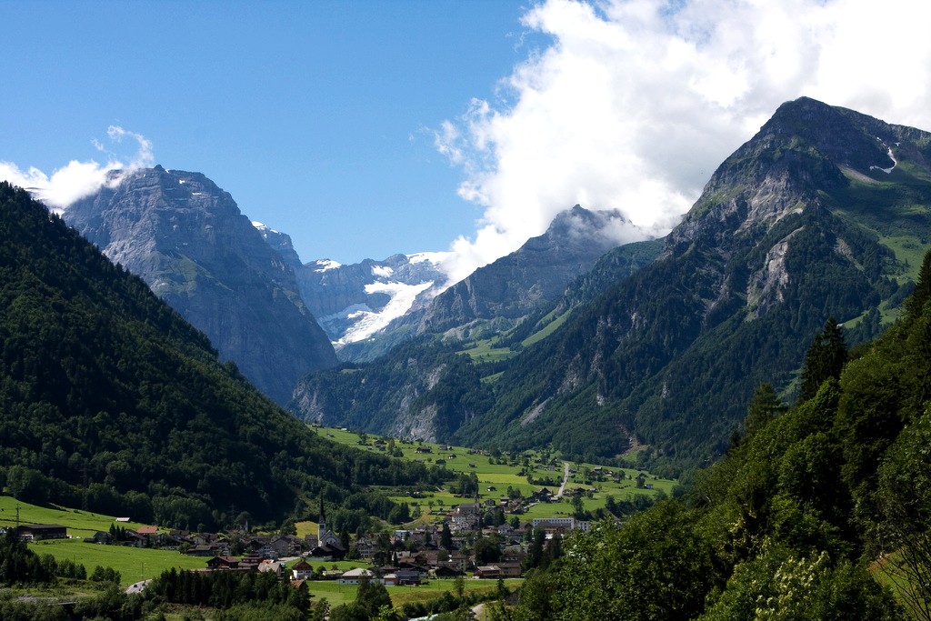
The Linth is an Alpine river in eastern Switzerland that begins in the high valley around Linthal and descends to the Obersee section of Lake Zurich. It is approximately 50 kilometres long and serves as an important natural corridor between mountain ranges. The river drains a compact mountainous basin and is fed by rainfall, snowmelt and small glaciers higher in the range.
Image gallery
6 Images


Course and characteristics
The Linth flows through a narrow upper valley, spreads into wider plains in its lower reaches and empties into Lake Zurich's eastern arm. Its upper valley separates the Glarus Alps to the east and south from the Schwyzer Alps to the west. The channel and floodplain have a mix of rocky, braided and canalized sections, reflecting both natural alpine processes and extensive human modification.
History and river regulation
Historically the Linth caused periodic flooding and created marshy ground near the lakes it feeds. In the early 19th century a major engineering project—commonly called the Linth correction—restructured the river to reduce floods and reclaim farmland. That intervention is a key episode in Swiss hydraulic engineering and in the economic development of the surrounding cantons, notably Glarus.
Economic uses and infrastructure
The river powered early textile mills in the canton of Glarus and helped establish local industry by providing reliable mechanical energy. In the 20th and 21st centuries the Linth's flow has been harnessed for hydroelectric generation: a series of plants and reservoirs exploit elevation changes in the upper basin, including the Linth–Limmern installations that form part of the region's renewable energy network.
Ecology and importance
The Linth valley supports montane river habitats, agricultural land in its lower reaches and settlements that rely on its water quality and flood management. River regulation improved land use but also altered natural floodplain dynamics; modern management balances hydropower, flood protection, drinking water supply and habitat conservation.
Notable facts and access
- Length roughly 50 km and flows from the canton of Glarus to Lake Zurich.
- Its upper valley marks a natural boundary between two Alpine subranges.
- It remains a focus of regional river management and hydroelectric projects.
For general overviews and regional guides consult local sources and maps for details about access, trails and current hydrological projects; many public resources and municipal sites cover the river's course and management in greater depth (river information).
Related articles
Author
AlegsaOnline.com Linth (Swiss river) Leandro Alegsa
URL: https://en.alegsaonline.com/art/58315
Sources
- map.geo.admin.ch : map.geo.admin.ch
- commons.wikimedia.org : Linth