Hurricane Hunters: Aircraft Reconnaissance of Tropical Cyclones
Hurricane Hunters are specially equipped aircraft that fly into tropical cyclones to collect direct observations used for forecasting and research, primarily in the Atlantic and eastern North Pacific.
Overview
Hurricane Hunters are specially equipped aircraft that fly into or around a tropical storm to obtain direct measurements of the atmosphere and sea surface. These missions provide information that cannot be fully replaced by remote sensing, improving forecasts of track, intensity and structure. Most routine hurricane reconnaissance flights operate in the Atlantic Ocean and the northeastern Pacific Ocean, supporting warning centers and emergency management.
Image gallery
4 Images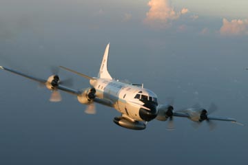


Capabilities and equipment
Crews use a combination of onboard instruments and expendable devices to sample the storm. Typical systems include:
- Research and weather radar to map precipitation and eyewall structure.
- Dropwindsondes or dropsondes released from the aircraft to measure vertical profiles of pressure, temperature, humidity and winds.
- Microwave radiometers to estimate surface wind speed and rainfall.
- High-resolution GPS and flight-level sensors for direct wind and pressure readings.
Operations and uses
Flights are coordinated with forecasting centers so data are assimilated quickly into models and guidance. Observations help locate the storm center, determine maximum sustained winds, detect eyewall changes and estimate minimum central pressure. The real-time data from these missions are often the most reliable input during rapidly changing storms.
History and notable facts
Aerial reconnaissance of tropical cyclones began in the mid-20th century and evolved into organized military and civilian programs. Units such as specialized Air Force Reserve squadrons and national research agencies operate modified turboprops and jets that can penetrate severe conditions. Crews undergo rigorous training because missions are complex and hazardous. While hurricane hunting is most common in the Atlantic and eastern Pacific basins, other regions rely on satellites and occasional research flights; the practice remains a critical tool for understanding and forecasting tropical cyclones worldwide.
For background on tropical cyclone definitions see tropical cyclone references and operational summaries at collection points like agency pages and regional modeling centers (Atlantic, Pacific).
Related articles
Author
AlegsaOnline.com Hurricane Hunters: Aircraft Reconnaissance of Tropical Cyclones Leandro Alegsa
URL: https://en.alegsaonline.com/art/45907