
Far North Region (Cameroon)
Overview of Cameroon's Far North Region: geography, people, environment, economy and protected areas, with notes on major rivers, Lake Chad and national parks.
The Far North Region of Cameroon occupies the country's northernmost territory and serves as a unique transition zone between the central African highlands and the Sahel. Its administrative capital is Maroua, a regional centre for commerce, administration and culture. The region's location along the border with Chad has shaped its history, trade and population movements.
Image gallery
10 Images
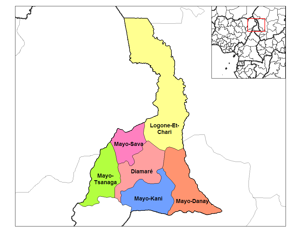


Geography and climate
This semi-arid region is dominated by flat plains, seasonal floodplains and the Mandara Mountains in the south-east. Two major rivers, the Chari and the Logone, form much of the international boundary with neighbouring Chad, and several smaller seasonal rivers (locally called "mayo") cross the landscape. Important water bodies include the eastern edge of Lake Chad as well as Maga Lake and Lake Fianga. The highest elevations are in the Mandara range, where peaks such as Mount Tourou rise above the plains. Rainfall is strongly seasonal, with a short wet season and a longer dry season, making agriculture and water management highly dependent on annual weather variation.
People, languages and culture
The Far North is ethnically diverse, home to more than fifty distinct groups. Among the better-known communities are the Shuwa Arabs, pastoralist Fulani (Peul), and the Kapsiki who live in the Mandara highlands. Languages, customs and lifeways vary from sedentary farming groups to transhumant herders. Towns such as Maroua act as marketplaces where agricultural produce, livestock and crafts are exchanged and where different cultural traditions meet.
Economy and land use
Local economies are largely based on rain-fed agriculture, livestock rearing and seasonal fishing where wetlands permit. Crops include millet, sorghum, maize and vegetables irrigated from ponds or small canals in wetter years. Pastoralism remains an important livelihood for Fulani and Shuwa communities. The region faces recurring challenges: drought, land degradation, and pressures on water resources around Lake Chad have significant effects on food security and mobility.
Protected areas and biodiversity
The Far North contains several protected areas established to conserve wildlife and support tourism. Waza National Park is the most prominent reserve, known for its savanna wildlife including antelope, giraffe, elephants, crocodiles and numerous bird species. Other protected sites include Kalamaloué National Park and Mozogo Gokoro National Park. These parks support biodiversity but also experience pressures from poaching, habitat conversion and human-wildlife conflict.
History, challenges and significance
The region has long been a crossroads for trade and cultural exchange across the Sahel. Its border location links it economically and socially with neighbouring countries. Current priorities for the Far North include adapting agriculture to a variable climate, managing shrinking and seasonal wetlands, protecting wildlife, and sustaining livelihoods for both farmers and pastoralists. Conservation and development efforts often seek to balance ecosystem protection with the immediate needs of local communities.
Major rivers, lakes and parks
- Rivers: Chari, Logone, Mayo Kébi, Mayo Louti
- Lakes and wetlands: Lake Chad, Lake Fianga, Maga Lake
- Protected areas: Waza National Park, Kalamaloué National Park, Mozogo Gokoro
Further information and resources
- Regional overview and administrative details
- Maroua — regional capital
- Chad–Cameroon border and transboundary rivers
- Lake Chad environmental information
- Antelope species of the Sahel
- Large carnivores and conservation issues
- Crocodile habitat and wetlands
- Elephants in Sahelian parks
- Giraffe populations and ranges
- Heron and waterbird ecology
- Hippo habitats and conservation
- Leopard occurrences in the region
- Lion status and monitoring
- Primate species in northern Cameroon
- Warthogs and savanna mammals
Questions and answers
Q: What is the Far North Region?
A: The Far North Region is a region in Cameroon.
Q: What is the capital city of the Far North Region?
A: The capital city of the Far North Region is Maroua.
Q: What are some ethnic groups that live in the Far North Region?
A: Over 50 different ethnic groups live in the Far North Region, including the Shuwa Arabs, Fulani, and Kapsiki.
Q: What rivers form the border between the Far North Region and Chad?
A: The Chari River and Logone River form the border between the Far North Region and Chad.
Q: What is the highest point in the Far North Region and where is it located?
A: Mount Tourou is the highest point in the Far North Region, at 1,442 metres. It is located in the Mandara Mountains.
Q: What is Waza National Park?
A: Waza National Park is a major tourist attraction in the Far North Region. It is 1700 km2 and is home to many animal species, including antelope, cheetahs, elephants, giraffes, lions, and more.
Q: What other national parks are located in the Far North Region?
A: Kalamaloué National Park and Mozogo Gokoro National Park are also located in the Far North Region.
Related articles
Author
AlegsaOnline.com Far North Region (Cameroon) Leandro Alegsa
URL: https://en.alegsaonline.com/art/33502