River delta: formation, types, ecology and human importance
An overview of river deltas: how sediment builds triangular landforms at river mouths, common shapes and examples, ecological value, human uses and threats, and how deltas differ from related features.
Overview
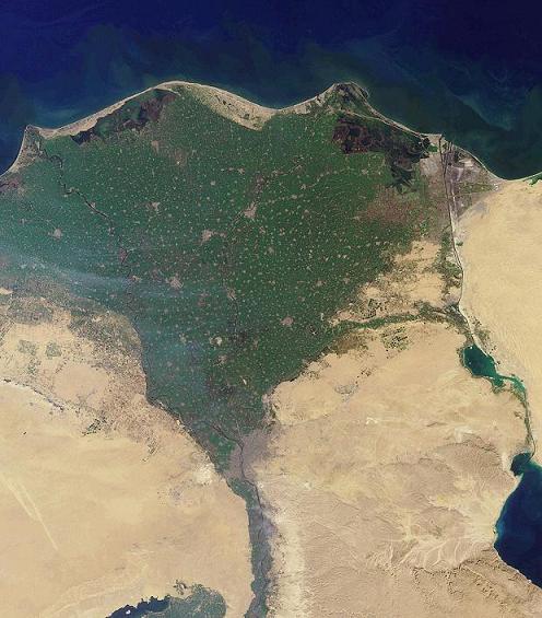
A river delta is a depositional landform created where a river reaches standing water or a very slow-moving basin, commonly an ocean but sometimes a lake, marsh, or even a dry basin or desert. At the river mouth the flow slows, and the material carried by the river — suspended silt, sand and pebbles — is dropped, building new ground. The name "delta" is inspired by the triangular uppercase Greek letter delta (Δ), a resemblance visible in many classic examples.
Image gallery
10 Images


How deltas form and their parts
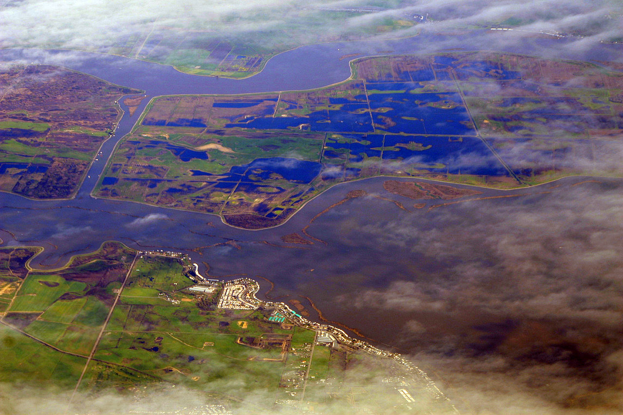
The core process is deposition: eroded material transported from upstream becomes sediment, which settles when current velocities fall. Sediment accumulation raises the bed, splits the flow into multiple channels called distributaries, and creates alternating aquatic channels and emergent land where vegetation can establish. Over years and centuries these deposits advance seaward in a process called progradation. Related features include marshes, levees, and lagoons; where coarse material fans out from a confined channel onto a plain it may produce an alluvial fan, a similar but distinct depositional form.
Shapes, common types and examples
Deltas display a variety of plan shapes determined by the balance of river supply, waves and tides. Typical categories include:
- Arcuate: broadly triangular with many distributaries (often wave-influenced).
- Bird's-foot: long protruding distributaries resembling toes (river-dominated).
- Cuspate: pointed or tooth-like forms created where currents converge.
- Digitate: series of thin, finger-like protrusions.
Famous deltas include the Nile, Mississippi, Ganges–Brahmaputra and Mekong systems; sizes range from small local deltas to vast plains spanning thousands of square kilometers. In geological records, ancient delta deposits are visible as layered sands and muds, and fragments of prior deltas appear in rocks—sometimes exposed in quarries where sediments have been quarried as building materials. During deep time, regions now temperate were once part of larger tropical systems on different continents, so deltaic signatures help reconstruct past landscapes.
Ecology, human uses and importance
Deltas are ecologically rich: they support wetlands, mangroves, productive fisheries and high biodiversity. Their fertile soils are prized for agriculture and have supported dense human settlement and major ports for millennia. Economically they concentrate resources (fish, sediment for land-building, navigation routes) and host large population centers, making them strategically important for food security and trade.
Challenges, management and distinctions
Despite their value, deltas are vulnerable. Reduced sediment supply because of upstream dams, land subsidence from groundwater or hydrocarbon extraction, and rising sea levels increase flood and erosion risks. Human engineering (levees, channelization) can stabilize short-term land but often accelerates long-term loss of wetlands. Deltas differ from estuaries (which are primarily tidal mixing zones) and from upland alluvial fans (alluvial fan) by scale, setting and mechanisms of sediment dispersal.
Understanding delta dynamics is essential for conserving ecosystems and sustaining the communities that depend on them. For further reading on geomorphology and coastal processes consult regional resources and geological surveys that specialize in riverine and coastal change (landform studies, river mouth dynamics).
Related articles
Author
AlegsaOnline.com River delta: formation, types, ecology and human importance Leandro Alegsa
URL: https://en.alegsaonline.com/art/83094