
Outflow (meteorology): thunderstorm downdrafts, gust fronts and boundaries
Outflow is the cool air pushed outward from a thunderstorm downdraft. It forms gust fronts and boundaries that affect weather, trigger new storms, create dust storms, and show distinct radar signatures.
Outflow in meteorology refers to the air that is expelled outward from a thunderstorm's downdraft. When precipitation and cooled air descend within a thunderstorm, that denser, colder air spreads horizontally at the surface as an outflow. The moving boundary between the chilled outflow and the surrounding warmer air is commonly called an outflow boundary or gust front, and it plays a key role in storm behavior and local weather changes. Observers often describe a burst of strong winds, abrupt temperature drops, shifting wind directions, or a sharp line of blowing dust or insects when a gust front passes.
Image gallery
6 Images


Physical characteristics and structure
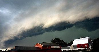
Outflow is generated by evaporative cooling of precipitation and by momentum transfer within the downdraft. The result is a fast-moving pool of relatively cool, dense air near the surface — sometimes called a cold pool. The leading edge of this pool produces convergence as it undercuts warmer air. Convergence and uplift along the boundary can produce new clouds and sometimes initiate fresh thunderstorm cells. Typical observable features include a visible shelf or arc of low clouds, a surge of wind known as a gust front, and rapid changes in temperature and humidity.
How outflow is detected
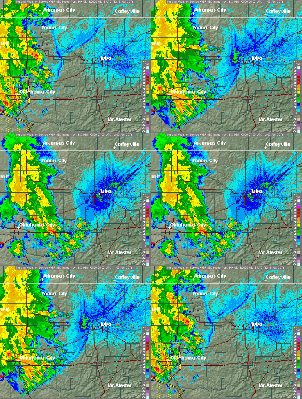
Weather radar and surface observations are primary tools for locating outflow boundaries. The leading edge often creates a distinct radar signature: enhanced returns in both clear-air and precipitation modes because of concentration of insects, dust, aerosols, and hydrometeors along the density contrast. Meteorologists use Doppler and reflectivity radar to track these echoes and to monitor boundary motion. The interface caused by the density difference is discussed in meteorological literature as a factor that increases backscatter and makes the front visible on radar returns. Surface stations and mobile observers can also identify the passage by a sudden wind shift and temperature change, often before the main rain arrives from the parent thunderstorm.
Importance and effects
Outflow boundaries influence weather in several ways. They can:
- Initiate new convection: the uplift along the front can trigger new thunderstorms or enhance existing ones.
- Create strong, gusty surface winds that can damage structures and produce hazardous conditions for aviation and marine operations.
- Generate dust storms or haboobs when moving over dry, loose soil, concentrating particulate matter and reducing visibility.
- Organize storm systems: multiple outflow boundaries interacting can lead to linear features such as squall lines or bow echoes, sometimes producing derechos.
Examples, distinctions and practical notes
Outflow boundaries resemble cold fronts on a small scale but are transient and often stem directly from convective downdrafts. They differ from synoptic-scale fronts in origin and persistence. Meteorologists look for concentrated echoes in both clear-air and precipitation radar modes; switching to precipitation mode can highlight hydrometeor development along the edge, while clear-air scans often show the dust, insects, or aerosols concentrated at the front. Satellite imagery and surface observation networks complement radar data in mapping boundaries and cloud features. For further introductory material, see general guides on storm structure and radar interpretation and resources that discuss gust fronts in practical forecasting contexts.
Understanding outflow is valuable for forecasters, emergency managers, aviators, and outdoor planners because these boundaries can rapidly change local wind, temperature, and precipitation patterns. Close monitoring using radar, surface reports, and mobile observations helps anticipate secondary storm development and near-surface hazards associated with gust fronts.
Related articles
Author
AlegsaOnline.com Outflow (meteorology): thunderstorm downdrafts, gust fronts and boundaries Leandro Alegsa
URL: https://en.alegsaonline.com/art/73658
Sources
- weather.gov : NOAA – National Weather Service – Glossary
- theweatherprediction.com : Weather Prediction Education