Mesocyclone — rotating updraft in convective storms
A mesocyclone is a mid-scale rotating updraft (about 2–10 km wide) embedded in a convective storm. It is important in severe-weather processes and often precedes tornado formation.
A mesocyclone is a concentrated, vertically oriented rotating column of air that develops within a larger convective updraft and inside a storm. Typically measured on the mesoscale, its horizontal diameter is commonly given as roughly 2 to 10 km. Mesocyclones are most often cyclonic (rotating in the same sense as larger low-pressure systems in their hemisphere), though anticyclonic examples can occur. They are a characteristic feature of many organized severe storms and are closely associated with the strongest hail, damaging winds, and the potential for severe thunderstorm hazards.
Image gallery
8 Images


Characteristics and structure
Mesocyclones consist of rising air that acquires rotation through environmental wind shear. The rotating updraft can be coherent for tens of minutes to several hours in long-lived storms. Within the updraft, vertical stretching of pre-existing horizontal vorticity intensifies rotation. Observers may note a lowered base or a rotating cloud feature (sometimes a wall cloud) beneath the main storm base where the mesocyclone is strongest.
Formation and lifecycle
Wind shear in the environment tilts and organizes vorticity into the vertical. When a storm's inflow is strong and the updraft is sustained, the combination of tilting and stretching can produce a rotating core. In supercell storms — highly organized, rotating thunderstorms — a persistent mesocyclone is a defining element. The mesocyclone’s lifecycle depends on storm-scale interactions: entrainment, downdrafts such as the rear-flank downdraft, and changes in inflow can strengthen, displace, or dissipate the rotating updraft.
Detection and meteorological significance
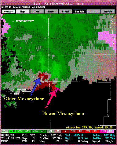
Operational meteorologists commonly identify mesocyclones using Doppler radar signatures: a close velocity couplet of inbound and outbound air indicates rotation aloft. Other radar echoes, such as the classic "hook" reflectivity pattern, often signal the presence of a rotating updraft. Because mesocyclones concentrate rotation on a scale much larger than a tornado, they are important precursors in tornado warning operations; however, a mesocyclone does not always produce a tornado, and tornadoes can form rapidly from a mesocyclone under the right conditions.
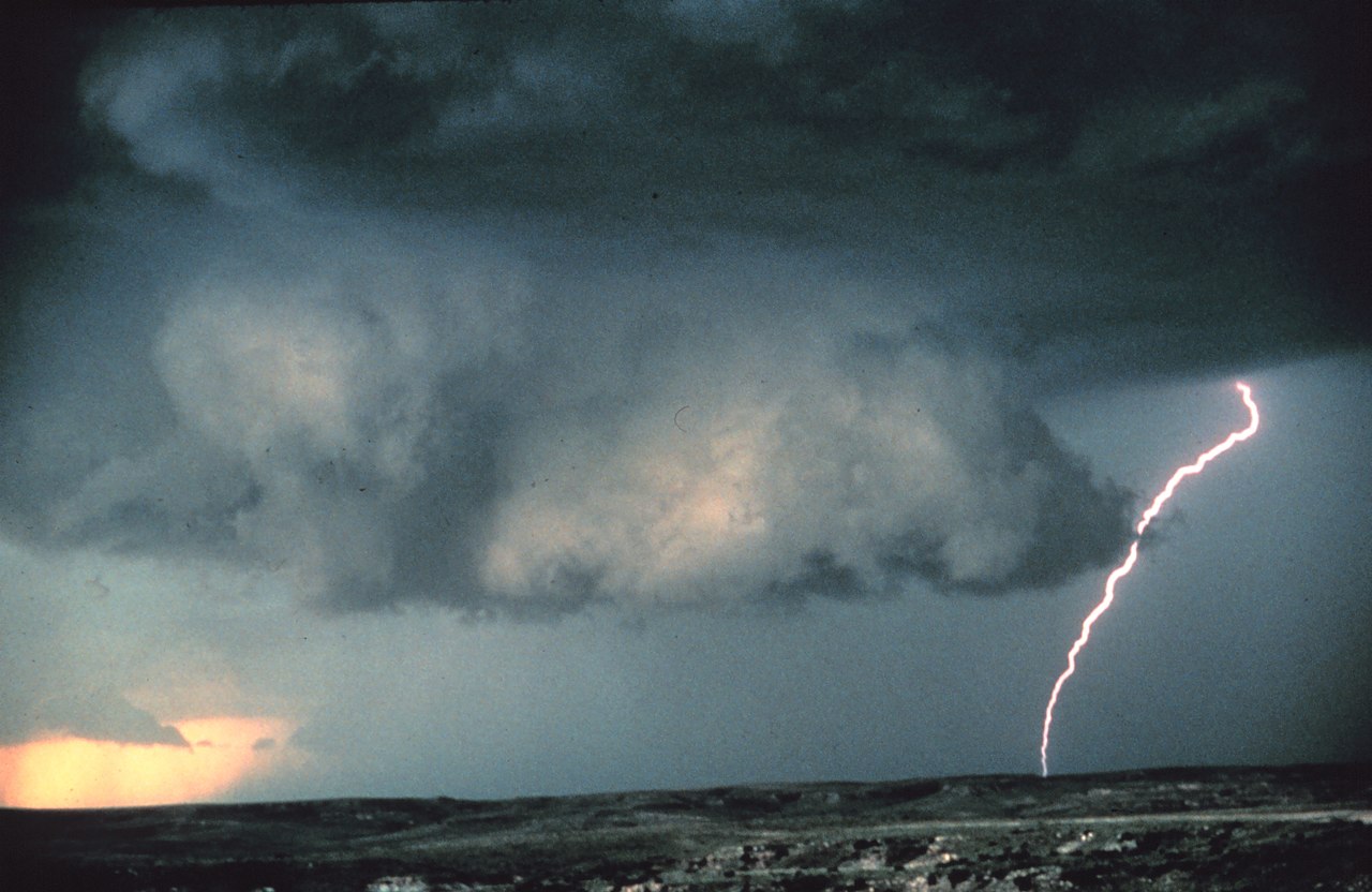
Observed effects and hazards
- Enhanced hail production due to strong, sustained updrafts.
- Potential for downburst or damaging straight-line winds when downdrafts interfere with the updraft.
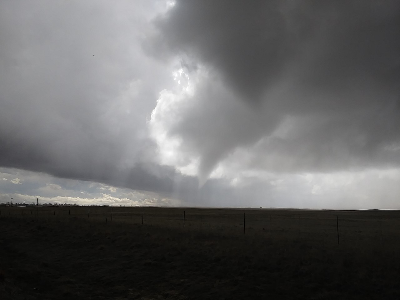
- In some cases, the mesocyclone tightens and funnels into a much smaller, intense vortex at the surface: a supercell can therefore produce a tornado, though causation requires additional local conditions.
History and terminology
The term combines the prefix "meso-" (middle scale) with "cyclone" and appeared in meteorological use in the early 1970s. It was introduced to distinguish these mid-scale rotating features from larger synoptic cyclones and from smaller-scale vortices. Since then, recognition of mesocyclones has been central to understanding organized severe convection and improving short-term warnings.
Despite their relatively small horizontal extent compared with synoptic systems, mesocyclones are among the most consequential storm-scale features for severe-weather forecasting. Their detection, monitoring, and study remain active parts of operational meteorology and severe-storm research, informing warnings that protect life and property.
Related articles
Author
AlegsaOnline.com Mesocyclone — rotating updraft in convective storms Leandro Alegsa
URL: https://en.alegsaonline.com/art/64088
Sources
- amsglossary.allenpress.com : "American Meteorological Society Glossary - Mesocyclone"