
Supercell (rotating thunderstorm)
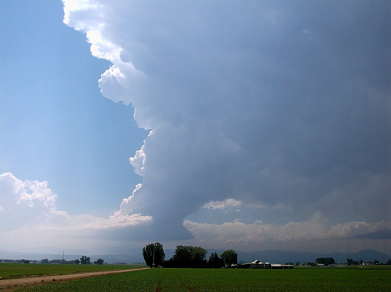
A supercell is a long-lived, highly organized thunderstorm with a deep rotating updraft (mesocyclone). It often produces large hail, damaging winds and tornadoes and differs structurally from ordinary storms.
Overview
A supercell is a powerful, highly organized thunderstorm characterized by a persistent, deep, rotating updraft known as a mesocyclone. Supercells are among the most intense convective storms and are capable of producing very large hail, strong straight-line winds, long-lived tornadoes and other severe weather. Meteorologists distinguish supercells from ordinary thunderstorms by their internal organization, longevity and capacity to produce concentrated severe phenomena.
Image gallery
10 Images





Structure and dynamics
The defining feature of a supercell is the rotating updraft. In favorable environments, wind shear (a change in wind speed and/or direction with height) tilts and organizes the updraft so it becomes separated from the storm's downdraft, allowing the system to sustain itself for hours. The central rotating column is often called a mesocyclone; observers and forecasters may refer to this feature in radar data as a rotational signature (mesocyclone or mesocyclone detection).
- Updraft: strong and tilted, lifts warm, moist air to great heights.
- Mesocyclone: the mid-level rotation that organizes the storm's internal flow.
- Precipitation and downdraft: may be offset from the updraft, producing asymmetric rain and hail cores.
Formation and lifecycle
Supercells typically form in environments with ample instability, sufficient low-level moisture, and moderate to strong vertical wind shear. A lifting mechanism such as a front, dryline, or mesoscale boundary initiates convection. Once established, the interaction between the updraft and environmental shear can lead to persistent rotation, storm splitting, or cyclic behavior in which the storm reorganizes and produces multiple severe outbursts over its life.
Types and distinctions
Meteorologists classify supercells by precipitation distribution and appearance into varieties often described as classic, high-precipitation (HP) and low-precipitation (LP). These types influence hazards and visibility: HP supercells can conceal tornadoes in heavy rain, while LP supercells often produce large hail with relatively little rainfall. Supercells are one of several thunderstorm categories, which also include simpler single-cell and multi-cell storms and linear systems such as a squall line.
Hazards, detection and forecasting
Because of their organized rotation and sustained updrafts, supercells are principal producers of the most severe convective hazards. Large hail and damaging downbursts endanger property and crops, while tornadoes pose acute danger to life and infrastructure. Advances in Doppler radar, storm-scale numerical modeling and observational networks have improved detection of mesocyclones and the issuance of warnings, though predicting the precise timing and intensity of tornado formation remains scientifically challenging.
Climatology and preparedness
Supercells occur worldwide where the atmospheric ingredients align, but they are especially noted in regions where strong instability and wind shear coincide. Public safety relies on timely warnings, robust communication of risk, and appropriate sheltering actions. Preparedness includes monitoring forecasts, having an emergency plan, and seeking substantial shelter during severe thunderstorm or tornado warnings.
Research and observation
Researchers study supercells through field campaigns, radar and satellite analysis, and numerical simulation to improve understanding of storm dynamics and to enhance forecasting lead times. Storm chasers and instrumentation can contribute valuable observations, but safe observing practices and coordination with warning agencies are important to reduce risk to observers and the public.
Questions and answers
Q: What is a supercell?
A: A supercell is a specific type of thunderstorm that has a strong, rotating updraft called a mesocyclone.
Q: How are supercell thunderstorms different from other types of thunderstorms?
A: Supercell thunderstorms are the largest and most dangerous type of thunderstorms because of their intense updraft and rotating mesocyclone.
Q: Are there different classifications of thunderstorms?
A: Yes, there are four classifications of thunderstorms, including single-cell, multi-cell, squall line, and supercell.
Q: How do supercell thunderstorms form?
A: Supercell thunderstorms form when warm, moist air rises rapidly and interacts with cooler, drier air. This creates an unstable atmosphere that can lead to intense thunderstorms.
Q: What is a mesocyclone?
A: A mesocyclone is a rotating updraft that is present in supercell thunderstorms.
Q: Why are supercell thunderstorms dangerous?
A: Supercell thunderstorms are dangerous because they can produce large hail, destructive winds, and tornadoes.
Q: How common are supercell thunderstorms?
A: Supercell thunderstorms are relatively rare, accounting for only a small percentage of all thunderstorms. However, they are responsible for a majority of severe weather events.
Author
AlegsaOnline.com Supercell (rotating thunderstorm) Leandro Alegsa
URL: https://en.alegsaonline.com/art/95036
Sources
- stormchasers.au.com : stormchasers.au.com
- crh.noaa.gov : Structure and Dynamics of Supercell Thunderstorms - NWS
- ww2010.atmos.uiuc.edu : University of Illinois World Weather Project
- srh.noaa.gov : Weather Glossary for Storm Spotters - NWS
- rmets.org : rmets.org