
Lake Nicaragua (Lago Cocibolca): geography, islands, ecology and history
Lake Nicaragua, the largest freshwater lake in Central America, lies in southern Nicaragua. Noted for its islands (including Ometepe), volcanic features, biodiversity and historic role in transport and canal proposals.
Overview
Lake Nicaragua, also known locally as Lago Cocibolca, is the largest freshwater lake in Central America. It occupies a central place in Nicaragua's landscape and economy, supplying water, fish and routes for local transport. The lake is set within a volcanic and tropical region and is known for its many islands, waterways and distinctive wildlife.
Image gallery
3 Images

Geography and hydrology
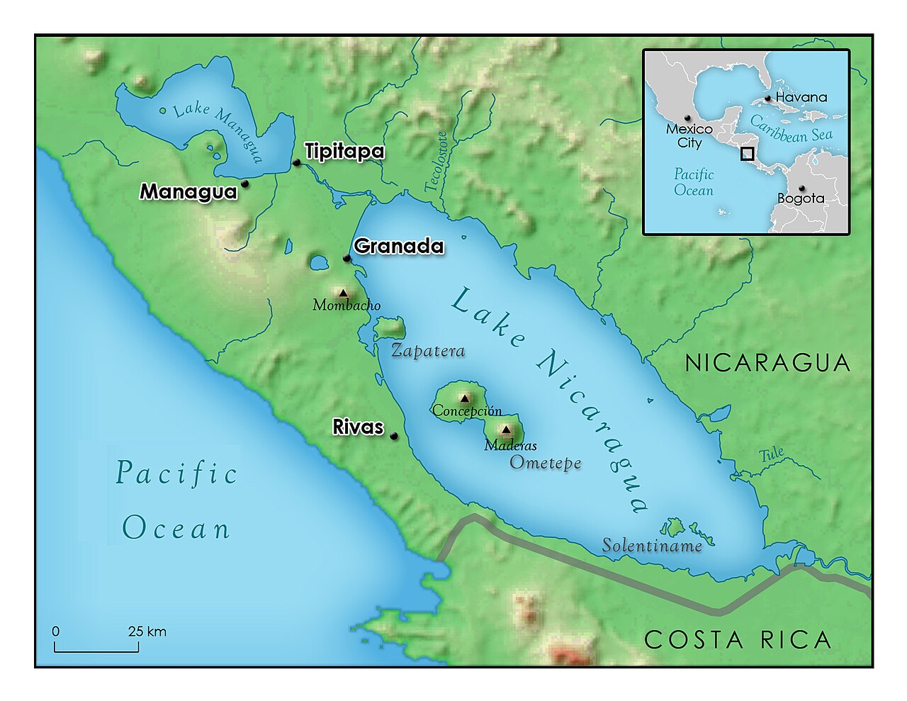
Situated in the south-central part of the country, the lake lies near the border area of neighboring countries and is part of a larger drainage system. A river link connects Lake Nicaragua with the smaller Lake Managua to the north, and the lake drains eastward via the San Juan River to the Caribbean Sea. The combination of shallow basins, volcanic slopes and wide shoreline gives the lake a varied shoreline and many sheltered bays.
Islands and volcanoes
Lake Nicaragua contains hundreds of islets and several notable islands. The volcanic island of Ometepe, formed by the twin volcanoes Concepción and Maderas, is the most prominent and attracts visitors for hiking and archaeology. Other island groups and isolated islets host fishing settlements, mangroves and archaeological sites. The lake’s volcanic islands are important landmarks and shape local microclimates and soils.
Ecology and human use
The lake supports freshwater fisheries that are important to nearby towns and villages, and its waters are used for irrigation and transport. The shoreline includes towns with colonial-era architecture as well as smaller farming and fishing communities. Reports and scientific studies indicate that marine species such as bull sharks have in the past moved from the Caribbean up the San Juan River and survived in the lake, a notable ecological phenomenon.
History and significance
Historically the lake and its outlet river served as a key route into the interior of Nicaragua during the colonial period and later. In the 19th and early 20th centuries, planners and engineers examined routes through the lake and river system as possible paths for an interoceanic canal. Today the lake remains important for tourism (volcano hikes, island culture and birdwatching), local commerce and as a freshwater resource.
Notable facts and conservation
- The lake is the largest freshwater body in Central America: fact link and central to regional hydrology (region).
- Located in the southern part of Nicaragua: location, and close to international borders (border, near Costa Rica).
- Contains numerous islets and island groups: islets, important islands include Ometepe and Zapatera: islands.
- The San Juan River connects this lake to the Caribbean Sea: San Juan River.
Conservation concerns include water quality, impacts from agriculture and development, and the need to balance fishing, tourism and habitat protection. The lake’s natural features — volcanic islands, wetlands and unusual fauna — make it a focus for both local livelihoods and scientific interest.
Related articles
Author
AlegsaOnline.com Lake Nicaragua (Lago Cocibolca): geography, islands, ecology and history Leandro Alegsa
URL: https://en.alegsaonline.com/art/55537