
Lake Pontchartrain — large brackish lake near New Orleans
Lake Pontchartrain is a shallow, brackish lake in southeastern Louisiana, notable for its size, ecology, shipping channels and role in regional history, storms and coastal restoration.
Overview
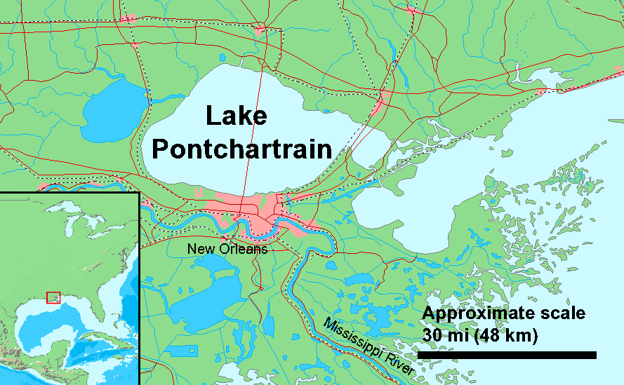
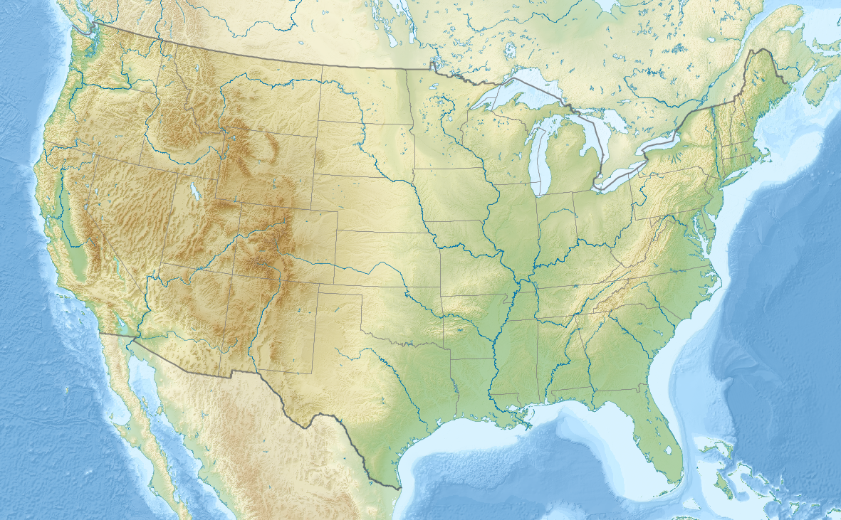
Lake Pontchartrain lies north of New Orleans in southeastern Louisiana and is the state's largest lake. Its French name is sometimes shown as Lac Pontchartrain. The lake is often described as the second largest salt-water lake in the United States, a distinction frequently noted alongside the Great Salt Lake in Utah, and is an important regional landmark for its scale.
Image gallery
10 Images




Physical characteristics
Lake Pontchartrain is a shallow, roughly oval body of water with an area of about 630 square miles and an average depth of around four metres. The broad dimensions — roughly 40 miles across and 24 miles from south to north — give it an exposed shoreline and long fetch during winds. Some shipping and navigation routes are maintained by dredging to create deeper channels for vessels. The lake is classified as a lake rather than an estuary in many maps, though its nature is transitional.
Hydrology and ecology
Pontchartrain is brackish: its salinity reflects a mix of fresh water from rivers and bayous with salt water from coastal inlets, a condition often summarized as brackish. This mix supports marshes, seagrass beds and fisheries that are ecologically productive and important for local commercial and recreational fishing. Wetlands around the lake act as nurseries for fish and as buffers that absorb storm energy.
History, use and infrastructure
Human use of the lake spans centuries, from Indigenous peoples to colonial and modern ports. The lake's shoreline and nearby settlements in southeastern Louisiana developed with navigation, fishing and later recreational boating. Modern infrastructure includes the long Lake Pontchartrain Causeway and several ports; dredged channels allow larger vessels to reach inland facilities.
Environmental challenges and notable events
Coastal erosion, subsidence and hurricane impacts have been central concerns. The lake featured prominently in the effects of Hurricane Katrina and other storms, which revealed vulnerabilities in levees and flood protection. Restoration projects and coastal planning aim to restore marshes and manage salinity and sediment to improve resilience.
Notable facts and distinctions
- The lake's name and cultural presence link to French colonial history and local communities.
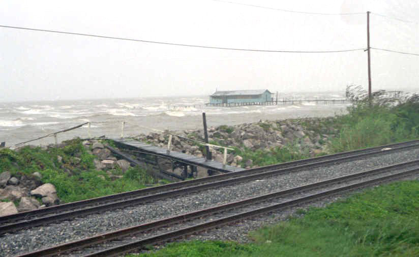
- Its shallow depths and wide surface make wind-driven waves and storm surge important hazards.
- Comparisons with other inland saline lakes emphasize size: see references to national rankings and the classification alongside the Great Salt Lake in Utah.
- Geographic notes often mention its shape (oval) and orientation from south to north.
For readers seeking maps, ecological data or management plans, consult regional resources and agencies linked from authoritative portals (language and place-name sources, conservation organizations and local government pages).

Development of traffic across the lagoon
Still under Spanish rule over Louisiana, the Carondelet Canal was dug in 1794, from the lagoon to what was then still French New Orleans. Then, until the late 19th century, Lake Pontchartrain remained an important waterway and had several harbors. One remnant of the harbors is the Port Ponchartrain Lighthouse, the 1855 lighthouse to the port of the defunct resort town of Milneburg. It served as offices for the Ponchartrain Beach & Amusement Park after its beacon went out in 1929, until the amusement park also disappeared in favor of a technology park at the old tower.
On February 25, 1964, a Douglas DC-8 commercial aircraft of Eastern Air Lines Flight 304 crashed into the lagoon on approach to the lakeside Lakefront Airport. All 58 occupants were killed, including singer and actor Kenneth Spencer and French feminist Marie-Hélène Lefaucheux.
A 40 km long double bridge crosses the lake, connecting New Orleans with Covington since 1956. The newer of the two bridges, the Lake Pontchartrain Causeway II, opened in 1969. The bridge is the tenth longest bridge in the world. The lagoon flooding associated with Hurricane Katrina in 2005 dislodged several of the bridge's roadway-supporting concrete elements from the bridge piers as they floated on the water masses. The structural failure was that a large enclosed air cavity was created under some bridge elements, which increased the buoyancy caused by the water masses. The bridge was repaired a short time later, as it is one of the most important access routes to the port city of New Orleans.
There is also an overhead high voltage power line across Lake Ponchartrain, with pylons on caissons. It is considered an example of illustrating the curvature of the earth.
Environment and nature
The lake is home to more than 125 species of lake or aquatic life - including anchovies, sharks and alligators. The surrounding wetlands are inhabited by otters, wild boar, ducks and eagles.
Until 1991, raw materials for cement and asphalt were dredged from the lake bed.
Lake Pontchartrain has long suffered from environmental pollution; pumping out the city of New Orleans after Hurricane Katrina released large amounts of polluted water into the lake.
Related articles
Author
AlegsaOnline.com Lake Pontchartrain — large brackish lake near New Orleans Leandro Alegsa
URL: https://en.alegsaonline.com/art/55550