Holyland Model of Jerusalem
A large, detailed scale model depicting Jerusalem in the late Second Temple period. Created in the 1960s, first shown at the Holyland Hotel and since 2006 displayed at the Israel Museum.
The Holyland Model of Jerusalem is a meticulously crafted three‑dimensional reconstruction of Jerusalem as it would have appeared in the late Second Temple period. The model presents an integrated view of the Temple Mount, surrounding religious and civic buildings, streets, walls and neighborhoods, offering visitors a coherent visual summary of the city's layout and built environment. The model's original site and present location are associated with these institutions: geographic coordinates, the Holyland Hotel where it was first displayed, and the Israel Museum where it has been exhibited since 2006.
Image gallery
2 Images
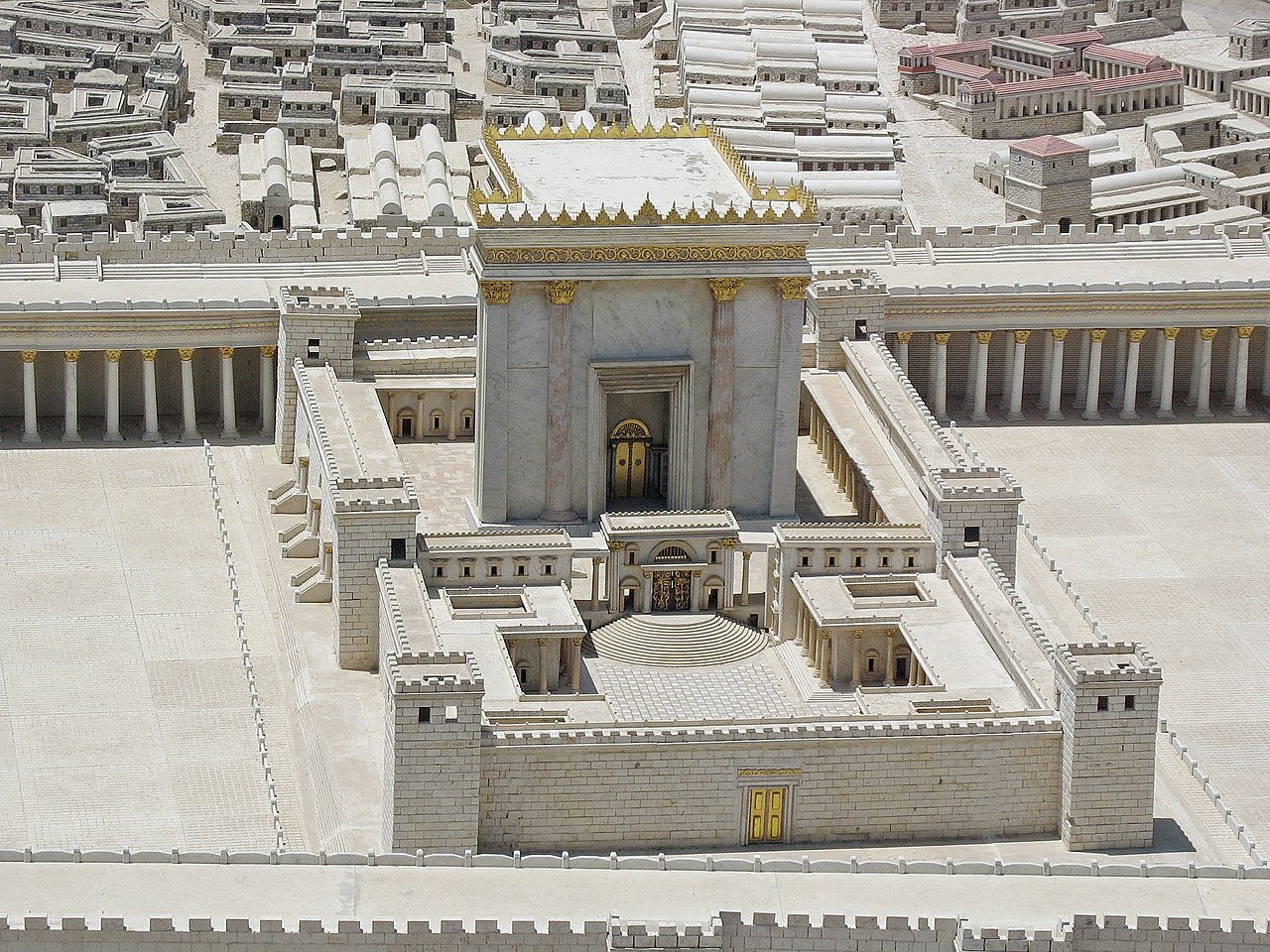
Physical characteristics and content
The work is a large‑scale, detailed miniature, designed to make relationships between monuments and neighborhoods immediately apparent. Prominent components visible in the reconstruction include the Temple complex with its outer courts, the surrounding city walls and gates, major palatial structures, public buildings, cisterns and street patterns. The model uses color and textural detail to suggest construction materials and topography, enabling viewers to compare elevations and sightlines that are difficult to grasp from two‑dimensional maps.
History and development
Produced in the mid‑20th century, the model was developed to accompany archaeological and historical interpretation of Jerusalem. It was publicly opened in 1966 as part of a series of displays that aimed to present ancient sites to residents and visitors. In 2006 the complete model was relocated to a museum setting to increase public access and to situate it beside complementary archaeological collections and research resources. The project reflects mid‑century approaches to museum education and historical reconstruction.
Uses, significance and reception
As an educational tool the model is used by teachers, tour guides and researchers to illustrate urban layout, ritual geography and the scale of public architecture. It has been a popular attraction for visitors wanting an immediate visual orientation to the city's ancient topography. Scholars and students often consult such reconstructions to test hypotheses about sight lines, processional routes and the relationships between sacred and civic spaces. The model is also referenced in books, exhibitions and multimedia programs that aim to communicate the look of ancient Jerusalem to wide audiences; see general background on the period via Second Temple era resources.
- Key visible elements: Temple Mount complex, city walls and gates, palaces and major public works.
- Original exhibition: Holyland Hotel; current display: Israel Museum.
- Location and orientation details: coordinates and mapping.
For visitors and researchers the Holyland Model remains an influential interpretive device: it condenses complex archaeological evidence into an accessible form and anchors scholarly debate about urban form in a tangible visual reference. Further institutional information and visiting details are provided by the museums and sites associated with its history and present stewardship; see museum pages and research guides linked here for starting points: model information and period background.
Related articles
Author
AlegsaOnline.com Holyland Model of Jerusalem Leandro Alegsa
URL: https://en.alegsaonline.com/art/44835