Gurdaspur district (Punjab, India)
Gurdaspur district in Punjab, India, lies in the Himalayan foothills and is known for its rivers, historic towns such as Kalanaur, agricultural economy, and strategic border location near Pakistani Punjab.
Overview
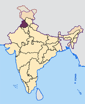
Gurdaspur district occupies a north‑eastern part of the Indian state of Punjab in India. The administrative centre is the town of Gurdaspur. The district sits at the transition between the alluvial plains and the lower slopes of the Himalayas, giving it a mix of fertile farmland and rising terrain. Two significant rivers, the Beas and Ravi, flow through or near the district and have shaped its agriculture and settlement patterns.
Image gallery
9 Images


Geography and borders
Gurdaspur shares an international boundary to the west with Narowal District in Pakistani Punjab. On the Indian side it is contiguous with districts such as Amritsar and Hoshiarpur in Punjab, Kathua District of Jammu and Kashmir, and the hill districts of Chamba and Kangra in Himachal Pradesh. The district's location at the foot of the mountains—often referred to as the Himalayan foothills—gives it varied topography and a seasonal climate influenced by the monsoon.
History and notable places
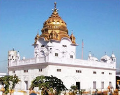
The area has a long recorded history with settlements and routes linking the plains to the hills. A notable historical episode associated with the district is the traditional account that the Mughal emperor Akbar was enthroned at a garden near the town of Kalanaur; that town and several others in the district retain archaeological and architectural traces of earlier eras. Qadian and Kalanaur are among the towns known for their historical and religious associations.
Administration, economy and land use
Administratively, the district is divided into subdistricts and local blocks for governance and rural development. The economy is primarily agricultural: wheat, rice and other seasonal crops are widely cultivated where irrigation from rivers and canals is available. In addition to farming, there are small‑scale industries, trade and services in larger towns. Border proximity and regional transport links also influence local commerce and movement.
Culture, religion and society
Gurdaspur is culturally Punjabi, with traditions, language and festivals reflecting the wider patterns of the state. Religious sites, historic gurdwaras, mosques and temples contribute to the district's diverse cultural landscape. Local fairs and markets remain important for social life in rural areas, while towns serve as hubs for education and healthcare.
Transport and strategic importance
- Road and rail connections link Gurdaspur to major centres such as Amritsar and regions further north and east.
- The rivers and fertile plains support agriculture, while the district's border location gives it strategic and administrative significance.
- Its position near the lower ranges of the Himalayas makes it a gateway between the plains and hill districts.
For more detailed administrative maps, demographic data, or historical sources, consult local government and academic references via the provided links and official portals: district overview, state resources at Punjab, and national information at India.
Related articles
Author
AlegsaOnline.com Gurdaspur district (Punjab, India) Leandro Alegsa
URL: https://en.alegsaonline.com/art/41475
Sources
- gurdaspur.nic.in : History of Gurdaspur