
Great Victoria Desert
Largest Australian desert spanning Western and South Australia; an arid landscape of dunes, gibber plains and salt lakes, with long Aboriginal occupation, unique wildlife and a contested modern history.
Overview
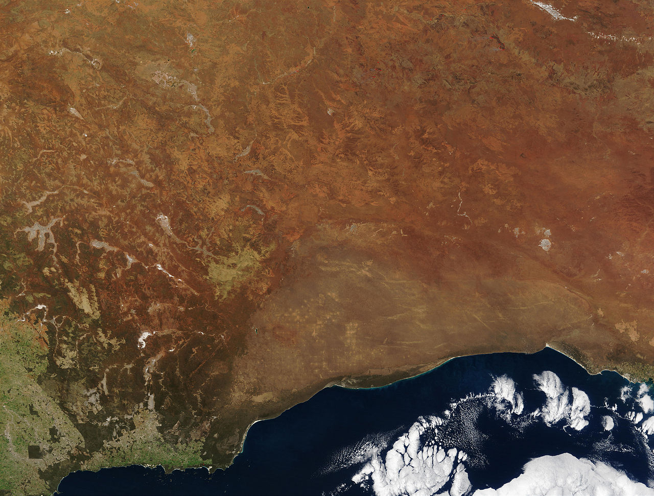
The Great Victoria Desert is the largest desert in Australia, occupying an extensive area across Western Australia and South Australia. It stretches roughly 700 km from east to west and covers tens of millions of hectares. The region is characterised by a mixture of sand dune fields, low sandhills, broad gibber (pebble) plains, intermittent salt lakes and expanses of spinifex and scrub. Rainfall is low and highly variable, generally around 200–250 mm per year, producing a harsh but ecologically distinctive arid environment.
Image gallery
7 Images



Landscape, climate and ecology
Geologically and visually the desert is varied. Parallel and crescent-shaped sand dunes alternate with flat, stony pavements known as gibber plains. Numerous ephemeral salt lakes and claypans form in depressions after rare heavy rains. Vegetation is dominated by spinifex grasses, acacias and scattered mallee eucalypts adapted to low nutrients and limited water. Animal life includes small marsupials, reptiles, ground-dwelling birds and a diversity of invertebrates adapted to hot, dry conditions and episodic resource pulses.
Human history and cultural significance
Aboriginal peoples have occupied, traversed and cared for parts of the Great Victoria Desert for many millennia; archaeological evidence and oral histories attest to occupation going back tens of thousands of years. Traditional owners maintained deep knowledge of water sources, seasonal foods and travel routes. European exploration reached the region in the 19th century and the name "Great Victoria Desert" was applied by explorer Ernest Giles in 1875 in honour of Queen Victoria.
Modern uses, conservation and legacies
Today the desert is sparsely populated. Economic uses are limited by remoteness and low productivity but include some pastoral leases, mineral exploration and mining in places. Conservation efforts aim to protect representative desert ecosystems and cultural sites; parts of the region are included in conservation reserves and Indigenous-managed lands. The Great Victoria Desert is also known for its role in mid-20th-century nuclear weapons testing at locations such as Maralinga and Emu, events that left lasting social, environmental and political consequences and prompted cleanup and compensation programs.
Distinctive facts and context
- The desert lies adjacent to other arid regions: the Nullarbor Plain to the south, the Gibson Desert to the north and Sturt's Stony Desert toward the east.
- It is recognised within Australia’s bioregional framework (IBRA) as a major arid bioregion.
- Its ecology responds strongly to episodic rainfall: years of higher rain can trigger plant flowering and short-lived increases in animal populations.
Further reading and resources
- General overview and facts
- Geographical context in Australia
- Vegetation and plains information
- Area and size data
- Area in acres and conversions
- Western Australia regional details
- South Australia regional details
- East–west extent and distances
- Distances in miles
- Average annual rainfall figures
- Rainfall in inches
- Historical note on exploration
- Naming and historical context
- Nuclear testing history and legacy
If you are researching the Great Victoria Desert further, consult regional environmental agencies, Indigenous land councils and scientific reviews for the most up-to-date and locally authoritative information.
Related articles
Author
AlegsaOnline.com Great Victoria Desert Leandro Alegsa
URL: https://en.alegsaonline.com/art/40558
Sources
- outback-australia-travel-secrets.com : Great Victoria Desert – The Largest Desert in Australia
- communitywebs.org : "Friends of the Great Victoria Desert - Facts and Figures"