Cumulus cloud
A cumulus cloud is a puffy, dense cloud formed by buoyant air. This article covers appearance, formation, common types, weather significance, and how cumulus differs from other cloud forms.
Overview
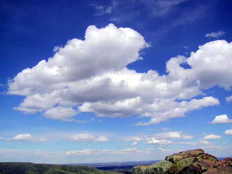
Cumulus clouds are compact, often bright-white cloud masses with a distinctive rounded, cauliflower-like outline. They form when pockets of warm, moist air rise, cool and condense into visible droplets. Observers usually note a relatively flat, sharp base beneath a lumpy upper portion whose contours change rapidly. Cumulus are commonly associated with fair weather but can also be the precursors to more vigorous convection.
Image gallery
9 Images


Key characteristics
- Shape: Puffy tops with a flat base that marks the local condensation level; the top grows as the rising air continues to cool.
- Color and composition: Generally white on the sunlit side, often darker underneath where droplets or shadows reduce transmitted light; composed mainly of liquid water droplets and, at greater heights, mixed-phase particles.
- Dynamics: Indicators of vertical motion and mixing; the presence of cumulus means air parcels are rising and descending in the column.
Formation and development
Cumulus clouds form from convective updrafts: warm air near the surface rises, expands and cools until its water vapor condenses. The altitude of the flat base corresponds to the level where relative humidity reaches saturation. If updrafts are modest, the result is small fair-weather cumulus. Stronger, sustained convection produces taller varieties and can evolve into towering cumulus that may develop into a thunderstorm cloud. For background on basic cloud terminology see cloud types and simple formation guides like condensation processes.
Common types and progression
Meteorologists classify cumulus by appearance and vertical extent: low, flattened forms often called humilis indicate weak convection; more developed, bulky forms (often labeled mediocris or congestus) signal growing instability. When a cumulus grows into a vigorous thunderstorm-producing column it becomes a cumulonimbus. Resources that describe cloud stages and thunderstorm evolution include visual keys and technical summaries such as convection guides.
Weather significance and human impacts
Cumulus clouds are useful visual cues for pilots, sailors and anyone monitoring weather: scattered small cumulus typically mean fair weather with localized thermals, while rapidly towering cumulus warn of developing showers or storms. They affect surface temperatures by shading and play a role in vertical transport of heat and moisture. For practical implications and safety guidance consult aviation and storm-awareness materials like pilot advisories and regional forecasts found at meteorological services.
Distinctive facts and comparisons
Although often called "fair-weather" clouds, cumulus can be the first stage in severe convective systems. They differ from stratiform clouds (which are layered and widespread) and from stratocumulus (which are more flattened and sheet-like). Deep convective clouds may overshoot into the upper troposphere and occasionally penetrate the lower stratosphere in powerful storms; for discussions of extreme convection and upper-atmosphere interactions see specialist summaries. Overall, cumulus clouds are a common, dynamic element of Earth's weather and a useful everyday indicator of atmospheric motion.
Related articles
Author
AlegsaOnline.com Cumulus cloud Leandro Alegsa
URL: https://en.alegsaonline.com/art/24658