Cumulonimbus cloud
A large, vertically developed cloud associated with thunderstorms and severe weather; forms from convective cumulus clouds and can produce heavy rain, hail, lightning, strong winds and tornadoes.
Overview
Cumulonimbus is a tall, dense cloud type that produces thunderstorms and other intense weather. Observers often call a mature cumulonimbus a "thunderhead." These clouds form where strong convection lifts warm, moist air, allowing a cumulus base to grow upward into a towering column that reaches into the upper troposphere and sometimes into the lower stratosphere. Modern cloud guides describe cumulonimbus as the principal cloud of heavy precipitation and convective storms; see a general entry on this cloud type at cloud classification resources.
Image gallery
10 Images


Structure and characteristics
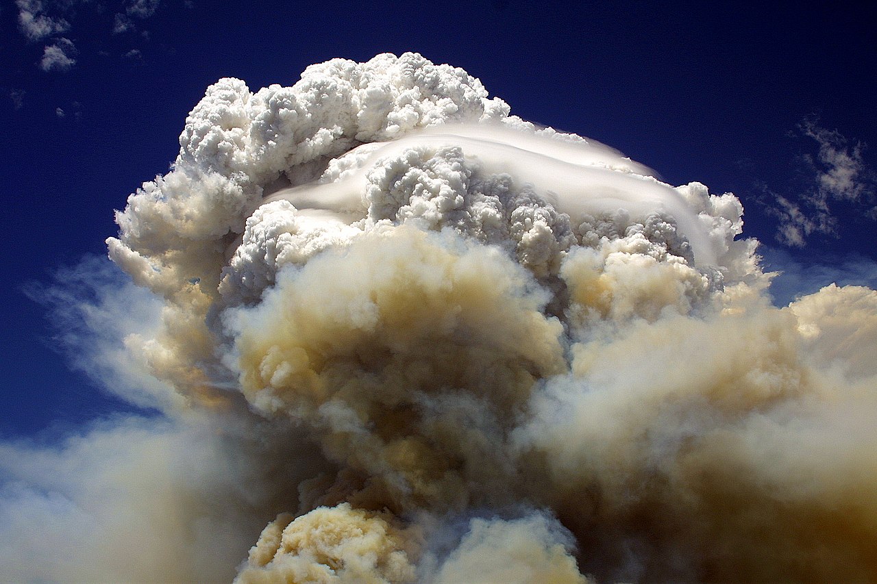
Cumulonimbus clouds typically have a dense, cauliflower-like lower region of water droplets and an upper region of ice crystals. The top often spreads into an anvil-shaped head called an incus when it reaches a stable layer. Common internal features include strong updrafts, downdrafts, and mixed-phase regions where liquid water and ice coexist. Variants and stages (for example, cumulonimbus calvus and cumulonimbus capillatus) reflect the degree of ice formation and fibrous appearance.
Formation, life cycle and development
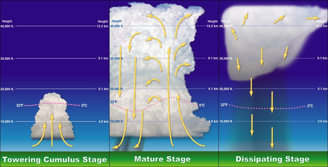
These clouds most often develop from growing cumulus congestus clouds in an environment with sufficient moisture, instability, and lift. They can occur singly or in groups, along a frontal boundary, or embedded in organized systems such as squall lines. A squall line along a cold front can feature a long band of cumulonimbus cells producing strong winds. Some cumulonimbus evolve into supercell storms with persistent rotating updrafts; such development is discussed further at supercell descriptions. The typical life cycle includes a developing (growth) stage, a mature stage with peak precipitation and lightning, and a dissipating stage dominated by downdrafts.
Associated phenomena and hazards
- Heavy rain and flash flooding
- Frequent lightning and thunder, the defining feature of a thunderstorm (thunderstorm info)
- Hail and strong straight-line winds, including microbursts
- Tornadoes: many tornadoes originate from powerful cumulonimbus systems, though not all such clouds produce tornadoes
Occurrence, importance and distinctions
Cumulonimbus clouds form in a wide range of climates but are especially common in the tropics and midlatitudes during warm-season convection. They play a major role in distributing heat and moisture in the atmosphere and are a central focus of weather forecasting and aviation safety because of their turbulence and severe weather potential. Distinguishing notes include the anvil-toped "incus" form, the fibrous upper parts indicating ice (capillatus), and localized pouch-like mammatus formations on the underside that often signal intense turbulence aloft. For more technical or visual references see general allied resources at severe weather guides and cloud development studies at cumulus evolution pages.
Historically, the system of naming clouds that includes cumulonimbus was popularized in early modern meteorology; the name combines terms indicating a heaplike form and precipitation-bearing character. For detailed meteorological analysis and safety guidance consult specialized sources such as general cloud references and storm research summaries at supercell descriptions.
Related articles
Author
AlegsaOnline.com Cumulonimbus cloud Leandro Alegsa
URL: https://en.alegsaonline.com/art/24657