Cumberland Gap: Mountain pass and gateway of the Wilderness Road
A natural gap in the Cumberland Mountains at the Kentucky–Virginia–Tennessee junction, historically a Native American route and key corridor for Daniel Boone, early settlers, and westward expansion.
Overview
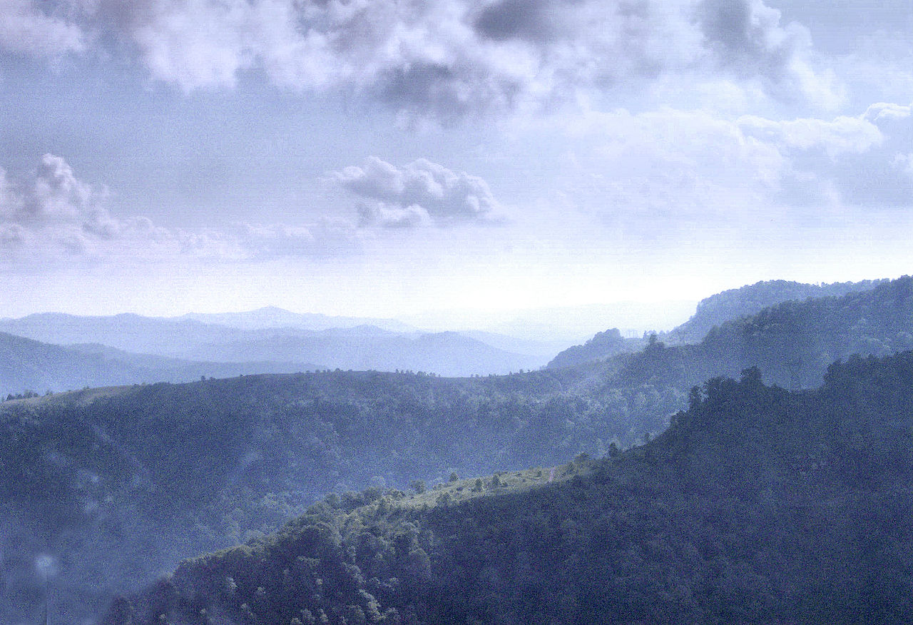
The Cumberland Gap is a narrow natural passage through the Cumberland Mountains, themselves a subrange of the Appalachian Mountains. The gap lies close to the junction where the U.S. states of Kentucky, Virginia, and Tennessee come together. Its topography forms a relatively low, comparatively accessible break in otherwise rugged terrain, and that quality made the gap a natural travel corridor for people and animals long before European contact.
Image gallery
10 Images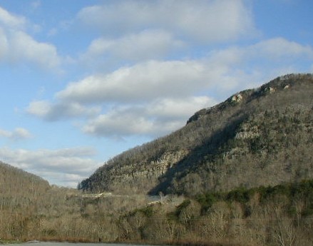


Geography and defining features
The Gap consists of a cut through ridgelines that channels weather, water, and foot traffic. The corridor is bounded by steep slopes and forested summits that are characteristic of the southern Appalachians. Because it provides one of the easier east–west routes across this section of the mountains, the location has long served as a choke point and a link between the interior highlands and the Ohio Valley. Today the area combines scenic overlooks, trails, and preserved historical sites.
History and human use
Native peoples used the passage for trade and seasonal movement for centuries; archaeological and oral histories point to long-standing indigenous presence and activity in the region, and the Gap remained an important route for Native Americans. In the 18th century the route became central to colonial and early American movement. In 1775 a party led by Daniel Boone blazed what would become known as the Wilderness Road, a frontier trail that used the Gap to reach lands to the west. Over the following decades thousands of migrants — often described in historical accounts as settlers — passed through the Gap en route to new farms and communities in Kentucky and Tennessee; the trail itself is sometimes referenced simply as the trail through the mountains.
Significance and later use
The Cumberland Gap held strategic and symbolic importance during periods of conflict and expansion. Its role as a gateway to the trans-Appalachian frontier meant it featured in military movements and in the larger story of United States westward migration. While exact numbers vary among sources, historians note that the route facilitated the movement of very large numbers of people over several decades, shaping settlement patterns in the early republic.
Preservation and visitor experience
Recognizing its natural and historical values, the area is protected within the Cumberland Gap National Historical Park. The park preserves segments of the original route and maintains interpretive exhibits, a visitor center, hiking trails, and overlooks that explain the Gap's role in regional history. Modern visitors can follow remnants of the old road, study period-era narratives, and enjoy the landscape that guided early travel. For additional context and resources about the Gap and surrounding ranges, see references to the pass itself (pass) and regional geology and routes (junction, Cumberland Mountains, Appalachian Mountains).
Notable facts
- The Gap functioned as a long-used corridor for indigenous peoples and later for European-American migration.
- Daniel Boone and other frontiersmen were instrumental in transforming the local footpath into the Wilderness Road.
- Today the region is interpreted and protected; the park offers educational programming about early travel, settlement, and natural history.
For those studying American frontier history or mountain geography, the Cumberland Gap remains a clear example of how a modest topographic feature can influence migration, economy, and culture. Additional readings and resources are available through park materials and regional historical collections that document the movement of people — both Native Americans and later settlers — across this landscape.
Related articles
Author
AlegsaOnline.com Cumberland Gap: Mountain pass and gateway of the Wilderness Road Leandro Alegsa
URL: https://en.alegsaonline.com/art/24639
Sources
- history.com : "The Wilderness Road"
- nps.gov : "Cumberland Gap National Historical Park, KY,TN,VA"
- commons.wikimedia.org : Cumberland Gap