Tupungato — 6,570 m Andean stratovolcano on the Argentina–Chile border
Tupungato is a 6,570 m stratovolcano in the Andes on the Argentina–Chile border, noted for its glaciated summit, role in regional geography, and popularity with high-altitude climbers.
Overview
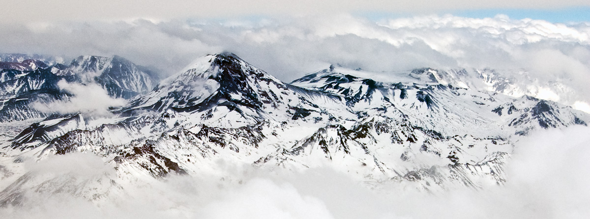
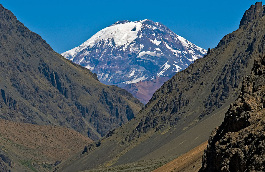
Tupungato is a high Andean peak reaching approximately 6,570 metres above sea level. It is generally classified as a large stratovolcano and stands among the higher summits of the Central Andes. The mountain lies in the Principal Cordillera and forms part of the mountainous frontier between Argentina and Chile. For quick reference and mapping resources see a location map.
Image gallery
7 Images


Geography and geology
The massif occupies a position in the volcanic arc of the Southern Central Andes. Its flanks are partly covered by permanent snowfields and glaciers at high elevations, which contribute seasonal meltwater to valleys below. The volcanic structure shows signs of long-lived construction and erosion; most sources describe its activity as primarily Pleistocene with uncertain Holocene activity. Geological summaries and studies are available through specialized databases and regional summaries, for example an overview of the Andes volcanic region.
Climbing and human significance
Tupungato is a destination for experienced mountaineers. Ascents involve high-altitude glacier and snow travel, requiring acclimatization, crevasse awareness and appropriate alpine equipment. Approaches are made from both the Chilean and Argentine sides; climbers and visitors often stage through the Mendoza region and the valley that bears the mountain's name. For practical climbing information consult regional guides or an expedition overview at climbing resources.
Uses, surroundings and economy
The mountain influences local climate and hydrology, feeding streams and groundwater used in nearby agricultural areas. The surrounding valleys, including areas in Mendoza province, support viticulture and tourism that benefit from views of the high summits. For regional context on human activities and protected areas see the local information pages at regional sources.
Notable facts and distinctions
- Elevation: about 6,570 m.
- Type: stratovolcano with glaciated summit.
- Location: on or near the Argentina–Chile frontier in the Central Andes.
- Access: routes from both countries; technical glacier travel required.
For further reading and academic references consult geology and mountaineering collections or authoritative compendia such as the Andes mountain summaries at regional mountain databases.
Related articles
Author
AlegsaOnline.com Tupungato — 6,570 m Andean stratovolcano on the Argentina–Chile border Leandro Alegsa
URL: https://en.alegsaonline.com/art/102048