
Sahel: the semi‑arid belt at the southern edge of the Sahara
A geographic and ecological overview of the Sahel: location, climate, people, environmental pressures such as desertification, and modern responses including conservation and sustainable land use.
Overview
The Sahel is a broad, semi‑arid belt of land that stretches across northern Africa along the southern margin of the Sahara Desert. Extending roughly from the Atlantic coast in the west to the Red Sea in the east, the Sahel forms a transition zone between the arid Sahara and the more humid savannas and forests to the south. It is commonly described in geographic sources as a long, narrow strip several thousand kilometers in length; local definitions vary but the zone is recognized for its climatic and ecological contrasts rather than precise political boundaries. The name 'Sahel' comes from the Arabic word for 'shore' or 'edge', reflecting its position at the desert’s frontier.
Image gallery
10 Images


Climate and physical characteristics
The Sahel has a tropical, semi‑arid climate with high temperatures year round and a short annual rainy season. Typical annual precipitation ranges from about 100 to 600 millimeters, concentrated in a few summer months and highly variable from year to year. Soils are often shallow and nutrient‑poor, vegetation consists mainly of grasses, shrubs and scattered drought‑tolerant trees, and rainfall variability determines the success of crops and pasture. Because of this climatic variability, the Sahel is prone to periodic droughts; notable multi‑year droughts occurred during the late 20th century and had major humanitarian and ecological consequences.
Geography and human geography
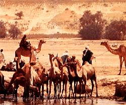
Countries that include Sahelian zones typically range from Mauritania, Senegal and Mali in the west through Burkina Faso, Niger, Nigeria and Chad to Sudan and Eritrea in the east. Human populations in the Sahel are diverse, including sedentary farmers, pastoralist herders and urban communities. Livelihoods depend heavily on seasonal rainfall and include rainfed agriculture, livestock grazing and, where available, irrigated cultivation. Population growth combined with changing land use has placed additional pressure on natural resources across the region.
Environmental challenges
The Sahel faces several interrelated environmental problems. Desertification—a process by which fertile land becomes degraded and more desert‑like—is a central concern and results from both climatic trends and human activities. Common local drivers include deforestation for fuelwood, overcultivation that depletes soil nutrients, and overgrazing that removes protective vegetation cover. When topsoil is exposed, wind and episodic heavy rains can cause erosion and further reduce soil productivity. These dynamics also affect important water bodies such as Lake Chad, which has experienced substantial shrinkage in recent decades due to combined climate and human pressures.
Responses, adaptation and restoration
Responses to Sahelian challenges combine local practices, national policies and international initiatives. Techniques that improve resilience include water‑harvesting and small‑scale irrigation (for example drip irrigation), improved and drought‑tolerant crop varieties, agroforestry that integrates trees with crops and livestock, and managed grazing systems that prevent overuse of pasture. Large‑scale restoration efforts, such as the Great Green Wall initiative, aim to restore degraded land and create employment through reforestation and sustainable land management. Early warning systems, better access to veterinary and medical services, land tenure reforms and community‑based resource management are also important parts of the response.
Practical measures and notable facts
Practical measures to reduce land degradation in the Sahel often appear in lists of recommended actions. Typical measures include:
- Regulating grazing and promoting rotational pasture to limit overgrazing.
- Adopting soil conservation methods such as contour bunding and mulching.
- Planting drought‑tolerant trees and practicing agroforestry to stabilize soils.
- Using efficient irrigation and water storage to reduce pressure on surface water.
- Strengthening local institutions and land rights to encourage long‑term stewardship.
For further background reading on the Sahel’s climate, ecology and ongoing initiatives consult regional summaries and project pages: Sahel region overview, geography and countries, climate and rainfall patterns, and desertification resources. Information on demographic and health changes is available at population trends and rural livelihoods. Project and restoration efforts, including soil and water conservation, can be explored via agroforestry programs, soil management initiatives, and regional restoration efforts. For material focused on major water bodies affected by regional change, see Lake Chad studies.
Related articles
Author
AlegsaOnline.com Sahel: the semi‑arid belt at the southern edge of the Sahara Leandro Alegsa
URL: https://en.alegsaonline.com/art/85275